Places
2 places found.
Those places high-lighted have photos. All locations may have maps, books and memories.
Photos
11 photos found. Showing results 41 to 11.
Maps
10 maps found.
Books
Sorry, no books were found that related to your search.
Memories
102 memories found. Showing results 21 to 30.
Memories Of Sandy
I lived in Sandy between about 1963 and 1979 and have seen changes even in that short time. It was a fairly quiet village when we first came in spite of the adjacent A1. I went to St Swithuns school in St Neots Road, then Sandy ...Read more
A memory of Sandy by
Baptist Chapel, New London Road
To the left of the Chelmsford Infirmary and Dispensary (as it was known), stands the Ebenezer Strict Baptist Chapel which was built in 1848. This place of worship is still in regular use in the 21st century ...Read more
A memory of Chelmsford in 1970 by
Growing Up
I was born into a family called Burns, Mother's name Dorothy, Father's name Leslie. They was a hard working family with two daughters Margaret and Patricia then there was three boys, Robert, Stephen and . for me it was a place that we ...Read more
A memory of Icklesham by
My Dad Was A Train Driver.
I grew up and lived in Durham Road, Feltham. From 1952 to 1971. Went to Cardinal Road infants school from 1957 - 1959. 1959 - 1963 Hanworth Road Junior School, 1963 -1967 Lafone Secondary School for Girls. Boundary ...Read more
A memory of Feltham
Junior School
I attended the C of E Junior School in High Street earl Shilton opposite the old Working Mens Club there were about 7 classrooms the Headmistress was a woman cannot remember her name two teachers I remember were Mrs Sidey and Mrs ...Read more
A memory of Earl Shilton by
Broughton Astley Pre 1950
This is my second entry about Broughton Astley and may contain some references to items in my first reminisces. As a person 'born and bred' in Broughton Astley, I have fond memories of the village as it was 'in ...Read more
A memory of Broughton Astley by
Early Days In Failsworth
I was born in 1947 in boundary park hospital, as it was then. My mum and dad lived in Holt Lane in Failsworth. I can remember the Argyll Mill as a working cotton mill which was just down the lane. My mum was a housewife and my ...Read more
A memory of Oldham by
Minster Memories
I delivered papers for Attwell's newsagents in the 1970's, and being an entrepreneurial child, did two paper rounds! The first one was from the Square along Monkton road, down Egbert Road, then the cul-de-sac end of ...Read more
A memory of Minster in 1973 by
Park Court ~ Balham Park Road
My Aunt & Uncle (Ella & Cecil Forbes) lived in a two bedroom flat in Park Court in Balham Park Road from 1948 & throughout the 1950s and I spent much time staying with them as my parents ran pubs in The City. ...Read more
A memory of Balham in 1955
Growing Up In The 70s
I was born and brought up in Thingwall Drive, right on the boundary of Irby and opposite the entrance to the golf course. I went to Irby CP School, Coombe Road, and then onto Calday Grange Grammar School. My Granny lived just ...Read more
A memory of Irby in 1976 by
Captions
233 captions found. Showing results 49 to 72.
Within the Leeds city boundary most of the open areas between the townships gradually dispersed under an urban sprawl of industrial and housing development.
Forming a boundary with the original Augustinian priory site established by Henry I, the High Street follows the route of the Watling Street ancient trackway.
The River Mole forms the county boundary here, south-west of the church, so the right bank in the view is in Sussex.
A Roman road marks one boundary.
Bladon is situated outside the southern boundary of Blenheim Park.
Bradwell is one of a group of villages just south of Great Yarmouth which were in Suffolk until boundary changes of 1974 brought them into Norfolk.
The River Welland is the boundary between it and Northamptonshire.
Two miles south of Maidstone, this little secretive village perched on a hillside once had thirteen watermills within its boundaries, powered by the two main streams flowing into the River Medway.
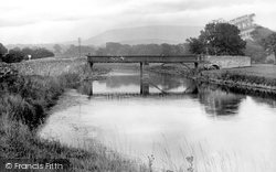
Until 1974, the River Ribble here formed the boundary between Lancashire and Yorkshire, with the bridge carrying the lane between Lancashire's Chatburn and Yorkshire's Grindleton.
The town's old graveyard behind the Town Hall had become very badly neglected by the beginning of the 20th century, so the gravestones were removed to line a boundary wall and the area
Monumental Tuscan boundary arches were built as entrances to the estate.
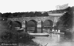
The river flowing beneath the 15th-century bridge is the Darent, which rises near the county boundary with Surrey near Westerham and runs through a myriad of Kent villages to the Thames near Long-reach
Close to the county boundary with Buckinghamshire and Bedfordshire, the unusually-named village of Bozeat was at the heart of a thriving weaving industry 600 years ago; the Weavers' Guild donated a rich
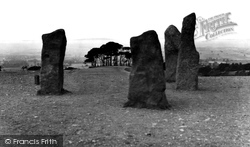
Along with the nearby Lickey Hills, the Clent Hills (which rise to 1,000 ft above sea level) form a clear boundary between rural countryside to the south and west and the man- made industrial
They once considerably exceeded their present boundaries, but have been much reduced with time.
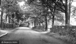
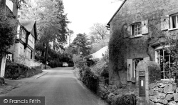
There cannot be a leafier lane than this within the boundaries of Middlesbrough.
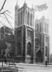
The Bristol dioceses was created by Henry VIII in 1542, and comprised eighteen parishes within the city boundaries, fourteen others in Gloucestershire, and Abbots Leigh in Somerset.
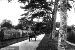
Two farm carts make their way down the drive, which is lined on one side with fir trees and on the other with the battlemented brick wall which is generally believed to form part of the original garden boundary
The road from Great Ellingham to Hingham runs dead straight for over half a mile, an unusual survival of an open-field boundary from the Middle Ages.
Its boundaries brush hard against the borders of neighbouring Hampshire.
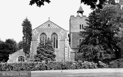
A substantial stone building of pleasing proportions, with a matching boundary wall, St Mary's Church was built in 1892 and stands on the High Street.
Along the southern boundary of Pulborough lies the River Arun, popular with Edwardian fishermen and boating enthusiasts.
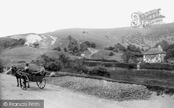
The stamp of ancient man is here too - there are traces of defensive works on the summit, while on the lower flank are Iron Age field boundaries or lynchets.
It sits alongside the Surrey boundary, two miles north of Edenbridge.
Places (2)
Photos (11)
Memories (102)
Books (0)
Maps (10)

