Places
17 places found.
Those places high-lighted have photos. All locations may have maps, books and memories.
- Bridge End, Oxfordshire
- Bridge End, Lincolnshire
- Bridge End, Essex
- Bridge End, Bedfordshire
- Bridge End, Clwyd
- Bridge End, Warwickshire
- Bridge End, Surrey
- Bridge End, Durham (near Frosterley)
- Bridge End, Northumberland (near Hexham)
- Bridge End, Hereford & Worcester (near Tirley)
- Bridge End, Hereford & Worcester (near Bosbury)
- Bridge End, Shetland Islands
- Bridge End, Cumbria (near Carlisle)
- Bridge End, Northumberland (near Hexham)
- Bridge End, Devon (near Kingsbridge)
- Bridge End, Devon (near Sidmouth)
- West End, Yorkshire (near Pateley Bridge)
Photos
40 photos found. Showing results 21 to 40.


Maps
524 maps found.


Books
2 books found. Showing results 25 to 2.
Memories
1,914 memories found. Showing results 11 to 20.
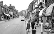
Shopping Memories.
This photograph shows two ladies chatting together in the foreground. On the right in the floral dress is my mother Mrs Beatrice Farnsworth. My family have been farmers in the locality for three generations. My mother's car is ...Read more
A memory of Worksop by
Memories Of Baby Burial At Dilston Maternity Hospital
by Mr Alex Hillary (April 6th 2007) - as reported to Susan Hedworth, Community Care Assistant No, we don’t get the snow like we used to! Like it was in 1941, I mean. I was a taxi driver at ...Read more
A memory of Corbridge by
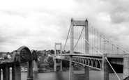
Which Side Of The River Tamar?
This photo is actually taken from the Devon side of the River Tamar, in St Budeaux, looking towards Saltash on the Cornwall side. In photos taken after the road bridge opened in 1961, you can tell which side is which, ...Read more
A memory of Saltash by
The Buildings Have Gone
The building to the right hand side has gone but the long wall remains. The church spire in the distance is all that remains of St Marks Church near to the Carfax. The rest of the church was demolished to make way for the new ...Read more
A memory of Horsham by
The Rec!
Ah yes, The Rec! Scene of many a battle and many a cup final, in later years there was romance! You could get through the hedge and down onto the railway line to put halfpennies on the line that got flattened by trains as they ran ...Read more
A memory of Little Sutton by
My Poor Upbringing By Teresa Shackell/Torrington
I was brought up in gwehelog no usk very poor and I can ember vividly very hungry most of the time oh and ice inside the windows I was so cold yet we had coal or rather wood from our local fields we used to ...Read more
A memory of Usk by
The Anchor
I was born on the Anchor in 1941. The houses were set back from the road with rough patch of ground in front of them where Pat Collin's fair used to set up every year in the summer. From the canal bridge on the left was the pub, The ...Read more
A memory of Deepfields by
Stowlangtoft Hall
Hi my name is Rita i don't remember much about my time at the hall as I was only 7months old in 1957 when we arrived Luckily my sister Maria Attard and brother Dominic Attard were a bit older, my sister was 3 years old and ...Read more
A memory of Stowlangtoft by
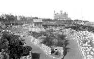
My Late Parents
I have on my wall a photograph featuring my late parents, Rex and Barbara Grimmer just after they were married standing on the bridge with the Japanese style building still standing. This was in the early 50’s, and I can recall it from my youth.
A memory of Lowestoft by
The Kennet
The river is the Kennet and this view shows the junction of the Kennet river (from low level bridge on the right) and the Kennet and Avon Canal (towards the locks straight ahead). The tributary to the left is towards the West Mills flour mill (water powered). The view is upstream (West).
A memory of Newbury by
Captions
1,770 captions found. Showing results 25 to 48.

Just beyond Bridge Foot we enter Bridge Street.

Further east along The Embankment, Newnham Bridge crosses the north branch of the River Ouse at the south end of Tennyson Road.

Framwellgate was Durham's first bridge over the Wear.

An excellent view of the Old Bridge with the castle in the background.

Part of Beeding's Bridge is just visible on the small rise at the far western end of the High Street, next to the Bridge Inn on the left.

Beyond is the Suspension Bridge linking Mill Meadow Island with Embankment Gardens at the right-hand end of the bridge.

Abingdon Bridge, built 1416-1417, is classified as a listed monument.

Two lads enjoy the view from the hillside above Newby Bridge, the small village at the southern end of Windermere, with the low south Lakeland hills in the background.
That was an age of great prosperity, thanks to the flourishing wool trade, and there is little sign of such wealth and population in the small hamlet of today.

A family group of children enjoy a boating trip on the River Leven at Newby Bridge, at the southern end of Lake Windermere.

Wren's bridge, built by Robert Rumbold in 1709-12, has a balustraded parapet and heraldic beasts on display.

A family group of children enjoy a boating trip on the River Leven at Newby Bridge, at the southern end of Windermere.

Compare this photograph with R67001 - the new bridge carries one of the approach roads to the Jubilee Bridge.

East from the south end of Reading Bridge John Tims Boatyard building, with its punts and boats for hire, has now all gone, replaced by the less than wonderful eleven-storey Reading Bridge House.

The Welsh name for Bridgend is 'Yr Hen Bont'.

The main A59 road from Liverpool to Preston runs through the centre of the village, and at the far end, rises over the Leeds and Liverpool Canal.

The seaward end of Broad Street was once the hub of Lyme Regis with its old Custom House, until a devastating fire in 1844.

Once a popular riverside haunt for the locals, Hog Island is now known as Piper's Vale, and is more remarkable today as the north-eastern end of the Orwell Bridge.

A lock linked the river and Nottingham Canal at the projection near the end of the walkway.

Th A415 heads south along the 15th-century causeway above the marshy river meadows to Culham Bridge, built in 1416-22 by Abingdon's Fraternity of the Holy Cross, but now by-passed by a modern bridge.

This beautiful wooden trellised bridge crosses the end of a mill stream, where it joins the River Ouse.

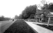
At Water End, the River Gade runs under the fine three-arched bridge and through water meadows shaded by beech, willow and oak trees.

Returning to the west end of the bridge, a most dramatic view of Andover was to be seen over Micheldever Road in 1908.

St Thomas Becket church is at the east end of Cliffe High Street, which runs west to cross the Ouse into School Hill and Lewes proper.
Places (17)
Photos (40)
Memories (1914)
Books (2)
Maps (524)

