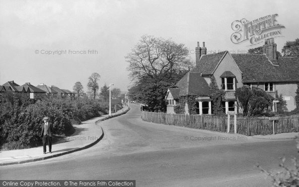
Hornchurch, Wingletye Lane, Photograph C.1950
A Memory of Hornchurch.
I lived in Glanville Drive, a residential road off Upminster Road about 100 yards to the west of Wingletye Lane, for the first part of my life from 1947 so I knew the area well.
The building on the corner of Wingletye Lane and Upminster Road is 'Dury Falls', a Grade II Listed Building which I remember was being used as offices in the 1960s.
The strip of land planted with bushes on the left-hand side of the photograph had, I believe, been left undeveloped to protect the route of a planned main road from the A127 'Southend Arterial Road' to somewhere in the south of the county that was never built. There is a similar strip alongside Hacton Lane on the other side of Upminster Road. I only remember the strip as being grassed so the bushes must have been removed in the 1950s.
About 200 yards along Wingletye Lane on the right-hand side was Dury Falls Secondary School.
About 350 yards along Wingletye Lane is the bridge over the Romford-Upminster railway branch line. About 100 yards along the railway cutting to the west of the bridge is a Site of Special Scientific Interest which marks the southernmost extent, around 450,000 years ago, of ice during the ice ages.
Add your comment
You must be signed-in to your Frith account to post a comment.
Add to Album
You must be signed in to save to an album
Sign inSparked a Memory for you?
If this has sparked a memory, why not share it here?


Comments & Feedback
Be the first to comment on this Memory! Starting a conversation is a great way to share, and get involved! Why not give some feedback on this Memory, add your own recollections, or ask questions below.