

The Frith Shop

Find out about the products we offer, all of which are inspired by the rich nostalgic photographs and maps that form today's Francis Frith Collection.
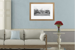
Photo Prints
A nostalgic print from The Francis Frith Collection is special, handmade by us to order and available in a variety of styles and sizes.
Find out more

Sheet Maps
Handy maps offer fascinating insight into the history of a local area at a great price.
Find out more
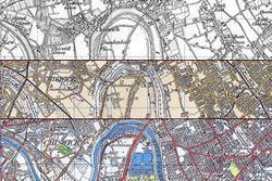
Old Maps
Stunningly detailed old Ordnance Survey Maps Prints, Sheet Maps and Victorian County Maps in a wide range of sizes and styles to suit every budget.
Find out more
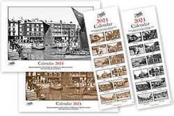
Calendars
Personalised calendars in a choice of black and white or sepia and available in two sizes, all featuring stunning old photos from the Collection.
Find out more
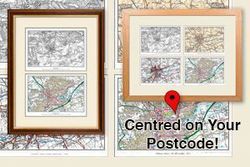
Postcode Centred Maps
Products featuring Ordnance Survey maps centred on a postcode of your choice.
Find out more
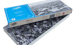
Jigsaws
A 500 or 1000 piece Jigsaw of any Frith photo or map. Packed with period detail, your individually-made Jigsaw will keep you absorbed for hours as you piece together the unique history of the place you love.
Find out more
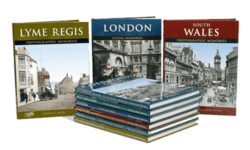
Photo Books
Hundreds of nostalgic photo books about Britain. 10 fascinating ranges to enjoy, lavishly illustrated with our high quality photographs. Most books are now printed to order, so you can personalise your copy.
Find out more
Tableware
Create unique table mats and coasters for your home, printed with your choice of local nostalgic photos from The Francis Frith Collection.
Find out more
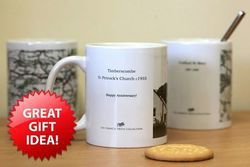
Mugs
Create a mug featuring a favourite personalised nostalgic Frith photo or map of your choice. These friendly ceramic mugs make great gifts for the coffee and tea lovers in your life.
Find out more
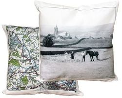
Cushion Covers
High quality cushion covers designed to fit a standard 45 x45 cm (18" square) cushion. A great gift or a wonderful unique addition to your own home decor.
Find out more
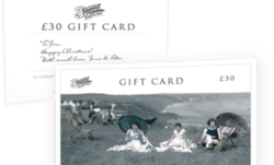
Gift Cards
Frith Gift Cards are flexible presents for any occasion, perfect for when you aren’t sure which Frith gift is just the right choice. Available in £20-£150, you can include a personal message.
Find out more
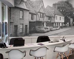
Wallpaper
Many Frith photographs are now available printed as wallpaper, so why not really create some impact by covering your walls at home with one of our photographs that means something to you!
Find out more
What people say:
Added 25th July 2012
“I received my photograph today and I would like to thank you for the excellent service. I'm delighted with the photograph of Lower Largo and it has brough back many good childhood memories and as this is a present for my borther I'm sure he will be deighted with it too”
Added 16th March 2011
“I just wanted to say a huge thank you for such an excellent service, I ordered my print yesterday and it arrived this morning. The print itself is fabulous and I am sure it will be a very much appreciated birthday present”
Added 29th November 2017
“Just received the map and photo both on canvas on wood frames.
These are excellent, the image is sharp and crisp, I was a bit concerned because it was on canvas but it is very good.
The wooden frames are excellent, very robust and well finished.
I didn't want the standard glass frame as the image would look a bit odd because it was small compared with the overall frame so I took a gamble on having the canvas ones as the size is just the image plus a bit.
Very happy with these.
Best wishes
Ian”
Added 20th December 2017
“I have just received the calendars I chose, featuring the places in Shropshire that my ancestors came from. The photos exceeded all expectations and bring to life the towns and streets where my ancestors were born, lived, married and worked. I can't wait to pass these gifts on to the family. Many thanks for the prompt delivery as well as these great calendars.”
(This will navigate you away from this page)