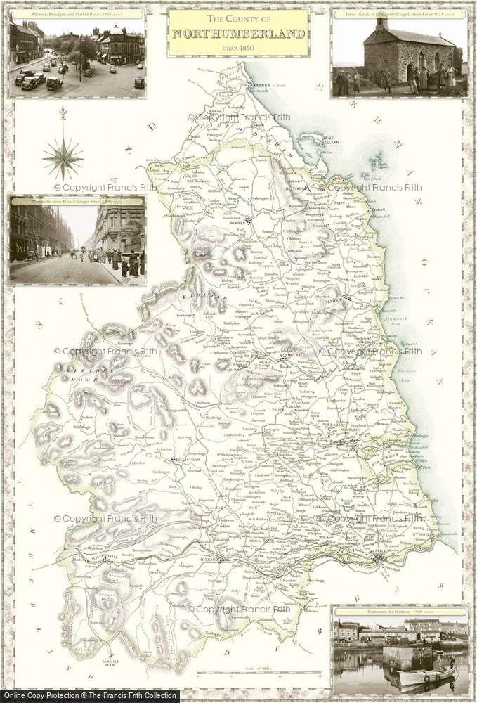
Historic County Map of Northumberland

These superbly detailed maps provide an authoritive and fascinating insight into the history and gradual development of our cities, towns and villages. The maps are decorated in the margins by selected Frith photographs. Available to buy in a range of sizes and styles, including large prints on canvas and tea towels.
Buy a Print
Unframed, Mounted, Framed and Canvas prints in a range of sizes and styles.
 Size: 420 x 297mm (16.5 x 11.7")
Price
$45
View Sizes & Prices
Add to Album
You must be signed in to save to an album
Sign in
This County Map features these photos:
 Seahouses, the Harbour c1936
Ref. S521027
 Farne Islands, St Cuthbert's Chapel, Inner Farne 1933
Ref. F152004
 Alnwick, Bondgate and Market Place c1955
Ref. A223017
 Newcastle upon Tyne, Grainger Street 1900
Ref. N16314
About This Map
- Year drawn: 1840
- Series: Samuel Lewis County Maps
- Map reference: f29
- Features four Frith photos from the area covered in the margins. More details shown below.
- Learn about Samuel Lewis County Maps maps
Samual Lewis Victorian County maps
Published 1840
Stunning, full-colour reproductions of hand-tinted original county maps which were drawn by R. Creighton and engraved by T. Starling and J. & C. Walker. They were created in the 19th century, during the great coaching era for Samuel Lewis' renowned guidebook.
