Merry Christmas & Happy New Year!
Christmas Deliveries: If you placed an order on or before midday on Friday 19th December for Christmas delivery it was despatched before the Royal Mail or Parcel Force deadline and therefore should be received in time for Christmas. Orders placed after midday on Friday 19th December will be delivered in the New Year.
Please Note: Our offices and factory are now closed until Monday 5th January when we will be pleased to deal with any queries that have arisen during the holiday period.
During the holiday our Gift Cards may still be ordered for any last minute orders and will be sent automatically by email direct to your recipient - see here: Gift Cards
Places
26 places found.
Those places high-lighted have photos. All locations may have maps, books and memories.
- Town End, Derbyshire
- Town End, Buckinghamshire
- Town's End, Somerset
- Towns End, Dorset
- Town End, Merseyside
- Town End, Cambridgeshire
- Town's End, Buckinghamshire
- West End Town, Northumberland
- Bolton Town End, Lancashire
- Kearby Town End, Yorkshire
- Town End, Cumbria (near Grange-Over-Sands)
- Town End, Cumbria (near Bowness-On-Windermere)
- Town End, Yorkshire (near Huddersfield)
- Town End, Yorkshire (near Wilberfoss)
- Town End, Cumbria (near Appleby-in-Westmorland)
- Town's End, Dorset (near Melbury Osmond)
- Town's End, Dorset (near Swanage)
- Town End, Cumbria (near Ambleside)
- Town End, Cumbria (near Lakeside)
- Town End, Cumbria (near Kirkby Lonsdale)
- Town End, Cumbria (near Ambleside)
- Town's End, Dorset (near Bere Regis)
- West-end Town, South Glamorgan
- Townend, Derbyshire
- Townend, Strathclyde (near Dumbarton)
- Townend, Staffordshire (near Stone)
Photos
26 photos found. Showing results 1,381 to 26.
Maps
195 maps found.
Books
160 books found. Showing results 1,657 to 1,680.
Memories
3,720 memories found. Showing results 691 to 700.
Hillikers Faggots
My Nan and Grandad lived on the corner of Factory Road, and Cranbury Road, opposite Stan Brehaut the photographer, who went on to work with Jack Hargreaves in his programme 'Out of Town'. The Centre of Eastleigh holds such fond ...Read more
A memory of Eastleigh in 1956 by
Years Gone By
Moved to Roadhead 1949, from 19 Netherby St, Longtown. Dad was Rendall Colling [Policeman], we lived at the Police House, until 1954 when we moved to Frizington, West Cumberland. Went to school at the Baily. Brother Cuthbert was born ...Read more
A memory of Roadhead in 1949 by
Erith And Belvedere
I lived in Upper Belvedere from the time I was born until I married 1n 1954. I used to catch the 99 bus from the Eardly Arms pub, on a Saturday morning. to the Ritz cinema in the high street Erith. There was no Odeon then. The only ...Read more
A memory of Erith in 1930 by
Good Old Days?
I remember walking past this point on shopping trips with my mother, being dragged along (wasn't good at walking) or on my way to/from school. I was born in 1953 in Sugden avenue where bungalows had massive areas of land (maybe I was ...Read more
A memory of Wickford in 1960 by
Our Stay In Thaxted
In 1969, my father, a MSGT in the USAF, was stationed at RAF Wethersfield. While waiting for base housing, we rented a beautifully situated place named Barn Cottage, a 600-year-old converted stable. Our landlord, Mr. Ainsworth, ...Read more
A memory of Thaxted in 1969 by
Childhood Dreams
I came across this website by accident, what a treat. I was raised in Croydon, actually Addington. My nana and granddad lived at 195 Purley Way in Wadden. I spent many happy hours there as a child. I would spend several weeks with ...Read more
A memory of Croydon in 1955 by
When I Was A Boy
My name is Peter Labdon and I lived with my father Wilf, my mother Ruby and my brother David in Halberton from 1933 to 1943, between the ages of two and twelve. We lived first in Norway House, at the top of the road to Lower Town, ...Read more
A memory of Halberton in 1930 by
The Norfolk Family Settle In East Kilbride
Work brought me to Scotland in 1975 and I needed to live within commuting distance of the Bank of England branch in Glasgow. Elizabeth and I looked around the south side of the City and fell in love ...Read more
A memory of East Kilbride in 1975 by
1960s And Prior London Road Haunts
I was born in Bagshot but moved to Camberley in 1955 when I was 8. I attended York Town Primary School which was, and on checking the maps still appears to be, located on the other side of the London Road, a bit ...Read more
A memory of Camberley in 1960 by
My First Visit
Was overwhelmed by open spaces,woodland, fields of pasture, arable, all seemingly laid out with such precision. Those responsible for management of the land appear to take so much care. Aberdeen Angus; Pheasants; variety ...Read more
A memory of Kirkton of Logie Buchan in 2007 by
Captions
5,111 captions found. Showing results 1,657 to 1,680.
An evocative view from the north-east of the part of the town immediately below the Castle and the impressive Castle and prison itself.
Leaving town by the line of the present existing Old Bedford Road, it crossed the river by a ford on the town side of Little Moor.
Corbridge is a small town with a traumatic history.
It is a quiet morning in this pleasant small town, situated on a gentle hill a few miles west of Sevenoaks.
This famous and picturesque town is situated on a hill above the River Blackwater.
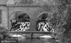
Broadwaters Park stream flows towards the town. It is culverted under the main road, and collects in a large lake, which lies between Broadwaters Lane and the estate of houses.
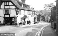
This lovely old building, the town museum and waxworks when this photograph was taken, adorns Brading High Street. Note the early appearance of double yellow lines prohibiting car parking.
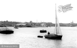
The vessel moored to buoys against the far bank is probably unloading grain into a Town Mills silo. This view across the river separates Rochester Cathedral and the castle.
Other notable changes in town before the Second World War were the straightening of Marlow Hill in 1936, which involved demolishing buildings on the left side of the road south of St Mary's Street
Like many old towns, Stafford retains its medieval layout at its heart. At the town centre, then as now, was the Market Square, mostly lying on the east side of the main street.
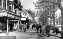
Laid out as an extravagant boulevard in the 1820s, Lord Street's many elegant buildings reflect the town's ambitions as a high-class residence and resort.
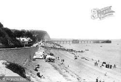
The Victorian penchant for building piers in seaside resort towns is on show here. This example dates from 1894 and was 658 feet in length.
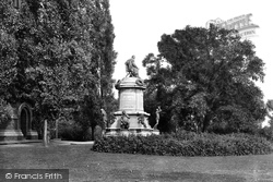
This was presented to the town in 1888 by the sculptor Lord Ronald Gower. Around the base are characters from various plays.
It was close by that the Roman invaders landed, founding a town close to the mouths of the Stour and the Avon.
Here we see some of the gardens to the west of the main town, much enjoyed by residents and visitors. The land slopes more gently than in the Shrubbery area.
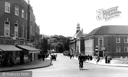
On the left is the Queen's Head Hotel; beyond that is the Chesterfield & District Co-operative Society. Directly ahead is the town branch of Barclays Bank.
It attracted both of the author's grandfathers to the town!
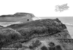
Exploring the dramatic coastline, pastoral countryside and delightful towns and villages never fails to make for a memorable holiday.
The original town was built around a six acre lake called the Mere, its southern edge bordered by a large village green.
The blue and red brick buildings on the extreme right of the photograph serve as perfect examples of the regional building style of the 18th century.
This was in the days when supermarkets complemented high street shopping, and there was still room for the smaller, independent retailer.
By now the motorcar and charabanc had put Skipton firmly on the map as the principal southern gateway to the Dales.
The town is changing, and Barclays Bank has replaced the London and Provincial, while Smiths Garage provides petrol from a pump.
Shepshed used to be heavily involved in hosiery and knitwear, and the town still has links with its original industries.
Places (26)
Photos (26)
Memories (3720)
Books (160)
Maps (195)


