Merry Christmas & Happy New Year!
Christmas Deliveries: If you placed an order on or before midday on Friday 19th December for Christmas delivery it was despatched before the Royal Mail or Parcel Force deadline and therefore should be received in time for Christmas. Orders placed after midday on Friday 19th December will be delivered in the New Year.
Please Note: Our offices and factory are now closed until Monday 5th January when we will be pleased to deal with any queries that have arisen during the holiday period.
During the holiday our Gift Cards may still be ordered for any last minute orders and will be sent automatically by email direct to your recipient - see here: Gift Cards
Places
36 places found.
Those places high-lighted have photos. All locations may have maps, books and memories.
- West End, Gwynedd
- West End, Hampshire (near Southampton)
- West End, Surrey (near Camberley)
- West End, Hampshire (near Medstead)
- West End, Leicestershire
- Ward End, West Midlands
- Shard End, West Midlands
- West End, Gloucestershire
- West End, Dorset
- West End, Strathclyde
- West End, Mid Glamorgan
- West End, Gwent
- West End, Hertfordshire
- West End, Suffolk
- West End, Sussex
- West End, Lancashire (near Morecambe)
- West End, Yorkshire (near Tadcaster)
- West End, Avon (near Nailsea)
- West End, Somerset (near Wells)
- West End, Oxfordshire (near Wallingford)
- West End, Berkshire (near Wokingham)
- West End, Norfolk (near Great Yarmouth)
- West End, Bedfordshire (near Great Staughton)
- West End, Kent (near Sittingbourne)
- West End, Yorkshire (near South Cave)
- West End, Avon (near Yate)
- West End, Wiltshire (near Shaftesbury)
- West End, Wiltshire (near Bowerchalke)
- West End, Berkshire (near Bracknell)
- West End, Yorkshire (near Driffield)
- West End, Yorkshire (near Hedon)
- West End, Lincolnshire (near Boston)
- West End, Cumbria (near Carlisle)
- West End, Yorkshire (near Cleckheaton)
- West End, Yorkshire (near Horsforth)
- West End, Oxfordshire (near Hardwick)
Photos
279 photos found. Showing results 941 to 279.
Maps
1,651 maps found.
Books
19 books found. Showing results 1,129 to 19.
Memories
2,057 memories found. Showing results 471 to 480.
Search For Relatives
My great grandfather and great great grandfather lived at 13 and 15 Regent Street West, as per the 1911 and 1881 census respectively. Is there anyone who can supply me with information about this town and possibly some ...Read more
A memory of Briton Ferry by
Greengrocers In Vivian Ave
My Saturday and school holiday job was working for the greengrocers, can't remember their name, next to ABC bread shop. Really nice people and gave me a life long understanding of quality fruit & veg. ...Read more
A memory of Hendon by
Hett Hills
I lived at what is now Old County View at Hett Hills from 1959 to 1963. My sister and her husband - Sam Wears, had a house built in the garden next door to us. There was a square of about 6 houses behind us which were demolished ...Read more
A memory of Hett Hills in 1959 by
Langley Residential Special School 1956
Hi All, Just to say that I was a resident of Langley from January 1956 to July 1956. Have an autograph book here with staff and boys/girls comments on leaving - Staff: Afred/Margaret (Gardeners) D Barry ...Read more
A memory of Baildon by
Elm Road Baptist Church
I was married to my long standing girl friend Brenda at Elm Road, Baptist Chapel in September 1968. We had first met six years earlier at the Regal dance hall in Beckenham and after our marriage, lived in Anerley Park, ...Read more
A memory of Beckenham in 1968 by
Hepple School Northumberland
As a child my family lived on a farm about two miles from Hepple village. Like my 2 older brothers I attended the primary school at nearby Hepple. I started my school life there in August 1961 and remember being upset ...Read more
A memory of Hepple in 1965 by
A Watchet Boy
I was born in Woodland Road in 1948. The houses were brand new. I used to watch the builders from Dates going up the road to work on the houses at the top. I would stand on next door's doorstep and swear at them as they passed. My ...Read more
A memory of Watchet by
Rood End School
I was born in July 1939 in a street with the unbelievable name of `Dog Kennel Lane` in Oldbury, now in West Midlands, can you believe that? Actually I think it was in the Langley area of Oldbury. As I was so young at the time I ...Read more
A memory of Oldbury in 1930 by
My Youth In Grimethorpe
I was born in Batley in the West Riding, but moved with my parents in 1947 to Grimethorpe. We lived on Carlton Street with my grandparents, Charlotte & Efram Dawson. Efram was my grandmother's second husband, her ...Read more
A memory of Grimethorpe in 1947 by
1930 2012
1935: went to Crowland Rd. School till 1939 - lived in Gladesmore Rd. Moved to Pelham Road 1939 with brother Derek and sister Connie. Started at Seven Sisters school. Evacuated to Baldock, I contracted diphtheria, thankfully ...Read more
A memory of Tottenham in 1940 by
Captions
1,993 captions found. Showing results 1,129 to 1,152.
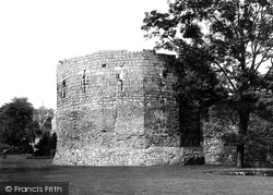
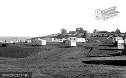
The lower part of this strange structure is Roman; it was the west corner of the Roman fort. The upper part is 14th-century.
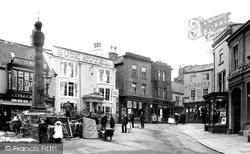
As we move further west, we see a part of St Mary's Street with an interesting mix of buildings with alleys leading down to the river front and The Meadows.
Opened throughout in 1772, the Staffs & Worcestershire Canal was designed by James Brindley as part of a scheme to allow traffic to operate between the Thames,Trent, Severn and Mersey.
On the west side of the green area called the Croft, backing on to the river, are the workhouse and St Gregory's off to the left.
The Causeway leads from the town of Buntingford to the original, and now derelict, parish church of St Bartholomew, Layston.
The church of St Mary was burnt down in 1914 and rebuilt by W Fellowes Prynne. What remained of the old building was the brick west tower dating back to around 1635.
The centre of the village dates from the restoration and repairs begun in 1752 by Lord Crewe's trustees.
Here we see a fine display of weatherboarding along the empty and dusty main street. The faded pub sign is for the Bull Inn.
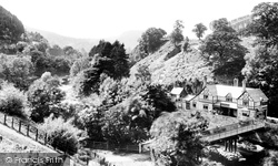
Berwyn is a lonely spot west of Llangollen, where the half-timbered Chain Bridge Hotel and the station on the old Llangollen-Corwen railway stand beside the River Dee as it enters a small gorge.
The mill was built as a corn mill, and mill workers' cottages grew up along the Tringford Road, complete with an 1870s elementary school.
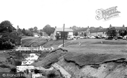
The village of Hutton-le-Hole lies about one mile west of Lastingham.
New properties and hotels were erected at such a pace that two brickyards were established. The boom did not come, and building stopped.
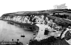
Jack Rattenbury, the 'Rob Roy of the West', was born at Beer in 1778 and experienced a series of adventures at sea before settling down to a life of smuggling along this wild and lonely
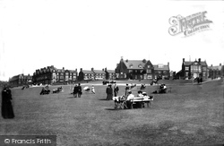
Hunstanton is unique for north Norfolk resort towns in that it looks west across the sea and not east.
The Benedictine Priory, founded in 1043, grew to become one of the wealthiest in the midlands, and the sheer bulk of its buildings must have made an imposing sight on the Coventry skyline.The complex
The town centre is in the distance; there are some Edwardian and many modern buildings here.To the north is a pond, and south of the railway line is a water tower resembling a castle.
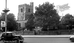
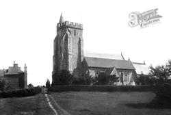
The trees have grown, and the street signs have changed, but the church, with its substantial 15th-century ragstone west tower and mid 18th-century brick-faced body, remains substantially unaltered behind
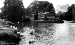
Stevens's Boatyard withdrew to the west parts of Nag's Head Island beyond the bridges, and the Abingdon Bridge Restaurant and Tea Rooms took over their buildings to serve river- borne
The church of St Mary the Virgin, standing on its mound on the edge of Romney Marsh and viewed here from the south-west, dates from the 13th and 15th centuries.
In May 1822, a spring was discovered about one mile to the south west, and Guisborough climbed aboard the spa town bandwagon.
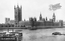
By this time the wharves have been cleared away to create Victoria Embankment Garden, a more fitting context for the Mother of Parliaments, rebuilt in Gothic style between 1839 and 1860 by Pugin and Sir
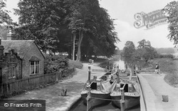
Here we see two horse-drawn narrowboats, 'Linnet' and 'Evelyn', at the attractively-sited lock in Cassiobury Park, Watford.
An isolated village of flint and brick cottages, to the west of Chichester. In the village are Adsdean, a gabled Tudor style house of around 1850, and the church of St Mary, built in 1859.
The Star Inn is now more of a brasserie than a pub, and the adjacent post office has been replaced by a television and video shop.
Places (99)
Photos (279)
Memories (2057)
Books (19)
Maps (1651)


