Places
26 places found.
Those places high-lighted have photos. All locations may have maps, books and memories.
- Cemmaes Road, Powys
- Six Road Ends, County Down
- Road Weedon, Northamptonshire
- Severn Road Bridge, Gloucestershire
- Roade, Northamptonshire
- Berkeley Road, Gloucestershire
- Harling Road, Norfolk
- Road Green, Devon
- Builth Road, Powys
- Cross Roads, Yorkshire
- Steele Road, Borders
- Cross Roads, Devon
- Four Roads, Dyfed
- Road Green, Norfolk
- Biggar Road, Strathclyde
- Clarbeston Road, Dyfed
- Five Roads, Dyfed
- Eccles Road, Norfolk
- Grampound Road, Cornwall
- Morchard Road, Devon
- Wood Road, Greater Manchester
- Four Roads, Isle of Man
- St Columb Road, Cornwall
- Clipiau, Gwynedd (near Cemmaes Road)
- New Road Side, Yorkshire (near Silsden)
- New Road Side, Yorkshire (near Cleckheaton)
Photos
14,329 photos found. Showing results 1,141 to 1,160.
Maps
476 maps found.
Books
5 books found. Showing results 1,369 to 5.
Memories
11,058 memories found. Showing results 571 to 580.
Early Mobile Days In Welling
Light-years before the introduction of the mobile phone, Welling in the 1950's had mobile networks of its own. These were weekly delivery services to households in and around local streets. As a young child I was always ...Read more
A memory of Welling by
Another Slice Of Life In Burghfield And Sulhampstead
My Grandfather George Thomas Cooper 1880 to 1957 lived at Hebron a Detached Victorian House ( which is opposite what today is Coopers Place, named after my late Father Phillip George ...Read more
A memory of Burghfield Common by
Little Sutton In The 1950/60's
I lived in Kronsbec Ave and started school at Berwivk Road in 1955 just before my 5th birthday. I recall my first teacher was Miss Anscombe and then Mrs McClaren. Then Mr Foxall and finaly a female whose name I ...Read more
A memory of Little Sutton by
Covered Bus Stop On Sale Canal Bridge.
Born, bred, lived and worked in Sale. 50 years b4 I moved to Scotland. I seemed to be the only one, amongst my peers, to recall a scaffold-pole framed, covered bus stop situated on the wide pavement between the old ...Read more
A memory of Sale by
Marks & Spencer
I remember M & S very well in West Ealing. Around the fifties they had St Michael toys. One I remember was a milk float, it had little crates with bottles in them. It was made of polythene as a lot of toys were then. Also they ...Read more
A memory of West Ealing by
60s /Irby
Born 1959 & lived down the bottom of Coombe Road. Looking at the pics of the village I can remember the daily uphill trudge with mum to the shops. Ok I was in a pushchair on the way up but that became a shopping trolley on the way ...Read more
A memory of Irby by
Born In 1942 Lived In Westbrook Road
Born in 1942, Lived in Westbrook Road. Attended Heston Infants School, Heston Junior School and Spring Grove Central School. I have lots of memories, but reading other people’s entries has reminded me of names of ...Read more
A memory of Heston by
Blagdon Road And The Fountain Pub.
My family lived in Blagdon Road back in the early 50s , and I was born there. I believe my grandmother stayed living there for a good few years until she moved to Nelson Road where she died in the 60s. My estranged ...Read more
A memory of New Malden by
Wartime Memories Of Romiley
My memory of Romiley was around the Summer of 1940. My family stayed in a stone cottage, there were about 10 of them. They were on the road up to Greave which was about half a mile away. Going in the opposite direction down ...Read more
A memory of Romiley
Growing Up In Mitcham
I was born Leslie Dennis Crutch in Grove Road 1948. My brother Ken was born 9 months after dad (Ronald Kenneth) had gone to Normandy as part of the landings - I was born 9 months after he was demobbed (funny that) to mum Winifred ...Read more
A memory of Mitcham by
Your search returned a large number of results. Please try to refine your search further.
Captions
5,036 captions found. Showing results 1,369 to 1,392.
It all looks very quiet along Rye Ground Lane, quiet enough for a group of locals to stand chatting in the middle of the road.
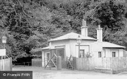
The Neo-Doric lodges on the Basingstoke Road were built by Wyatt in 1807-12.
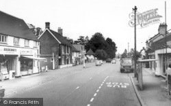
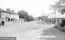
This view looks west along Main Road. In the distance a lorry is being loaded with milk churns from Old Post Office Farm. In 1900 there were twelve farms in the village, all with dairy herds.
This view looks west along Main Road. In the distance a lorry is being loaded with milk churns from Old Post Office Farm. In 1900 there were twelve farms in the village, all with dairy herds.
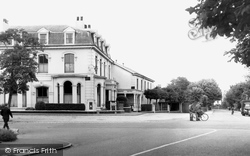
We have our backs to the Red Lion, and are looking down the A257 Sandwich and Deal road, with Lloyds Bank clearly visible on the right.
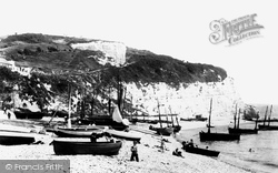
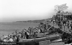
There were plenty of fishing boats in what used to be known as Beer Roads. The rocky promontory, East Ebb, divided Seaton from Beer and kept the two places apart.
The River Fal is one of the glories of Cornwall, and winds a serpentine course towards Falmouth and the Carrick Roads.
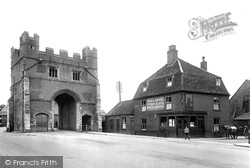
The East Gate to the town was demolished in 1800, but the old South Gate on the road from London still stands.
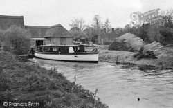
The Maltsters Inn can be seen across the road. The flint walled boatshed on the left is now obscured by a gift shop/information centre.
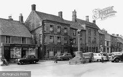
Stow-on-the-Wold is the junction of eight major roads, including the Roman Fosse Way, and has always attracted travellers from far and wide.
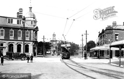
Through-services to Blackpool began in 1897, and the route was via St Anne's, then along through the sand dunes of Clifton Drive, then to Squires Gate, and on to Station Road.
It just goes to show it is not only the roads which suffer from traffic jams.
The road in front of the houses if Channel View, and beneath if we can see the railway lines, now only a single main line used primarily to transport coils from the Llanwerm steelworks to the Ebbw Vale
They were built by Spencer's Engineering Works, which moved to Beanacre Road in 1903.
This picture shows the River Ebble and the A354 Blandford Road running side- by-side through the village of Coombe Bissett, a couple of miles south of Salisbury.
A small boy watches the antics of the Frith cameraman as he positions his camera for this picture of the main road to Sheffield.
As numerous pictures in our archive show, traffic was light enough for our cameraman to stand in the road in order to take this image.
Yates's map of 1786 shows that there was a toll booth between the road junctions.
In February 1953 the Promenade was buried under thousands of tons of shingle, and the roads blocked by smashed boats.
There have been recent alterations to this junction between Rake and Station Roads.
The main road towards Reading is to the right.
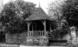
The village pump, situated at the junction of Park Street and Grove Road, is over 300 years old and a listed structure.
This pub, just across the road from the church, was once the town's courthouse.
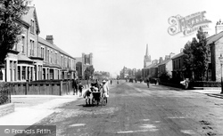
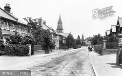
This photograph shows the shingled spire of Holy Trinity Church peeping above the rooftops in Church Road.
Places (26)
Photos (14329)
Memories (11058)
Books (5)
Maps (476)


