Places
36 places found.
Those places high-lighted have photos. All locations may have maps, books and memories.
- Shanklin, Isle of Wight
- Ventnor, Isle of Wight
- Ryde, Isle of Wight
- Cowes, Isle of Wight
- Sandown, Isle of Wight
- Port of Ness, Western Isles
- London, Greater London
- Cambridge, Cambridgeshire
- Dublin, Republic of Ireland
- Killarney, Republic of Ireland
- Douglas, Isle of Man
- Plymouth, Devon
- Newport, Isle of Wight
- Southwold, Suffolk
- Bristol, Avon
- Lowestoft, Suffolk
- Cromer, Norfolk
- Edinburgh, Lothian
- Maldon, Essex
- Clacton-On-Sea, Essex
- Felixstowe, Suffolk
- Norwich, Norfolk
- Hitchin, Hertfordshire
- Stevenage, Hertfordshire
- Colchester, Essex
- Nottingham, Nottinghamshire
- Bedford, Bedfordshire
- Bury St Edmunds, Suffolk
- Aldeburgh, Suffolk
- St Albans, Hertfordshire
- Hunstanton, Norfolk
- Chelmsford, Essex
- Bishop's Stortford, Hertfordshire
- Peterborough, Cambridgeshire
- Brentwood, Essex
- Glengarriff, Republic of Ireland
Photos
11,145 photos found. Showing results 18,361 to 11,145.
Maps
181,031 maps found.


Books
442 books found. Showing results 22,033 to 22,056.
Memories
29,076 memories found. Showing results 9,181 to 9,190.
Gaslight 1954
In the early 50's many streets in Uxbridge were still lit by gas. So "lighting up time" had a whole different meaning. The iron lampposts were much lower than the lighting masts of today and were more widely placed along the ...Read more
A memory of Uxbridge in 1954 by
Flixton Road
This picture shows the Post Office - the nearest of the row of shops. Note the old-fashioned police telephone just outside the Post Office. The next shop is the barbers where I used to get the haircut! The son of this barber had a ...Read more
A memory of Flixton in 1965 by
The 'new' Shops
Known locally as 'the new shops' close to the junction of Moorside Road and Woodsend Road. The shops also included a branch of Boots, Bamforths cycle and radio shop, an off-licenes (right in the corner), a grocers, a newsagent, dry cleaners and chippie. There may have been a fishmongers as well?
A memory of Flixton in 1960 by
Old Memories Of Hartlepool In Olden Days
Does anyone know any information about 72 d Southgate. The headland in Hartlepool at all?
A memory of Hartlepool by
Fond Memories.
I lived in Coval Lane from my 1st birthday to my 24th birthday - 1948/1971. Then I got married and moved out. At that time the shop on the corner was a wool shop because my mum, an ardent knitter, bought most of her wool there. I ...Read more
A memory of Chelmsford by
40s/50s
Early memories of Buckhurst Hill. Re. Mark Brazier's message. Yes I remember the Three Colts and the French family. The son David was a close friend so I spent a lot of time there. I remember your mother and father Audrey and Ged ...Read more
A memory of Buckhurst Hill by
Great Memories Of Durham City
My Uncle Gordon was the police man who used to sit in the police box at the top of the street in the market square directing traffic. This was around 1950s. I used to live in Meadowfield and came to Durham many, many ...Read more
A memory of Durham by
Heysham Towers Holiday Camp
I remember arriving in Morecambe in 1967, with a mate of mine, to work the Summer at Pontin's in Middleton but, due to a clerical error, our job's were no longer open. So, on the way back to Morecambe, (on the bus), we ...Read more
A memory of Heysham in 1967 by
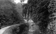
Springs Canal
View of Springs Canal. Gravel Chutes from Old Bailey railway can be seen at the end of the canal.
A memory of Skipton in 1945 by
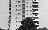
New Housing Estate
Lived here on top floor of Morville House from 1955/6 till I left home and parents moved, in mid seventies. Went to Honeywell Primary School and later Eliot in Putney. Supported Chelsea and used to walk there down Trinity ...Read more
A memory of Wandsworth by
Your search returned a large number of results. Please try to refine your search further.
Captions
29,395 captions found. Showing results 22,033 to 22,056.

Chigwell Hall dominates the land behind the churchyard of St Mary's. It was built in 1876 to designs by Norman Shaw, his only house in the area. It is now a Grade II listed building.

This community relocated to Prinknash in Gloucestershire and the buildings were taken over by the present community of Cistercian monks.

This scene is indicative of the time - there is not a car in sight. Indeed, the sign on the left is for Holliday's Livery and Stables, where you could also hire a landau or dogcart.

Cheap Street is one of Sherborne's ancient trading areas, and still fulfils that function today. Notice the cricket bat sign over Freeman's Sports Shop.

After the war, the remains of the city centre were demolished to make way for a new, more regular street plan. In this picture the new Post Office is still under construction on the right.
The Leys was founded by Methodists as a boys' school run on Christian principles.

Being within a few miles of the village, they helped Wroxham become the major centre for cruising that it is today.

A Manchester Corporation tramcar stands at the Altrincham terminus in Railway Street, its route back to Manchester being by way of Stamford New Road, Sandiway Road, Manchester Road, Washway Road, Cross

The Parade, seen here with North Street in the distance, is at the very heart of Taunton. On the left are the Victoria Rooms, built as a market in 1821 and sadly demolished in 1963.

There were 10 chambers, each one duplicated to speed the flow of traffic.

It was built by the Pennant family on the proceeds of their huge Penrhyn slate quarries at Bethesda.

This is an early view of Tunbridge Wells, with a lone cart ascending the hill beside the common, where early visitors like Queen Henrietta Maria had camped. The view is unmistakable, even today.

The thatched house north of the crossroads no longer has a village shop. The outbuilding on the right is now The Cat's Whiskers, a hairdresser's whose name wittily puns on the road name.

Of the original mansion built in the mid 16th century, only the corner tower survives. This substantial building now houses the Rochford Hundred Golf Club. Ann Boleyn had links with this ancient town.
A plaque on the structure protecting the stocks refers to the legislation of 1376, which required that stocks be set up in every town and village 'to encourage virtue and discourage evil doers'

Despite increases in population and the subsequent rise in road traffic, Herefordshire still manages to retain an aura of peacefulness and serenity, exemplified in this photograph.

The interior of St Peter and St Paul's church is much the same, although sadly, in my opinion, the 'God Is Love' script has been painted out. Notice, also, the beautifully carved pulpit.

This picture again shows the upper living quarters and ground floor fish cellars typical of the time.

Sheltered from the sea by a spit of land called the Shingles is Keyhaven. Its marshes, tidal waters and mudflats are a favoured and sheltered spot for sailors and an important bird reserve.

Belvoir is home to the Manners family, Dukes of Rutland. The castle holds a lofty hilltop position surveying five counties. It is visited by many every year, and holds various special attraction days.

The bandstand on the left would have been the scene for many entertainments for holidaymakers. The pier, opened in 1872, offered a variety of attractions, as well as a good spot for fishermen.

Notice the nets to the left of the hut.

This is the only one of the four town gates that survived. Dating from 1329 or 1381, it had a portcullis and a drawbridge, and is a most imposing entrance to the town.

If the High Street represents remarkable survival, London Road does not. The fine Italianate stucco building of about 1850 on the right survives, and is now Lloyds Bank.
Places (6814)
Photos (11145)
Memories (29076)
Books (442)
Maps (181031)

