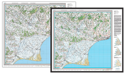
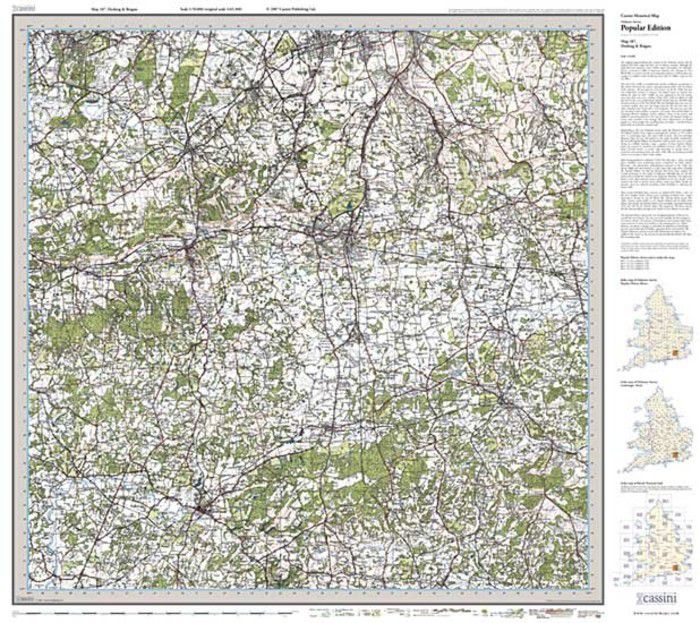
Dorking & Reigate Popular Edition Sheet Map

Made in Britain logo

These maps are taken from Ordnance Survey's Popular Edition maps which were first published between 1919 and 1926. They have all been carefully scanned, digitally re-projected and enlarged to match the present-day Ordnance Survey Landranger® series. Each Popular Edition map is directly comparable with the corresponding Ordnance Survey Landranger® and uses the same sheet number and grid references, so enabling the past and the present to be compared with ease and accuracy. Popular Edition maps have the same name, reference number and coverage as the appropriate Ordnance Survey Landranger®.

About This Map

Format:
Folded Sheet Map
Map title:
Dorking & Reigate
Size:
Folded: 13.5cm x 22.5cm (approx. 5" x 9")
Opened: 100 cm x 89 cm (approx. 39" x 35")
Series:
Popular Edition Sheet Maps
Map year:
1920
Sheet No.:
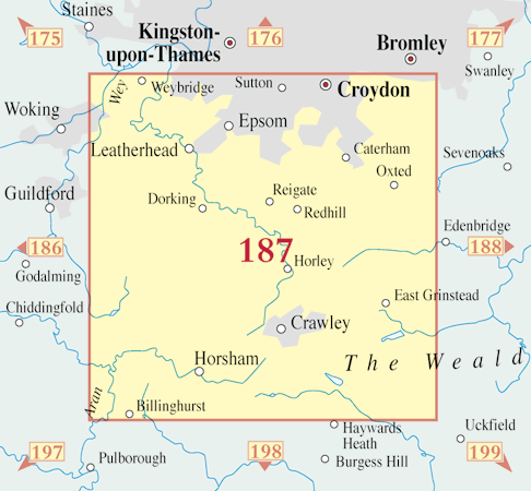
187
Coverage:
38 x 25 miles (Approximate)
Places:
See covered places
Map ISBN:
978-1-84736-130-1
Delivery:
Printed to order: up to 7-10 working days
Express delivery is unavailable.

Buy flat/framed

This map is also available as a flat sheet with an optional choice of frame too!

Buy Flat, Framed or on Canvas >>

Covered in the Map

Abinger Common, Abinger Hammer, Addington, Albury, Ardingly, Ashtead, Ashurst Wood, Balcombe, Banstead, Barns Green, Beare Green, Beddington, Belmont, Benhilton, Betchworth, Biggin Hill, Billingshurst, Bletchingley, Blindley Heath, Box Hill, Brambletye House, Broadbridge Heath, Broadham Green, Brockham, Brook, Buckland, Bucks Green, Burgh Heath, Burstow, Byfleet, Capel, Carshalton, Caterham, Chaldon, Charlwood, Cheam, Chelsham, Chelwood Gate, Chessington, Chipstead, Claygate, Cobham, Coldharbour, Copthorne, Copthorne Bank, Coulsdon, Cranleigh, Crawley, Crawley Down, Crowhurst, Croydon, Danehill, Dorking, Dormansland, Downe, Downside, Drift Bridge, Earlswood, East Clandon, East Grinstead, East Horsley, Effingham, Ellen's Green, Epsom, Esher, Ewell, Ewhurst, Farleigh, Farley Green, Faygate, Felbridge, Fetcham, Forest Green, Forest Row, Friday Street, Gatton, Godstone, Gomshall, Great Bookham, Hackbridge, Handcross, Headley, Hersham, Highbrook, Holland, Holmbury St Mary, Holmwood Corner, Hook, Hooley, Horley, Horne, Horsham, Horsted Keynes, Hurst Green, Ifield, Itchingfield, Kenley, Keston, Kingswood, Leatherhead, Leigh, Leith Hill, Limpsfield, Limpsfield Chart, Lindfield, Lingfield, Little Bookham, Locksbottom, London Gatwick Airport, Lower Beeding, Lower Kingswood, Lowfield Heath, Malden Rushett, Mead Vale, Merle Common, Merstham, Mickleham, New Addington, Newdigate, New Haw, Nork, North Holmwood, Nutfield, Nuthurst, Nutley, Ockham, Ockley, Okewood Hill, Old Coulsdon, Outwood, Oxshott, Oxted, Pease Pottage, Peaslake, Pound Hill, Purley, Ranmore Common, Redhill, Reigate, Riddlesdown, Ripley, Rudgwick, Rusper, Salfords, Sanderstead, Selsdon, Sharpthorne, Shere, Shipley Bridge, Sidlow, Slaugham, Slinfold, Smallfield, South Godstone, South Holmwood, South Merstham, South Nutfield, South Park, Southwater, St Leonard's Forest, Stoke D'Abernon, Stoneleigh, Strood Green, Sutton, Tadworth, Tandridge, Tatsfield, Tattenham Corner, Three Bridges, Titsey, Turners Hill, Wallington, Walton on the Hill, Warlingham, Warnham, Warninglid, Westcott, West Ewell, West Hoathly, West Horsley, Westhumble, West Wickham, Weybridge, Whitemans Green, Whyteleafe, Wisley, Woldingham, Woodmansterne, Worth, Wotton.