Places
26 places found.
Those places high-lighted have photos. All locations may have maps, books and memories.
- Cemmaes Road, Powys
- Six Road Ends, County Down
- Road Weedon, Northamptonshire
- Severn Road Bridge, Gloucestershire
- Roade, Northamptonshire
- Berkeley Road, Gloucestershire
- Harling Road, Norfolk
- Road Green, Devon
- Builth Road, Powys
- Cross Roads, Yorkshire
- Steele Road, Borders
- Cross Roads, Devon
- Four Roads, Dyfed
- Road Green, Norfolk
- Biggar Road, Strathclyde
- Clarbeston Road, Dyfed
- Five Roads, Dyfed
- Eccles Road, Norfolk
- Grampound Road, Cornwall
- Morchard Road, Devon
- Wood Road, Greater Manchester
- Four Roads, Isle of Man
- St Columb Road, Cornwall
- Clipiau, Gwynedd (near Cemmaes Road)
- New Road Side, Yorkshire (near Silsden)
- New Road Side, Yorkshire (near Cleckheaton)
Photos
14,329 photos found. Showing results 2,201 to 2,220.
Maps
476 maps found.
Books
5 books found. Showing results 2,641 to 5.
Memories
11,058 memories found. Showing results 1,101 to 1,110.
Growing Up In Newton
I was born in the old cottage on the left, 175 High Street, in 1948, as June Glencross, my parents squatted there after the war, my dad became the local builder. In 1956 we moved up the road to the old congregational ...Read more
A memory of Newton-le-Willows in 1948 by
Where Was Boots In 1955?
I think that Boots was still on the other side of the road (as seen in the 1950 photo)
A memory of Haverfordwest in 1955 by
Martins News Agents Bilton Road 1965
Wow, I was looking at the pictures of Bilton Road, and it's good to see the newsagents, Martin's is still there. The Maternity Hospital, I can confirm was on Stockdove Way at the junction of Perivale Lane and Argyle Road, I still remember seeing the signs for it.
A memory of Perivale by
Good Times
I was born in Hopkinstown and lived in 58 Hopkinstown Road, I will never forget the place, I have been away for a long time but plan to go back soon.
A memory of Hopkinstown in 1950 by
Chelmsford, Shire Hall 1895.
Many years ago the Shire Hall was where the Quarter Sessions trials were held. This would be the same as the Crown Court trials of to-day. The magistrates court was held in an old building which can still be seen in ...Read more
A memory of Chelmsford by
Crompton County Secondary Modern School. (T''central)
t'Central stood at the junction of Kings Road & Moor Street, almost on the bend.Compared to the junior school it seemed very modern and had only been open about twentyfive years. It had a ...Read more
A memory of Shaw in 1947
Abbey Foregate
I was born in no 112 in 1940 and lived there until 1960. I have distinct memories of cattle market days when cattle being driven down to the market left unpleasant reminders all across the road. Remember too when the trees were ...Read more
A memory of Shrewsbury in 1940 by
St. Mary's High School
I'm wondering if anyone remembers St. Mary's High School in Western Road. I attended the school when I was very young in 1946-9, before my family emigrated first to Canada, then to the USA. My best friends were Zena O'Shea, ...Read more
A memory of Romford in 1949
Chelmsford, Tindal Street, 1919
This shows the view looking up Tindal Street from the London Road end. In the centre of the photo you can see a sign sticking out. This you can just make out is the Spotted Dog public house which was there until ...Read more
A memory of Chelmsford by
Northfields, Witley
As a child on holiday with my aunts, uncles and grandma who lived at Northfields (where the post office is situated by the main road), I would spend many happy times buying pens, pencils, notebooks etc. I remember a Mr Bannister used to run the shop then.
A memory of Witley in 1951 by
Your search returned a large number of results. Please try to refine your search further.
Captions
5,036 captions found. Showing results 2,641 to 2,664.
The church is close to the main road and vulnerable to vandalism, so access is rarely easy; but the interior, whilst not of breathtaking interest, is worth seeing.
This view on the Stainby Road, with the houses on the left fronting onto the High Street, which runs left from the signpost, hardly does justice to this large and attractive village in whose part-Norman
In more recent years the village has been the annual venue for a very popular half-marathon road race.
large building to the left behind the Castle Tavern is the Methodist chapel in Ryder's Wynd, replacing an earlier chapel nearby, and superseded by the present Methodist church in Queens Road
This is still the main road, though its cobbles have been obscured by tarmac.
Even the road sweeper has momentarily stopped work. Beyond the houses, across the fields, the roofs of Ashford can be seen.
The old Post Office is now a house and the front gardens have been lost owing to the widening of the very busy road.
Imagine the road rage if there were such obstructions today.
South of Redhill, east of the A23 Brighton Road and west of the M23 motorway, Salfords has avoided much of the development that has affected less isolated parts of this area.
A new road bypassed the village, and it has reverted back to its secluded charms. Its church, dedicated to St Edmund the Martyr, was built in the 12th century.
Just off the main road through unspoilt Bilsdale is the northern part of the village of Chop Gate. Bilsdale Hall is hidden behind the trees (centre).
As the road approaches the level crossing, we can see a signal box and a foot bridge - in recent years the signal box has been demolished.
In 1987, despite vigorous opposition, the gates were moved a few hundred yards to the left to make way for the access road to the new Ken Marriott Sports Centre.
Again a much-changed view, this time looking into The Turnpike from Manor Road.
Underneath this main road flows a stream that rises from a spring under the church of the Holy Rood, built in the 12th century.
The sign in the foreground points to the Army's Central Ammunitions Depot in Bramley Road, which eventually shut in the 1970s.
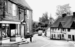
The front doorsteps at the house on the left lead on to the road - not user-friendly, perhaps.In the distance we can see the spire of St Nicholas's Church; nside, the church has no aisles.
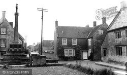
Across the road is Monks Corner, a reminder that the church once belonged to the priory at Bruton. Adjoining this is Crown Lane, named after the Crown Inn, which was demolished in 1984.
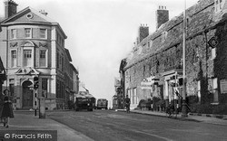
The old Automobile Association cast-iron signpost standing at this former major road junction has long since gone. On the left we can see Barclay's Bank, on the corner of Cricklade Street.
His brand new Volvo once rolled, driverless, across Blandford Road and into Pardy's Hill, coming to rest harmlessly against the tree (centre).
Sir Arthur Wellesley, later the Duke of Wellington, lived in Castle Road in 1808, and later at Walmer Castle as Lord Warden of the Cinque Ports, where he died in 1852.
The road is now partly pedestrianised, and leads to the Market Place and the 1851 Town Hall, which was originally built as the corn exchange.
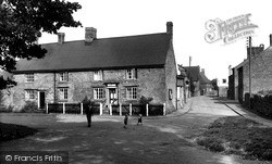
It is sign of the times that the children were safe to play in the road, although Staverton still offers a fairly quiet environment with little traffic.
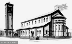
Romanesque Italy arrived in Susans Road, Eastbourne, with this remarkable church in yellow and red brick and terracotta funded by a great-niece of the Duke of Wellington, Lady Victoria Wellesley, and
Places (26)
Photos (14329)
Memories (11058)
Books (5)
Maps (476)


