Places
26 places found.
Those places high-lighted have photos. All locations may have maps, books and memories.
- Cemmaes Road, Powys
- Six Road Ends, County Down
- Road Weedon, Northamptonshire
- Severn Road Bridge, Gloucestershire
- Roade, Northamptonshire
- Berkeley Road, Gloucestershire
- Harling Road, Norfolk
- Road Green, Devon
- Builth Road, Powys
- Cross Roads, Yorkshire
- Steele Road, Borders
- Cross Roads, Devon
- Four Roads, Dyfed
- Road Green, Norfolk
- Biggar Road, Strathclyde
- Clarbeston Road, Dyfed
- Five Roads, Dyfed
- Eccles Road, Norfolk
- Grampound Road, Cornwall
- Morchard Road, Devon
- Wood Road, Greater Manchester
- Four Roads, Isle of Man
- St Columb Road, Cornwall
- Clipiau, Gwynedd (near Cemmaes Road)
- New Road Side, Yorkshire (near Silsden)
- New Road Side, Yorkshire (near Cleckheaton)
Photos
14,329 photos found. Showing results 781 to 800.
Maps
476 maps found.
Books
5 books found. Showing results 937 to 5.
Memories
11,058 memories found. Showing results 391 to 400.
Different Times
Chris Searle....many happy memories growing up in Houghton ..Ithink it was late 60s when we came here via kent /London...My first school here was Hillborough junior [GREAT PLACE] even with its outdoor pool bbbrrrrr...Would love ...Read more
A memory of Houghton Regis by
High Wycombe 1956 On
I was born in the Shrubbery Nursing home in 1956. I grew up in Lane End, about 5 miles away. I have photos of me looking awful in baggy knickers on the Rye (the park in Wycombe town) as a toddler. There was a play area on ...Read more
A memory of High Wycombe by
Hatch End Shops In The 1960''s
I lived in Hatch End from 1956 until I went up to Manchester in 1966, so I got to know my local shops both as a helpful schoolboy running errands for my mum to MacPhails the greengrocer and later as a teenager buying ...Read more
A memory of Hatch End in 1960 by
Waterloo Road
This photo was taken from immediately in front of my Uncle's/Father's (Antiques) shop in Waterloo Road, looking towards the station. Divers, the shop with all the hardware items immediately in the foreground, was next door and I was ...Read more
A memory of Epsom in 1965 by
The Brown Family Who Lived In A Cottage Called The Groves
I was surprised to find no memories recorded for Auchinairn, even though it is a small place, so the following is a start. When I was about the age of 10 in the mid 1950's my mother told ...Read more
A memory of Auchinairn by
Riding My Horse
This was one of the routes I took in the early 70s when riding my beautiful horse out. We would go up West Balgrochan Road, turn in to Acre Valley Road and go up the hill where the woods are and down to the other side, sometimes going ...Read more
A memory of Torrance
Gold Cottages Government Road
my dad Walter James Harrison lived in 2 Gold Cottages, the Stubbs i think on government road its where the fishing lakes are now. his dad Albert Edward Harrison died there in 1936. just trying to find out more about the place back in the day
A memory of Ash Vale by
Caravan Park Early 1950's
I was 5/6 years old and lived with my two sisters, older brother, baby brother and mum & dad in a cramped caravan that was given to us after the war. We were called 'gypsies' but my dad worked at the Woolwich 'arms ...Read more
A memory of Datchet by
Pier Road
In 1952 I lived from a baby, below the record shop in Pier Road. When standing looking down towards the river, it was on the right hand side. The access was via a track that ran parallel to Pier Road, behind the shops. We had sleeper steps ...Read more
A memory of Erith by
Childhood Memories
We used to stay at an Aunt's caravan just beyond the amusement park. One day - I think I would have been about 3 - I fell head first into the boating pond - luckily my cousin was there to haul me out - I remember being covered ...Read more
A memory of St Osyth
Your search returned a large number of results. Please try to refine your search further.
Captions
5,036 captions found. Showing results 937 to 960.
Now, the level of the road was raised to prevent flooding of the cottages on the far side.
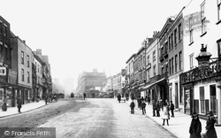
Much of 18th-century Stamford's trade came from its location on the Great North Road, and it had numerous coaching inns.
Nothing much has altered here except that the Narrow Road sign has been changed and there are some new power lines across the road.
Albion Road, the most easterly of the Victorian developments south of the railway, has its back garden fences along the parish boundary with Carshalton.
We are looking south-eastwards from the Yetminster road towards the mediaeval Hamstone cross in a triangle of cobbles (centre), with roads at the junction signed to Sherborne (left) and Chetnole (right
This small elevated village lies about a mile to the north-east of Melton Mowbray on the A607 Grantham road.
Back on the A24 London to Worthing Road, and north of Capel, is Beare Green with the Duke's Head pub.
The camera looks east down the High Street, which opens onto Church Gate and Derby Road. Kegworth's origins lay in its medieval weekly market and annual fair.
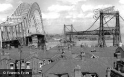
To the right is the transporter bridge, which was dismantled in 1961 -2 months after the new single-span road bridge opened on Saturday, 22 July 1961 by HRH Princess Alexandra.
The main axis of the principal roads consists of the Roman east-west artery, now the High Street, and one of the Roman north-south roads, now North Hill and Head Street.
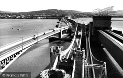
This interesting study of old and new highlights the abstract lines of the various bridges - road, rail and foot - that span out from under the walls of Conwy Castle and illustrates perfectly the importance
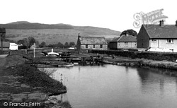
An aqueduct carries the canal over the river, the main road crosses over the canal and a railway runs over the road.
The original Red Lion, after which the street was named, stood at the junction with Germain Street and, due to road improvements, was replaced by a 1930s neo-Georgian road house style pub.
Tylers Green merges to the east with the older village of Penn, mainly along Church Road.
Speciality shops occupied the other side of the road; from memory they included a haberdashers, a newsagents and tobacconists, and a cycle shop.
On the right is Eastwood's musical instruments shop — it appears to be on Briercliffe Road, but it is actually at 119 Colne Road. The sunblinds protected the various instruments from sunlight.
The south side of Windsor Road lay undeveloped until c1880 with the construction of the block seen here beyond the roundabout.
They would not notice the milk churns on the stand by the side of the road (left), as they were a common sight then.
This is the approach road from the Barrow in Furness direction to Newby Bridge, now the A590, with the Swan Hotel on the far side of the bridge.
London Road, as the name implies, was the turnpike from London; it climbs up to the Wheat Sheaf, one of several coaching inns in Daventry.
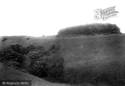
It stands at the junction of two Roman roads, the Ackling Dyke running from Dorchester to Old Sarum, and the Bath to Poole road, although there is still doubt that the latter was ever completed.
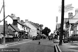
A fine car approaches the High Street by the Parliament Building (right), and a dog feels safe enough to trot down the middle of the road.
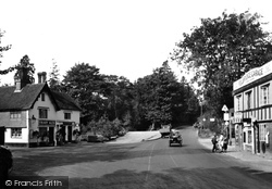
The Star pub stands at the junction of the Crawley road, leading to the left, and the old Roman road heading towards London via the Caterham Valley.
Sitting beside the River Mersey, Warrington developed as an important junctin for both road and river traffic.
Places (26)
Photos (14329)
Memories (11058)
Books (5)
Maps (476)


