Places
36 places found.
Those places high-lighted have photos. All locations may have maps, books and memories.
- Cardiff, South Glamorgan
- Barry, South Glamorgan
- Penarth, South Glamorgan
- Rhoose, South Glamorgan
- St Athan, South Glamorgan
- Cowbridge, South Glamorgan
- South Molton, Devon
- Llantwit Major, South Glamorgan
- Chipping Sodbury, Avon
- South Chingford, Greater London
- South Shields, Tyne and Wear
- Ayr, Strathclyde
- St Donat's, South Glamorgan
- Llanblethian, South Glamorgan
- Thornbury, Avon
- Llandough, South Glamorgan
- Fonmon, South Glamorgan
- St Nicholas, South Glamorgan
- Jarrow, Tyne and Wear
- Penmark, South Glamorgan
- Font-y-gary, South Glamorgan
- Maybole, Strathclyde
- Yate, Avon
- Oxford, Oxfordshire
- Torquay, Devon
- Newquay, Cornwall
- Salisbury, Wiltshire
- Bournemouth, Dorset
- St Ives, Cornwall
- Falmouth, Cornwall
- Guildford, Surrey
- Bath, Avon
- Looe, Cornwall
- Reigate, Surrey
- Minehead, Somerset
- Bude, Cornwall
Photos
5,607 photos found. Showing results 1,941 to 1,960.


Maps
2,499 maps found.


Books
23 books found. Showing results 2,329 to 23.
Memories
1,580 memories found. Showing results 971 to 980.
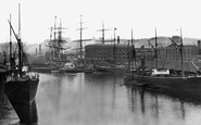
Bristol At Sea
Over a thousand years ago Bristol's harbour developed around the lowest bridging point of the River Avon. The exceptional tidal range of the Severn Estuary and Avon carried laden ships into the city and scoured the river of ...Read more
A memory of Bristol by
Crystal Radio In Chingford.
Back in the early 1950s my girlfriend lived in South Chingford. I'd stay with her and her parents for a weekend every 8 weeks when I got a pass home from the Hydro Electric Construction job in Scotland. Often we'd ...Read more
A memory of South Lambeth in 1950 by
Old Times
I was born at Gwaenfarren House in Merthyr Tydfil and lived at 70 Bryncelyn Ave with my father, step-mother and brother Barrie until I left to join the RAF in 1970. I can remember the old prefabs being knocked down and the ...Read more
A memory of Nelson in 1953 by
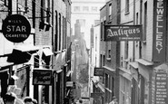
Bristol's Christmas Steps, Lewins Mead Bs1
This is one part of ancient Bristol that has survived, virtually unchanged apart from the signs but the city beyond is very different. At one time sailing ships moored at the bottom of these steps ...Read more
A memory of Bristol by
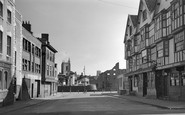
The Llandoger Trow History
Bristol's historic King Street. The Llandoger Trow inn on right of photograph.King Street is a 17th-century street in the historic city centre of Bristol. The street lies just south of the old town wall and was laid out ...Read more
A memory of Bristol by
Rock
Underdown was a magical place, a narrow island of rock left by quarrying at some time in the past. This photo is taken from the western end. At the eastern end there was a copse and the top of the island merged back into the side of ...Read more
A memory of Sampford Peverell in 1956 by
Ormston
My dad John lived in Broomhill and married my mother Evelyn Crackett from Amble in 1947. I don't now anything about my dad's family other than his mother who's name i don't know died in1958 and he had a sister, Mary Stewart, still ...Read more
A memory of North Seaton in 1947 by
November 5th 1954
I, at the tender age of fourteen, arrived in Croglin on November the 5th, 1954. It was 'Bonfire Night' and as strangers in the village I did not know a single soul. However the bonfire for the celebrations had been situated in the ...Read more
A memory of Croglin in 1954 by
Reminiscence
Yvonne Colwell's notes brought back memories of a few families, but I can't place St John's Lane, even though I lived in Pantycelyn until I moved in the late sixties after the prefabs were demolished. Both my parents are ...Read more
A memory of Nelson by
My School
I was born at Filleigh and went to Filleigh Infants School. But then at eleven years old went to school at South Molton Secondary Modern. It was 1953 and the school was quite new, opening in 1952 if I remember correctly. As I ...Read more
A memory of South Molton in 1953 by
Captions
2,476 captions found. Showing results 2,329 to 2,352.

By 1955 they made only soft drinks, and they closed in 1980; the factory, at the south end of the village, is now housing.

This view is taken from the Norman Tower looking south. Beyond Westgate Street lies woodland and countryside, including Hardwick Heath.

SIR DRAKE, whome well the world's ends knewe Which thou didst compasse rounde: And whome both poles of Heaven ons saw, Which North and South do bound : The starrs above will make thee known,

The Eye Hospital movement had started in King Street as a public charity in 1815; by 1840 the hospital had moved twice and settled at No 3 South Parade, and were treating around 3,000 out-patients per

Running parallel to the south of the road, the Great Ouse meanders between the two towns, and Houghton took advantage of both road and waterborne trade.

At the south end of New Road were shops, stores and businesses, including F Cutmore, sanitary engineer, decorator and undertaker.

Some of the original small lancet windows and the early south aisle timber roof are still visible.

Within five years his business had outgrown his premises; this prompted his move into South Road, where he described the business as 'a cabinet maker and furniture warehouse'.

A peculiarity of Loftus town hall is that there is no south-facing clock face, because funds were low and this face was mostly out of sight, so expense was saved by only buying three faces!
Houses were built on most of the remaining available land - this was mainly between Park Road and Sandy Lane; to the north and south of the High Street; and along Fairfax Road.

Seaton is situated on Rutland's south- eastern edge, about half a mile from its border with Northamptonshire, overlooking the Welland Valley.

Yet the family who had done so much to establish Cardiff,had driven the South Wales coal industry, had built the gothic fancy Castell Coch, and boasted an estate of 22,000 acres passed on a mere £437 as

Preston was always a town that you had to pass through to go north to south, but as the popularity of Blackpool increased, so did the traffic east to west.

Situated on the uplands to the south of the River Ash, it straddles the B1004 road between Much Hadham and Ware.

Unique in Hertfordshire, Standon parish church has a detached bell tower and a porch at the west end rather than on the south wall.

The Palace was built to rival the Crystal Palace on Sydenham Hill in South London.

Looking South to Marlborough Road The buildings to the left stood next to the Old Town Hall on the Market Square.

They stand in a line running north to south and at intervals of 200 to 370 feet.

Here are the remains of a circular keep, the southern barbican, and two wing walls on the south side of the motte.

We are standing in South Promenade, with the Chadwick Hotel on the corner. Lightburn Avenue was named after the second lighthouse at St Anne's.

It is late Norman, apart from the large pointed window over the middle arch; on either side of this are two smaller arches which led to the north and south aisles.

Opposite, carrying the plate for South Street, is the Town Hall (right).

From the south the full beauty of the church can be seen as it floats above the fields.

Unusually, this river flows north to join the River Avon at Evesham; most Cotswold rivers flow south-east to join the Thames.
Places (15471)
Photos (5607)
Memories (1580)
Books (23)
Maps (2499)

