Places
17 places found.
Those places high-lighted have photos. All locations may have maps, books and memories.
- Bridge End, Oxfordshire
- Bridge End, Lincolnshire
- Bridge End, Essex
- Bridge End, Bedfordshire
- Bridge End, Clwyd
- Bridge End, Warwickshire
- Bridge End, Surrey
- Bridge End, Durham (near Frosterley)
- Bridge End, Northumberland (near Hexham)
- Bridge End, Hereford & Worcester (near Tirley)
- Bridge End, Hereford & Worcester (near Bosbury)
- Bridge End, Shetland Islands
- Bridge End, Cumbria (near Carlisle)
- Bridge End, Northumberland (near Hexham)
- Bridge End, Devon (near Kingsbridge)
- Bridge End, Devon (near Sidmouth)
- West End, Yorkshire (near Pateley Bridge)
Photos
2 photos found. Showing results 1 to 2.
Maps
Sorry, no maps were found that related to your search.
Memories
Sorry, no memories were found that related to your search.
Captions
15 captions found. Showing results 1 to 15.
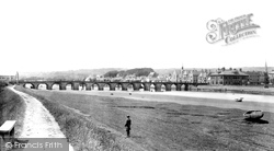
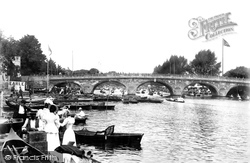
A superb study of the Long Bridge, taken at low tide. The iron supports of the railway bridge, just 25 years old at this time, are visible beyond.
Just after the end of the First World War the town suffered a serious loss with the closure of Days' Brewery.
The ground floor comprised a hall, a parlour, a buttery and a kitchen. Upstairs were many chambers, all magnificently furnished.
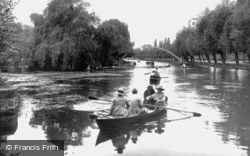
The river Great Ouse in Bedford is as popular today with boaters, walkers and fishermen as it was eighty years ago when this picture was taken.
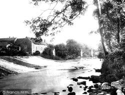
Here we see the old bridge and the mill.
Having Avenham Park in the background does enhance the pleasure of a walk over the bridge. Avenham Tower can be seen in the trees to the right, and the paths lead away to Frenchwood.
In the first view (right) we are looking towards the bridge from south Riverside and the second (bottom right) was taken from the bridge itself.
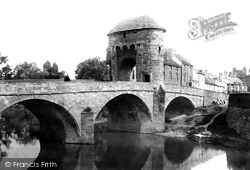
This gate is a Norman structure dating from 1262, and it is a rare example of a fortified gateway on a bridge.
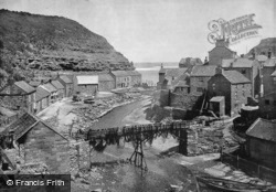
The nets strewn across the railings of the bridge emphasise the importance of this small harbour; in 1887, it boasted over 80 cobles and yawls, employing over 200 fishermen.
The Millers House seen here is all that remains of a much larger building; it is now almost invisible from the bridge downstream because the trees and riverside vegetation have grown so much.
The far, tall building marks Bridge Street, the spot where the first bridge upstream was located.
Upper Rushall Street and Peal Street running north and south from the bottom of the church steps indicate ancient routes to Lichfield and Wednesbury.
Downstream from the old bridge, the Wharfe takes on a gentle benign feel. Here pleasure boats can be hired in the summer months.
On one of Stony Stratford's first bridges over the River Great Ouse, Grilkes Inn had been operating since 1317, possibly the oldest alehouse in Buckinghamshire; and the Cross Keys (1475) and the
The tenements could only expand lengthways along their own ‘backsides’, and most buildings had a jumble of outhouses, barns and sheds at the rear.
Places (17)
Photos (2)
Memories (0)
Books (2)
Maps (0)


