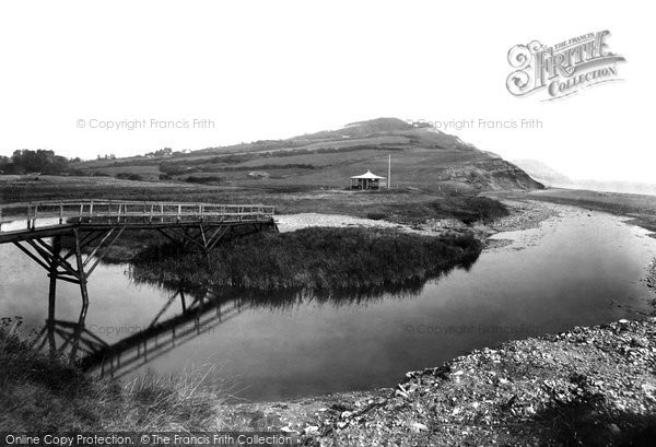
Charmouth, The Beach 1900
Photo ref:
46064


More about this scene
We are looking eastwards from the blocked mouth of the River Char, which ends its journey to the sea by having to break through a ridge of shingle (right). The coastal footpath from Charmouth (left) crosses to a shelter on Evan's Cliff (centre), but is then subject to recurrent problems as it crosses the landslip zone at Cain's Folly (central skyline). Here a Royal Air Force coastal radar station slipped down the cliffs on 14 May 1942. Its concrete and brick remains are entombed in the undercliff. The distant cliff, towards Bridport, is Thorncombe Beacon (towards top right).
Add to Album
You must be signed in to save to an album
Sign inShare This Photo
Buy a Print
Unframed, Mounted, Framed and Canvas prints in a range of sizes and styles.
View Sizes & Prices
A Selection of Memories from Charmouth
For many years now, we've been inviting visitors to our website to add their own memories to share their experiences of life as it was, prompted by the photographs in our archive. Here are some from Charmouth
Sparked a Memory for you?
If this has sparked a memory, why not share it here?







 Before
 After
After