Places
36 places found.
Those places high-lighted have photos. All locations may have maps, books and memories.
- Pentre-cwrt, Dyfed
- Pentre Halkyn, Clwyd
- Pentre, Mid Glamorgan
- Ton Pentre, Mid Glamorgan
- Pentre, Powys (near Llangynog)
- Pentre, Powys (near Guilsfield)
- Pentre, Powys (near Bishop's Castle)
- Pentre, Clwyd (near Mold)
- Pentre, Clwyd (near Ruabon)
- Pentre, Shropshire (near Chirk)
- Pentre, Clwyd (near Hawarden)
- Pentre, Dyfed (near Pontyates)
- Pentre, Powys (near Newtown)
- Pentre, Clwyd (near Chirk)
- Pentre, Clwyd (near Ruthin)
- Pentre, Clwyd (near Mold)
- Pentre, Shropshire (near Oswestry)
- Pentre, Powys (near Welshpool)
- Pentre, Clwyd (near Mold)
- Pentre, Shropshire (near Forton)
- Burntwood Pentre, Clwyd
- Pentre Berw, Gwynedd
- Pentre Hodre, Shropshire
- Pentre Llanrhaeadr, Clwyd
- Pentre-celyn, Clwyd
- Pentre Broughton, Clwyd
- Pentre Gwynfryn, Gwynedd
- Pentre Maelor, Clwyd
- Pentre-clawdd, Shropshire
- Pentre Galar, Dyfed
- Pentre Llifior, Powys
- Pentre-cefn, Shropshire
- Pentre-Gwenlais, Dyfed
- Pentre-Poeth, Dyfed
- Pentre Cilgwyn, Clwyd
- Pentre Morgan, Dyfed
Photos
98 photos found. Showing results 2,761 to 98.
Maps
316 maps found.
Books
2 books found. Showing results 3,313 to 2.
Memories
1,250 memories found. Showing results 1,250 to 1,250.
Captions
3,594 captions found. Showing results 3,313 to 3,336.
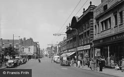
To the left the Shopping Centre occupied the Victoria Palace Theatre; this was mainly used as a cinema, and by the date of this photograph had been stripped of its ornate stucco facings.
It is an evangelical church, and the present clergy are noted for taking their message out into the nearby shopping centre.
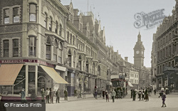
The Town Hall tower (centre right), designed by T M Lockwood and E A Landsdowne, was opened in 1885. It has since been demolished to make way for the British Home Stores.
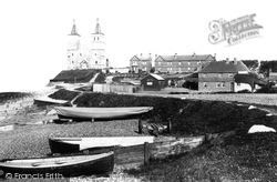
The famous twin towers of the Norman church, built on the site of an earlier Saxon abbey and the centre of the Roman fortress of Regulbium, built around AD 280 by Carausius, were for many centuries a landmark
In the centre there was once a circular Market Hall, where farmers and their wives gathered to buy and sell local produce.
Coal was imported down to the mid 20th century – we can see a small Dutch coaster discharging her cargo, with coal heaped on the quayside (centre).
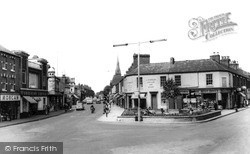
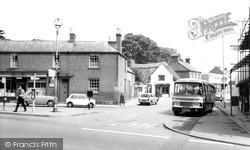
Here we see an attractive village centre group and a splendid single-decker bus.
His brother, Francis Smith, designed the stable block (centre left) in 1737.
The gateway in the stone wall (centre left) is now a garage door. The Millar Tobacconist at the foot of the hill beyond the horse and cart is now Castle Photography.
The Wellington column can be seen in the centre of the picture.
We are now in the centre of Eastleigh; in fact, we are looking from the station along Leigh Road, originally a farm track but steadily improved and extended as the town grew.
The modern town centre is well to the west around Corporation Street and the Market Square.
On the other side of the road was a garage, which is now the Job Centre and the Sue Ryder shop. Then comes the HSBC bank followed by a building dated 1789 which now houses Calthop, solicitors.
The Butter Market of 1853 (centre) is now Achurch Hardware Store, and the snack bar next door is now a pizza and kebab house.
The triangular-topped frontage right of centre is James Duckworth`s grocer's shop. Shaw became part of Oldham in 1974.
The village is certainly on a hill, and at the foot of the hill is a small vineyard, as well as a thriving family-owned garden centre.
Many of the shops on the left remain, whilst most of those on the right were demolished in the early 1970s for the building of the Trident Shopping Centre.
The greenhouse behind the wall (centre foreground) was owned by the Old Bell; it was demolished in 1977 to enable the Queen`s Jubilee Garden to be created, which was opened in 1978.
A recent use as an arts centre has collapsed, and it remains boarded up (2004).
A mile east of the Culham Science Centre we reach the charming village of Clifton Hampden on its tree-covered cliff by the River Thames.
Skirting the modern shopping centre, our tour reaches Stert Street, which runs south towards the Market Place; in the 1890s, it was one of Abingdon's main shopping streets.
A mile and a half east of the European School complex is the Culham Science Centre, where the Joint European Torus (JET) project is based.
Here we see an attractive village centre group and a splendid single-decker bus.
Situated at the head of the valley of the East Allen, Allenheads was an important centre for the lead-mining industry from the late 18th to the mid 19th century; the mines here produced around 14 per
Places (57)
Photos (98)
Memories (1250)
Books (2)
Maps (316)


