Places
36 places found.
Those places high-lighted have photos. All locations may have maps, books and memories.
- Cardiff, South Glamorgan
- Barry, South Glamorgan
- Penarth, South Glamorgan
- Rhoose, South Glamorgan
- St Athan, South Glamorgan
- Cowbridge, South Glamorgan
- South Molton, Devon
- Llantwit Major, South Glamorgan
- Chipping Sodbury, Avon
- South Chingford, Greater London
- South Shields, Tyne and Wear
- Ayr, Strathclyde
- St Donat's, South Glamorgan
- Llanblethian, South Glamorgan
- Thornbury, Avon
- Llandough, South Glamorgan
- Fonmon, South Glamorgan
- St Nicholas, South Glamorgan
- Jarrow, Tyne and Wear
- Penmark, South Glamorgan
- Font-y-gary, South Glamorgan
- Maybole, Strathclyde
- Yate, Avon
- Oxford, Oxfordshire
- Torquay, Devon
- Newquay, Cornwall
- Salisbury, Wiltshire
- Bournemouth, Dorset
- St Ives, Cornwall
- Falmouth, Cornwall
- Guildford, Surrey
- Bath, Avon
- Looe, Cornwall
- Reigate, Surrey
- Minehead, Somerset
- Bude, Cornwall
Photos
5,607 photos found. Showing results 761 to 780.


Maps
2,499 maps found.


Books
23 books found. Showing results 913 to 23.
Memories
1,580 memories found. Showing results 381 to 390.
Uley, The Street
When I spent my holidays in Uley during the mid 1950s, open drains ran at the edge of the street, for dirty water (not sewage) draining from the houses adjoining the road! I recall the Post Office, Mr Phillp's grocery store (by the bus ...Read more
A memory of Uley by
Living In Binfield 1946 1971
I moved to Binfield with my parents Rose and Cyril Richardson and my brother Brian in 1946. We lived in Rose Hill at a house called “Athlone”. It isn’t there any more, it was demolished and six houses built on the ...Read more
A memory of Binfield by
Memories Of Stanford Le Hope
I too have many memories of Stanford-le-Hope. I was born in Orsett hospital. My mother came from South Wales whilst my father came from Ashford in Middlesex. The reason they came to live here was my aunt ...Read more
A memory of Stanford-le-Hope
Rocking In The 60s
On the left of the photo is Woolworths, above which were flats - including one where the rock star/ wannabe MP Screaming Lord Sutch lived for a while. Another Rocker lived in South Harrow - Johnny Kidd (and the Pirates). I ...Read more
A memory of South Harrow in 1965 by
Rounders In The Road
I was brought up in Brewood, in the cottage which is called South View and later next door in what is now 38 Shop Lane. There were four children in our family, I had two older brothers and a younger sister. Our friends came ...Read more
A memory of Brewood in 1945 by
Earliest Workplaces
This picture was taken from the now demolished Circular and then quite unique Car park overlooking the Lake in front of Lord Alexander House on the right hand side of picture . This office was built in 1959/60 and the ...Read more
A memory of Hemel Hempstead in 1961
In The Footsteps Of Dead Poets.
Just out of Trumpington, on the road to Grantchester, was the entrance to an area known as Byron’s Pool, named after Lord Byron who apparently frequented the area whilst at Cambridge University. Probably hoping ...Read more
A memory of Grantchester in 1956 by
Redhill, Market Hall 1915
Like the young cool girl who remembers the Hollies at the Market Hall on a Saturday night, I too found live music there. I think me and a school mate (from Radnor House School for boys) called Hank Jell, so named after Hank ...Read more
A memory of Redhill in 1962 by
Evacuation From London To Harpley
I remember Harpley as a four-year-old, when it had no running water, electricity or gas. I was evacuated there when first born, in 1939 during the war years and stayed in a cottage opposite to the village ...Read more
A memory of Harpley in 1940 by
Holiday Memory
In the previous two years we'd had our holiday in South Devon, but in 1958, for some reason, my father decided we would stay in Lerryn, & booked himself, mother & I into a B&B (possibly The Old Forge?) by the river. I was ...Read more
A memory of Lerryn in 1958 by
Captions
2,476 captions found. Showing results 913 to 936.

The canal opened in 1817, and ran from Kendal to Lancaster, later continuing south to connect with the Leeds and Liverpool Canal via a tramway at Preston.

Four hundred years ago, Godstone was at the centre of the leather trade and the manufacture of gunpowder, while to the south there were important iron-works.

Cosily tucked away in a fold of the sandstone hills south-east of Godalming, Mare Lane leads to the highest point of the Down at Hydons Ball, where it reaches 593 feet.

In this view we look past the Horse and Jockey pub towards the south of the village; the church is beyond the high tree on the left.

A directory of the time states that 'the church of All Saints is a plain and ancient edifice of flint, consisting of chancel, nave, south aisle and porch, and a small wooden tower with pinnacles, rising

This view is south-westwards from the quarry gallery to Anvil Point (centre left) where Purbeck's coast becomes a vertical wall of stone.

Looking from South Street the general appearance of Victoria Road has changed little in the last 50 years.

One of the most famous pubs in the area, the building stands on the Berkshire/Hampshire border, just to the south of Newbury.

Elmore Cottages still command the High Road opposite the village pond and crossroads but have been extended on the south side where the fence on the flint wall has been removed.

Running north to south with closely built houses of all ages, the High Street of this quaintly composed village is set in a large parish rich in vernacular architecture, ancient burial

We are coming down into Lower Eype from Mount Lane; the view is south-westwards from below the New Inn. The 1860-dated plaque (far left) is on Eype School.

Inside the church, the most interesting collection of monuments is in the Vernon Chapel in the south aisle.

There are several Norman features inside including the south doorway and chancel arch. The tower is late 13th-century and the spire has chamfers which reach halfway up.

From south west of the station go first to St Mary's Butts, whose wide street was used until about 1600 for archery practice at the 'butts'.

Originally it was a few fishermen's huts at the end of a lane south of Prittlewell. Here we see the central beach in the last years of the 19th century.

Ships from South Wales carrying lime and coal were once regu- lar visitors to the town.

St John Street is the main entrance to the city from the south. On the left is the Close Wall and St Ann's Gate; on the right is the timber- framed King's Arms, dating from the mid 17th century.

Originally clustered around the church to the south, the hamlet was destroyed by a fire in the 17th century and the Manor Inn, built in 1871, is the focus of the 'new' village.

The viaduct which carries the main Sheffield-Leeds railway line dominates this view of the High Street of the South Yorkshire town of Denby Dale.

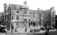
On the right is the Town Hall, built in 1902 to the designs of the South Shields-based architect Fred Rennoldson.

This view looks south, downhill past Horden's booksellers and stationers, which is undergoing repair.
Two of the girls have come down from the bridge and are inspecting the ruined south-west towers.

The River Mole forms the county boundary here, south-west of the church, so the right bank in the view is in Sussex. This is Long Bridge, seen from Church Meadow, now a more manicured space.

Further south, on the beach, there was an older thatched Watch House which became Old Watchouse Cafe.
Places (15471)
Photos (5607)
Memories (1580)
Books (23)
Maps (2499)

