Places
36 places found.
Those places high-lighted have photos. All locations may have maps, books and memories.
- Leitrim Village, Republic of Ireland
- Swanley Village, Kent
- Ewden Village, Yorkshire
- Glentrool Village, Dumfries and Galloway
- Aycliffe Village, Durham
- Clewer Village, Berkshire
- Crookham Village, Hampshire
- Church Village, Mid Glamorgan
- Carn Brea Village, Cornwall
- Elan Village, Powys
- Luccombe Village, Isle of Wight
- North Hinksey Village, Oxfordshire
- Cumeragh Village, Lancashire
- Hulland Village, Derbyshire
- Park Village, Northumberland
- Model Village, Warwickshire
- Outlet Village, Cheshire
- Hansel Village, Strathclyde
- Portlethen Village, Grampian
- Stockbridge Village, Merseyside
- Talbot Village, Dorset
- Abbey Village, Lancashire
- Aber Village, Powys
- Chelmer Village, Essex
- Dog Village, Devon
- Glenprosen Village, Tayside
- Hutton Village, Cleveland
- Heathfield Village, Oxfordshire
- Grange Village, Gloucestershire
- Perkin's Village, Devon
- Mawsley Village, Northamptonshire
- Wynyard Village, Cleveland
- Albert Village, Leicestershire
- Brockhall Village, Lancashire
- Cardrona Village, Borders
- Dutch Village, Essex
Photos
13,159 photos found. Showing results 1,021 to 1,040.
Maps
517 maps found.
Books
26 books found. Showing results 1,225 to 1,248.
Memories
4,713 memories found. Showing results 511 to 520.
Memories Of Raf Lichfield
My father was an officer in the RAF and was based in RAF Lichfield from 1954 - 1956. My brother and I went by bus to St. Christopher's School in Alrewas. The school building was on the side of the canal and from one ...Read more
A memory of Lichfield by
Balcary
Hi, I was born in New Luce and brought up at Balcary holdings by my dad, aunt, and gran. I went to Glenluce school. My uncle was a mechanic in Mclellands garage in the village, his wife worked in the bakers. I visit twice a year as the aunt who brought me up still lives in the village, aged 94.
A memory of Glenluce in 1950 by
Anyone Remember The Chapel By Cyfyng Cottage Near Ty Mawr National Trust House
A family member owns Cyfyng Cottage which is attached to the old Presbyterian Chapel that was used by people of the Wybrnant Valley from about 1850 until the 1960s. ...Read more
A memory of Penmachno in 1950 by
The Droves Connecting The Villages Of Houghton And Broughton
I have many memories of driving around the droves between Houghton, Broughton and up to the Beeches on the Buckboard, an old flatbed Austin 7 owned by Richard Carter and later ...Read more
A memory of Houghton in 1960 by
Purchase
Seeing an advert for sale of The Old School Lower Hartshay began an exciting voyage of discovery. 1884 now anchors my hold on local history and family research. Many have been the times when passers by have been invited in and have ...Read more
A memory of Lower Hartshay in 1980 by
Growing Up
my memory of living in "God's Village" is of days roaming round the grange, going down the fields to the beck, getting to the top of the "Red Ash Pit Heap", coming back round the coke works and spending loads of time messing around the TMS garage, most week nights and all day Saturday and Sunday.
A memory of Trimdon Grange in 1959 by
Straining The Memory
I attended primary school at Horstead Keynes briefly until it changed location a few miles away. (I went there as well but can't for the life of me recall the name of the place.) The head mistress was the tall and ...Read more
A memory of Horsted Keynes in 1953 by
Carrog Memory, As A Ww2 Evacuee.
I first visited Carrog in 1939 as an evacuee, at the start of World War 2. I was accompanied by my two sisters, having travelled by train from Birkenhead on the Wirral. All the evacuees were escorted to the Church ...Read more
A memory of Carrog in 1940 by
Oldcotes & Langold
The Priories Historical Society based in Oldcotes are looking for any old photos, maps, books, documents to facilitate our research into this important archaeological area. The Priories have talks every month at Oldcotes Village ...Read more
A memory of Langold by
County Oak Tushmore Sports And Social Club
So named because members were from north of Crawley on the main A23 Brighton Road, not big enough to be a village, but a hamlet stretching half a mile north and south of todays Manor Royal Estate ...Read more
A memory of Crawley in 1954 by
Captions
5,033 captions found. Showing results 1,225 to 1,248.
The influx of mine workers brought with it an expansion of the village. New Houses was built in 1788, and Fawside Green and Dudley Place in 1790.
Poltross Burn, which flows through the middle of the village, marks the border between Northumberland and Cumbria.
Monton had been a separate village until the incorporation of Eccles, when it was taken under the new council's wing. Monton Green is also the name of the road in our photograph.
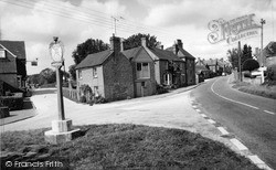
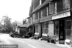
Located in a remote region north of Petworth, the village was originally formed in a clearing in the woods. The local wealden clay district is remarkable for large oak trees.
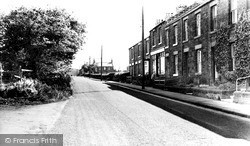
Very close to Junction 19 on the M1 motorway, the village is unremarkable.
East of the village, the Shelford Road climbs on to the red sandstone hills, which are undercut by the River Trent to form river cliffs.
East of Camberley, the route moves on to the villages between Bagshot and Guildford along the A322 on the east side of the sandy heathland of the Bagshot Sands; on the map we see army firing
Moving west, the route passes through Merstham, a village of two parts: the older part lies west of the railway, and to its east is a large former London County Council housing estate of the 1950s
This photograph is unfortunate in that it makes the village look a lit- tle ramshackle, but in fact it was rather smart.
The flax mill at Cod Beck is now a Youth Hostel, while the old School Room of 1836 is now the Village Hall. Lady Chapel, above the village, is 600 years old.
An expansive village, it sits on the River Devon, about a mile north of the Grantham Canal of 1797. This view looks south, away from the church.
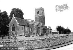
The busy A428 Northampton to Bedford Road winds through the village from west to east, curving round the parish churchyard's rubblestone retaining walls.
This chapter's tour finishes with an architectural flourish in Albury, a village still blighted by the A25.
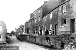
Another of the surrounding parishes into which Bridport borough expanded, Bothenhampton lies to the south-east, with a deep-cut village street which has left a dense cluster of terraces standing
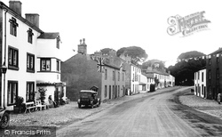
The name of the village had an 'e' on the end until the railway company put up their sign spelt 'Gisburn', and the 'e' was forgotten. Here we see the main street.
Moorsholm's one village shop is shown here on the right. The High Street becomes Freebrough Road and leads out on to the
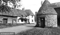
Although the base of the building may be older, the village pound, or lock-up, was certainly in use during Victorian times.
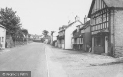
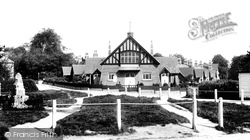
The half-timbered village hall, with its adjacent rows of almshouses, overlooks this peaceful scene with its curiously maternal architecture.
Fittleworth is a picturesque village of fine old houses, commons and fir woods. On the left of the picture is the Swan, a 14th-century coaching inn with a sign spanning the main road.
In the 1950s a new and busy road separated the two villages of Little and Great Eccleston.
So often forgotten by travellers through Hertfordshire, Wareside is one of the county's prettiest villages.
Chailey (thought to mean `clearing in the gorse`) is a village that straddles the A272.
In the background (centre) is the Methodist chapel, a common feature of most former lead mining villages in the White Peak.
Located in a remote region north of Petworth, the village was originally formed in a clearing in the woods. The local wealden clay district is remarkable for large oak trees.
Places (114)
Photos (13159)
Memories (4713)
Books (26)
Maps (517)


