Places
3 places found.
Those places high-lighted have photos. All locations may have maps, books and memories.
Photos
63 photos found. Showing results 1,061 to 63.
Maps
12 maps found.
Books
1 books found. Showing results 1,273 to 1.
Memories
7,564 memories found. Showing results 531 to 540.
Bluntisham
Hi everyone, does anyone know if there are any early graves in Buntisham? I am talking of 1600 -1700 up till 1800, the name Lack. I know of quite a few in Willingham church, but also have details of births and deaths in Bluntisham ...Read more
A memory of Willingham by
Swan Hill And The Swan & Mitre
My family moved to Shortlands, between Bromley and Beckenham, in 1945 when I was a three-year-old. I lived in Shortlands, in Recreation Road, until 1968 when I moved abroad to work. Now, over 40 years later, back in ...Read more
A memory of Bromley by
Woodley Village As It Was
I was brought up in Woodley in the 1960's when Woodley was a tight knit community. My parents had a shop on Hyde Road, "Kelsall's". It was a sweets and tobacconist shop and at the back of the shop there was ...Read more
A memory of Woodley in 1964 by
Lost Village Of East Holywell
I was born in East Holywell in 1946 and lived at 24 North Row. By then there were only 2 rows of houses left. We lived with my grandmother, Eva Barnfather, who had been there since the turn of the century. Like ...Read more
A memory of East Holywell in 1950 by
Growing Up In Wandsworth
As a young schoolboy I lived in Wandle House off Garrett Lane which was owned by Peabody estates at that time. So, taking a walk from there, I can remember the rag and bone carts passing on their way home to the other ...Read more
A memory of Wandsworth in 1960 by
Mitcham
Great site, brings back a number of memories. I went to Bond Road School in 1962ish with my twin brother Robert. We left at about 1970 and went Alphea in Merton before going on to Pollards Hill High School. Mitcham has changed so much, who ...Read more
A memory of Mitcham by
Playing In Salford
I was born in Salford in 1954, except for a brief spell of 4 years in Newton Heath in the late fifties, I have lived there ever since. When I was 11 years old my friend and I were playing digging on the old nursery croft on ...Read more
A memory of Salford in 1964 by
51 Hempstead Street
I was born in Dover, but my mum was Welsh and we moved back to her home town when I was small. However, every year we would visit my dad's relatives in Kent (mainly Ashford). My Auntie Nell ran a flower shop here and I remember ...Read more
A memory of Ashford in 1955
Tarentella Coffee Bar Happy Memories
I met my husband of 41 years back in the 60's, I lived in Shirley, a very new housing estate then, called Shrublands. We used to ride around Croydon and Norbury on his scooter and often visited the Tarentella ...Read more
A memory of Croydon in 1963 by
Hulme Schools And Green Grocers
My girlfriend's mum went to Mulberry Street School in the 1950s and went on to Jackson Street School in Hulme, Manchester, and my grandparents on my mum's side had a green grocers in Moss Side. My ...Read more
A memory of Hulme in 1940
Captions
2,471 captions found. Showing results 1,273 to 1,296.
Following the death of the owner, the site was acquired by the town and first opened to the public in 1960.
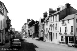
Further south, High Street opens up to the river, the buildings terminating in an elegant early 19th-century five-storey warehouse with a hipped roof: more like a very tall villa than a warehouse.
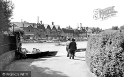
Only a solitary punt and a small rowing dinghy occupy the 267ft-long lock on this summer day. Beyond the lock gates the Thames will carry the boats down to Laleham and Chertsey.
The turning for Glebe Road is by the double-fronted house in the centre, and the National Provincial Bank was later built on the opposite corner.
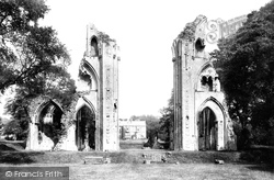
A closer view of the transept.
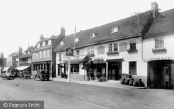
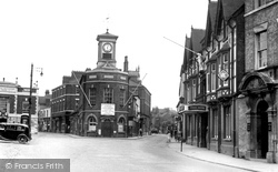
The large half-timbered building on the left with its awnings out was built in the mid-1890s, and became the local branch of F W Woolworths.
In the 1890s there were several tramway schemes to link Southport to Lytham St Anne's, though the real fly in the ointment was bridging the River Ribble.
General Wolfe spent his childhood in Quebec House and is said to have passed his last night in his beloved town at the George and Dragon, shown here in the foreground.
On 18 July 1844 the London and North Western Railway Company began work to extend the railway from Lancaster to Carlisle.
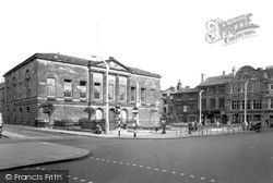
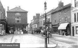
The elegant, classical façade of the Shire Hall has dominated the Market Square since it was built in 1798, replacing an earlier Elizabethan hall.
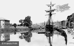
The Exeter Ship Canal, five miles long, reaches the sea at Topsham, and was built in 1564-6 after the building of a bridge at Countess Wear stopped the use of the river for trade.
From this view it is obvious that the town occupies a ridge between the two rivers: the land drops to the Great Ouse (see the previous views) and to the Ouzel, as we see here - this view was
Completed in 1868, the Infirmary was designed by Gilbert Scott, whose other major work at this time was the hotel at St Pancras Railway station in London.
We start with the White Hart (left); then comes A J White, watch and clockmaker (the other half of the building was Barclay's Bank, open on Wednesdays), George Howe, draper and grocer, Adam's, baker and
The Lloyds Bank to the left of the road is still in existence and bears a commemorative plaque to Gwen John and her brother Augustus John, both artists.
The 1870 view of the bridge is particularly interesting, for it shows the Berkshire bank before the spread of late Victorian developments that brought large houses and villas to the Berkshire hillside
Comparing this to picture D83053, we can see that the decorators have changed position. The painter is now 'footing' the ladder for his colleague.
We can see the Midland (HSBC) Bank to the front right and the National Provincial (NatWest) to the far left.
The Bon Marche on Bethcar Street was a large general department store, selling practically anything.
The River Lea, part of the Leesic Navigation, runs for a long distance parallel to the New River.
Nine miles from York on the road to Leeds, Tadcaster was once the Roman outpost of Calcaria.
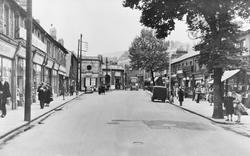
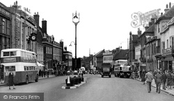
Despite the fact that post-war rationing was still in force, this market town was thriving. On the left is an optician's, A Bateman's.
This photograph shows the view south across Devonshire Street into King Street. Half hidden by the Musgrave monument is Graham's grocers, established in 1793.
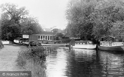
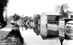
The flour and malting mills on the far bank dominate this peaceful riverside scene.
Places (3)
Photos (63)
Memories (7564)
Books (1)
Maps (12)

