Places
36 places found.
Did you mean: street or streetly ?
Those places high-lighted have photos. All locations may have maps, books and memories.
- Heathfield, Sussex (near Cade Street)
- Street, Somerset
- Chester-Le-Street, Durham
- Adwick Le Street, Yorkshire
- Scotch Street, County Armagh
- Friday Street, Surrey
- Potter Street, Essex
- Boughton Street, Kent
- Newgate Street, Hertfordshire
- Streetly, West Midlands
- Shalmsford Street, Kent
- Green Street Green, Greater London
- Boreham Street, Sussex
- Park Street, Hertfordshire
- Cade Street, Sussex
- Appleton-le-Street, Yorkshire
- Hare Street, Hertfordshire (near Buntingford)
- Romney Street, Kent
- Trimley Lower Street, Suffolk
- Streetly End, Cambridgeshire
- Hare Street, Hertfordshire (near Stevenage)
- Brandish Street, Somerset
- Colney Street, Hertfordshire
- Langley Street, Norfolk
- Silver Street, Somerset (near Street)
- Street, Yorkshire (near Glaisdale)
- Street, Lancashire
- Street, Devon
- Street, Cumbria (near Orton)
- Street, Somerset (near Chard)
- Bird Street, Suffolk
- Black Street, Suffolk
- Ash Street, Suffolk
- Broad Street, Wiltshire
- Brome Street, Suffolk
- Penn Street, Buckinghamshire
Photos
21,809 photos found. Showing results 1,921 to 1,940.
Maps
1,622 maps found.
Books
1 books found. Showing results 2,305 to 1.
Memories
6,667 memories found. Showing results 961 to 970.
Gilbey St. Tooting
Hello does anyone know Margery Trip lived in Gilbey street Tooting or husband Dereck Trip if so will be please to hear from you thanks thank you francis frith I have been in contact with these people .
A memory of Tooting in 1956 by
Cronkeyshaw Junior School
I'm writing about my memories of Cronkeyshaw School. It was situated to the north of Rochdale Town Centre in the corner of a large open common grassland area, Cronkeyshaw Common, opposite Falinge Park. After school each ...Read more
A memory of Rochdale in 1955 by
Joynson Street, Off Lower Broughton Road
Born in May 1949 at no. 98 Joynson Street, two up two down,as they all were in them days. Tin bath in the back yard. Open fire in the front room where mam made us toast when we had enough bread. Dad was a ...Read more
A memory of Salford by
Market Square/Anchor Lane
Market Street/Square holds lots of memories. Those underground toilets, buses maneovering round to take us home to the Marsh, which when young seemed miles away. My father was born in Anchor Lane, and there used to be ...Read more
A memory of Lancaster in 1948 by
Julie Millburn, Park View.
HELLO AGAIN, CAN YOU REMEMBER THE PRISONERS OF WAR USED TO GET DROPPED OFF AT THE TOP OF THE STREET BY ARMY WAGON AND THEN PICKED BY TRACTOR AND TAKEN UP TO HANKEYS FARM UP THE NORE LANE TO WORK ON THE FARM. PLEASE ...Read more
A memory of Witton Gilbert in 1947 by
21 High Street
I lived in this from 1964 until I got married in 1987. My father Leslie Lougher lived here from 1962 with my mother Monica until she died in 1986. He then lived there until he died in 2012. He used to tell me that it was ...Read more
A memory of Nantyffyllon in 1964 by
High Street, Midsomer Norton
Does anyone remember an old school building that used to be roughly where the library is now? I remember going in there with my school friend but I don't know what school it was.
A memory of Midsomer Norton in 1965 by
Barking 1938 64
I was born in Barking, Suffolk Road, in 1938. Elder son of David & Edith Wardell (nee Fenn), and lived there until I married in 1964. My mother's family had lived in Barking for several generations, with Grandad Fenn living in ...Read more
A memory of Barking by
Bexleyheath Growing Up
I used to live in Oakland Road off of the High Street. I also used to go to Uplands Road infants and Junior School. Saturdays were spent at Saturday Morning Pictures at the ABC cinema. I also remember Hides department ...Read more
A memory of Bexleyheath in 1961 by
Comrades Club
Hello does anyone know of the comrades club in cross bridge street Waltham cross Bill Jamieson was the secretary of this club,he and his wife Mabs lived opposite the club I understand Bills portrate hangs over the bar along ...Read more
A memory of Waltham Cross by
Captions
5,381 captions found. Showing results 2,305 to 2,328.
The view down the High Street has changed very little, but the increased volume of traffic has brought traffic lights to the junction with the road to Over.
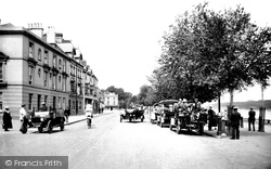
Aptly named, this wide street wends its way down to the river. In the foreground stands the Bear Hotel, formerly The Bear's Head, built around 1868, with its mock-Tudor façade.
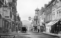
This classic view looks west down High Street to the Wey valley and beyond to Guildown (The Mount).
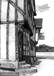
A range of 15th- and 16th-century timber- framed houses, some jettied, the Rose and Crown follows the curve of a lane linking Ipswich Road and East Street.
Gas street lighting was common at the time.
Stand by the Burton monument and look down the High Street to compare this photograph with the scene today. The Lion and Lamb on the right has changed its name, and is now called Fridays.
West Street includes various almshouses and picturesque stone cottages. The Victoria Inn on the left of the picture is now a private house.
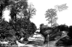
In 1901 the main road to the south was Park Street. The lane to the right leads to Gosmore, and at the top of the hill in front of us, hidden by the bushes, is the Moorhens public house.
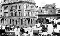
The Hand-in-Hand Fire and Life Insurance Society building stands at the junction of these two streets close by Blackfriars Bridge.
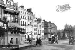
Park Lane, once the desolate by-road known as Tiburn Lane, was a refined street of palatial mansions enjoying expansive vistas of the Park.
The Hand-in-Hand Fire and Life Insurance Society building stands at the junction of these two streets close by Blackfriars Bridge.
This lovely street, fringed with cobbles, leads down to the White Lion Inn and the old church, where the poet William Cowper, 'England's sweetest and most pious bard', was laid to rest.
This is the same street as in view 54380 but we are looking in the opposite direction. There are cart tracks in the loose, unsealed road surface.
We can wlak along the High Street today and pick out most of these buildings, even if the delightfully named Public Benefit Boot Company on the right is more.
A comparison with the previous photographs of Church Street will show how little it changed in the half century following Victoria's reign,
At the top of the street, Church Road was already bisected by the arterial road to Southend.
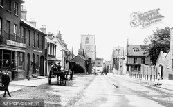
Note the sign on the left advertising Cadbury`s chocolate and the cobbled street leading up to the church.
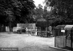
Off the west side of Sheep Street, a plaque informs us that the Zoo Park was opened in the grounds of the historic Croyland Abbey in 1943.
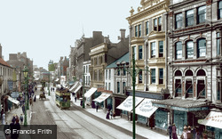
Before the town council renamed it Queen Street, this road was called Crockherbtown, allegedly because the monks of Greyfriars used to grow pots of herbs here. The last Cardiff tram ran in 1950.
There was once a railway running down the middle of this street and around the corner at the end. It went to Westward Ho! and Appledore, and ran for sixteen years, closing in March 1917.
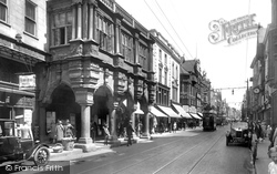
Another view of the High Street. The exquisite Guildhall is in the centre. It was built in 1330, remodelled in 1468, and the portico over the pavement added in 1592.
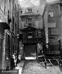
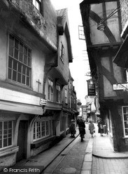
In the 15th century, this little street was full of open-fronted butchers' stalls with the meat being displayed hanging from large hooks.
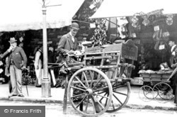
Many older tradesmen, unable to find work, took to the streets with their handcarts.
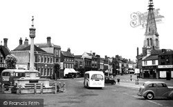
The open space around the square and the High Street to the north is bounded by well-mannered Georgian houses. 19th-century encroachments on the right do not distract from the beauty of the church, which
Places (385)
Photos (21809)
Memories (6667)
Books (1)
Maps (1622)


