Places
36 places found.
Did you mean: street or streetly ?
Those places high-lighted have photos. All locations may have maps, books and memories.
- Heathfield, Sussex (near Cade Street)
- Street, Somerset
- Chester-Le-Street, Durham
- Adwick Le Street, Yorkshire
- Scotch Street, County Armagh
- Friday Street, Surrey
- Potter Street, Essex
- Boughton Street, Kent
- Newgate Street, Hertfordshire
- Streetly, West Midlands
- Shalmsford Street, Kent
- Green Street Green, Greater London
- Boreham Street, Sussex
- Park Street, Hertfordshire
- Cade Street, Sussex
- Appleton-le-Street, Yorkshire
- Hare Street, Hertfordshire (near Buntingford)
- Romney Street, Kent
- Trimley Lower Street, Suffolk
- Streetly End, Cambridgeshire
- Hare Street, Hertfordshire (near Stevenage)
- Brandish Street, Somerset
- Colney Street, Hertfordshire
- Langley Street, Norfolk
- Silver Street, Somerset (near Street)
- Street, Yorkshire (near Glaisdale)
- Street, Lancashire
- Street, Devon
- Street, Cumbria (near Orton)
- Street, Somerset (near Chard)
- Bird Street, Suffolk
- Black Street, Suffolk
- Ash Street, Suffolk
- Broad Street, Wiltshire
- Brome Street, Suffolk
- Penn Street, Buckinghamshire
Photos
24,921 photos found. Showing results 4,001 to 4,020.


Your search returned a large number of results. Please try to refine your search further.
Maps
1,622 maps found.
Books
3 books found. Showing results 4,801 to 3.
Memories
6,667 memories found. Showing results 2,001 to 2,010.
I Was Born There
I was born in Tyldesley at 13 High Street - the house is gone now. I emigrated to USA in 1953, married and had 3 children. I went to St Josephs RC School and Sacred Heart Church. We all went to school in Hindsford, Tommy, Norah, ...Read more
A memory of Tyldesley in 1930 by
My Sisters Village
My sister moved from Manchester in 1990 to Keinton as her husband was working in Shepton Mallet. We have been visiting the village at least 3 times a year, Easter, Summer and usually Christmas. Our children say they can ...Read more
A memory of Keinton Mandeville in 1994 by
Bakery Entrance
From the early 1900s to the mid 1960s my family, the Coopers, owned Thompsons Bakers, Confectioners and Restaurant at 34-36 Tavern Street. If you turned left into St Lawrence churchyard - just where the person on the left of the ...Read more
A memory of Ipswich in 1960 by
The Plantations
Well not just for the 1930's but for twenty years after as well. Memories come flooding back - not just for this picture but for Wigan itself. I was born there in 1931 - in my grandparents home 38, Dicconson Street - a section no ...Read more
A memory of Wigan in 1930 by
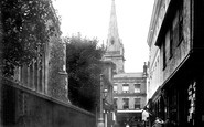
Looking Down North Street
This picture is much the same as the previous one. The horse and carriage should be on the left side...but who cares, there's nothing coming up the right side. The Grammar School's tall oaks can be seen in the distant centre.
A memory of Midhurst by
Childhood In Salford
I was born Susan Cooke in no. 11 Quanton House, Amersham Street just of Liverpool Street , in my nana's flat. We lived with her until I was 3 from 1957 to 1960 when we moved to Trenham Street near to where the Salford ...Read more
A memory of Salford in 1960 by
1947 To 1956
I was born in 1942 in Upton-by-Chester and my mother's family (Maddock) owned the butcher's shop that became Toycraft on Watergate Street, and one in the Market in the sixties. My parents emigrated to Canada with me in tow in 1956 and ...Read more
A memory of Chester in 1947 by
Childhood Memories
We moved to Prestatyn in 1960 when I was 3. My first memory was riding on my dad's shoulders walking up the High Street and seeing a bus with no roof! We lived in Linden Walk for three years and I used to enjoy milkshakes in a ...Read more
A memory of Prestatyn in 1961 by
Fabulous Hatch End
I also remember this scene of Hatch End. I lived in the Pub which just about appears in this picture on the top far right, its the white buillding that is just sticking out slightly. Next door to the pub was the Conoco garage ...Read more
A memory of Hatch End in 1967 by

Chester In The 1960s And 1970s
Chester for me, in the 1960s, was, first, the Museum. It was a full day out. The C4 or C3 bus from Overpool or the C6 from Rivacre, small pack of sandwiches and some orange squash in my school haversack and I could ...Read more
A memory of Chester in 1964 by
Captions
5,435 captions found. Showing results 4,801 to 4,824.

Local gentry applied for an Act of Parliament to allow them to build a new town and to develop the harbour, and work began in 1807, when the grid of broad, airy streets was laid out.

Doncaster's electric street tramway opened on 2 June 1902; it operated fifteen open-top cars, each capable of carrying a total of 56 passengers.

Humphrey's Bakery, High Street, has been dated 1332.
Regardless of the unsympathetic way it clashes with the rest of the street, the bank goes all out to impress. The timber-framed building on the right was built in 1906 as a temperance club.

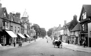
Along with the substantial numbers of parked cars along the verges, a laden lorry and a coach are advancing down the High Street, representative of the immense numbers of similar heavy vehicles which

We now move east to The Poultry, the street along the south side of the Council House.

We are looking south-east along Neston's main shopping street, with the wall of St Mary and St Helen's church on the immediate right.

This photograph looks eastwards towards the mediaeval town centre, but apart from reminding us that shop fascias were once sensitively designed, and that shopping streets were once pedestrian-friendly,

No 18 High Street (left, next to the fishmonger's) was a baker's run by Mr Brinkworth in the 1870s; it was a grocer's in 1890, run by Sarah Smith.

By now Hitchman's the chemists had been swept away: Montague Burton had built an art deco emporium (left) on the corner of Silver Street.

There has been a fair amount of rebuilding since the 1950s, as could be expected in such a busy commercial street, but Philadelphus Jeyes survives.

These baths are around the corner from where Throwley Road once turned to the north (it is now Throwley Way and acts as an inner relief road or High Street by-pass).

Frith's photographer looks south down the High Street from the Broadway.

This view looks from Godstone Road to the Plaistow Street-Newchapel Road junction.

The building on the left curving into Bath Street from the Square, with its many gables and ornate shop fronts (now a Chinese restaurant), replaced the Rising Sun Inn, a three-storey timber-framed

This view was taken looking north along Bridge Street towards the Market Place – indeed, in the left centre of the view we can see the cupola and stair tower of the Town Hall.

Still on the green, the camera points south to Steventon Road, the south lane from the High Street, already in 1955 closed to traffic.

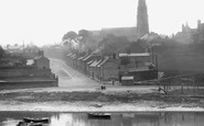
When the bus station opened on 20 May 1963, much Castleford history was lost with the demolition of the Queen's Head Hotel and Wainwright Street.

The path emerges in Pound Street.

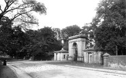
First to be completed was a pedestrian way linking Castle Street with the bus station. This was called Birdcage Walk, and once included an aviary housing tropical birds.

The High Street runs parallel to the north wall of the Abbey precinct and has a good range of Georgian and early 19th-century two- and three-storey houses.

The resulting Treaty of Wedmore divided England into two: the Danes were ceded all the territory east of Watling Street, the 'Danelaw'.

The first house on the left is named The Old Post Office, and the Old Cobblers Shop is further up the street.
By now Hitchman's the chemists had been swept away: Montague Burton had built an art deco emporium (left) on the corner of Silver Street.
Places (385)
Photos (24921)
Memories (6667)
Books (3)
Maps (1622)

