Places
Sorry, no places were found that related to your search.
Did you mean: north ness or na h ness or nook ness ?
Photos
12 photos found. Showing results 201 to 12.
Maps
9,582 maps found.


Books
30 books found. Showing results 241 to 264.
Memories
4,597 memories found. Showing results 101 to 110.
Living In Chilton
My family moved to Chilton Foliat and took over the "Old Post Office". I was still young then and went to the old school run by Mr & Mrs Hassall who lived next door to the school. Two classrooms and very fond memories. ...Read more
A memory of Chilton Foliat in 1964 by
Gone And Not Forgotten!
I can't believe no-one has bothered to write about LINSLADE, it may not be well known to the 'outsiders' but it's still worth a mention. My great-uncle, Robert Graham, used to work on Linslade railway station, he knew the ...Read more
A memory of Linslade in 1969 by
Fond Memories
I think it was around this time (1993) that I attended St Clots! I was sent there as I had been enjoying, to date, my time at bording school in Berkshire. My mother and my auntie had spent many many happy years here when my ...Read more
A memory of Lechlade on Thames in 1993 by
Another Howard Family Living In Hammersmith
My mother, Phyllis Howard Penn, was born in Kensington and had a brother Jack, his wife Ethel, their son, John Desmond Howard, his wife, Eileen and their son, John, who lived on Claybrook Road. I met ...Read more
A memory of Hammersmith in 1958 by
Ashby Broadway
I lived in Ashby as a child, and when I started attending Ashby Girls' School on Ashby Turn, I had to walk from the bottom of Ashby to the top every day, rain or shine. When I was 11 in 1948, Broadway was nothing more than an ...Read more
A memory of Ashby in 1958 by

Horney Common As A Child
I was born in London in 1938. When war broke out the following year my father sent my mother and myself down to Devon but soon after that he, and many of his regimental colleagues in the Army, rented a large country ...Read more
A memory of Horney Common in 1940 by
Longleat
My grandfather Cecil Welch, who was the local estate agent and auctioneer based at the Old Town Hall in the High Street, bought several old cottages next to the blacksmiths in Church End for his son John and wife Peggy, at the vast ...Read more
A memory of Great Dunmow in 1948
Guy Fawkes!
This is another part of Laindon that is no more. I can remember waiting outside the Fortune of War with a Guy leading up to Firework Night, I always collected lots of change from the kind patrons of this local drinking establishment. I ...Read more
A memory of Laindon by
Dibden Purlieu Newsagents Mr Mrs Storey
It was so lovely to see you refer to Mr Storey (Sid) in the earlier post - he was my wonderful Grandad! Nan and Grandad (Grace and Sid Storey) used to run the newsagents, and as a little girl, I was ...Read more
A memory of Dibden Purlieu by
Now Living In Egypt
Hi Anthony, I knew your grandmother Ketura and your grandfather Ellis and most of their children. They had a very large family. Your Auntie Margery and I were great friends. We were always getting into trouble for climbing ...Read more
A memory of Llysfaen in 1960 by
Captions
1,673 captions found. Showing results 241 to 264.

Here we see another tramcar and more granite setts. There is some activity around the base of the statue - are the two ladies selling flowers and button-holes?

At Kinsley Wood the ER was planted on both sides of the hill.

A short flight in this light aircraft, even just a few hundred feet up, would give the sightseeing holidaymaker a marvellous view of both the coastline and the Broads inland.

Along here were branches of both national and Cheshire retailers including Dewhurst, the butchers, and Waterworths.

This fine terrace of houses is another indication of improved housing design and of the spread of St Ives onto the higher ground overlooking St Ives Bay.

Another of the stunted carved crossheads in St Buryan's churchyard. The crucified Christ figure is robed; this indicates an eastern Byzantine style rather than western Roman influences.

Named after the knight who killed William Rufus, the Sir Walter Tyrrell became another hostelry that achieved prominence during the age of popular motoring - as this full car park indicates.

Like Bournemouth's pier, the structure at Boscombe was severely damaged in the Second World War, but both have been sympathetically restored.

The National Sea Training School trained both deck and catering ratings for service with the Merchant Navy. The trainees slept in the barrack-type accommodation seen in this picture.

Both Birkenhead and Wallasey Corporations operated their own tramway systems. Birkenhead's was electrified in 1901 and ran until 1937; Wallasey's operated from 1902 to 1933.

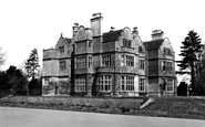
Note the impressive chimneys, both on the side and in the centre of the building.

Another view showing the popularity of Saltburn as a holiday resort in the years which followed the end of the Second World War, but before the advent of the affordable package

In this view the pub, the river, and both bridges can all be seen. Note the pole sign for the pub standing in the river.

It replaced the original after yet another Norfolk fire gutted the town centre.

Another view of Salutation Square before its redevelopment and transformation into a busy road junction. The board on the 'Keep Left' sign refers to a Royal Army Ordnance Corps exercise.

A fine study of the Ladies' Bathing Place, which seems a popular venue for both the women and menfolk of Portrush. A yacht can be seen out towards the Skerries.

Another general view, this time of the tranquil Usk as it wends its way down towards the Severn estuary south of Newport, Gwent. The Usk rises south-west of Trecastle in Powys.

Both Charles I and Oliver Cromwell stayed in the village during the Civil War. This tumble-down cottage had probably changed little since those stirring times.

This woman is carrying out another of the Gower Peninsular traditional occupations, cockle picking. Note her unusual dress: loose trousers (or is it a skirt tied at her knees?) and footless socks.

The Deanery on the left and the terrace on the right of the north side of Lower Close both incorporate much medieval work. The terrace was converted from the priory granaries.
The Deanery on the left and the terrace on the right of the north side of Lower Close both incorporate much medieval work. The terrace was converted from the priory granaries.

Another crowded scene on the South Beach close to the Spa, whose ornateness and splendour is clear to see. The Victorian beach was a place to promenade rather than to sit.

Before the Town Bridge was strengthened, heavy carts had to ford the river from either the ramp at the sunlit break beyond the trees or another ramp on the right beside the bridge.

Both were added to a 15th-century structure.
Places (0)
Photos (12)
Memories (4597)
Books (30)
Maps (9582)

