Places
36 places found.
Those places high-lighted have photos. All locations may have maps, books and memories.
- Pentre-cwrt, Dyfed
- Pentre Halkyn, Clwyd
- Pentre, Mid Glamorgan
- Ton Pentre, Mid Glamorgan
- Pentre, Powys (near Llangynog)
- Pentre, Powys (near Guilsfield)
- Pentre, Powys (near Bishop's Castle)
- Pentre, Clwyd (near Mold)
- Pentre, Clwyd (near Ruabon)
- Pentre, Shropshire (near Chirk)
- Pentre, Clwyd (near Hawarden)
- Pentre, Dyfed (near Pontyates)
- Pentre, Powys (near Newtown)
- Pentre, Clwyd (near Chirk)
- Pentre, Clwyd (near Ruthin)
- Pentre, Clwyd (near Mold)
- Pentre, Shropshire (near Oswestry)
- Pentre, Powys (near Welshpool)
- Pentre, Clwyd (near Mold)
- Pentre, Shropshire (near Forton)
- Burntwood Pentre, Clwyd
- Pentre Berw, Gwynedd
- Pentre Hodre, Shropshire
- Pentre Llanrhaeadr, Clwyd
- Pentre-celyn, Clwyd
- Pentre Broughton, Clwyd
- Pentre Gwynfryn, Gwynedd
- Pentre Maelor, Clwyd
- Pentre-clawdd, Shropshire
- Pentre Galar, Dyfed
- Pentre Llifior, Powys
- Pentre-cefn, Shropshire
- Pentre-Gwenlais, Dyfed
- Pentre-Poeth, Dyfed
- Pentre Cilgwyn, Clwyd
- Pentre Morgan, Dyfed
Photos
98 photos found. Showing results 2,861 to 98.
Maps
316 maps found.
Books
2 books found. Showing results 3,433 to 2.
Memories
1,250 memories found. Showing results 1,250 to 1,250.
Captions
3,594 captions found. Showing results 3,433 to 3,456.
The planners of the new town centre had no place in their design for this beautiful building, and it was swept away in 1965-66 and replaced by a branch of Tesco.
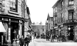
The village shop (centre) does a good trade in cycle parts, but at certain times in the religious calendar, pilgrims arrive on foot from all over Europe.
Pilkingtom Manor, mostly hidden by the trees on the left, was demolished in 1959, and today only the Dower House (the white gabled building in the centre of the photograph) survives.
The shot is north-eastwards, along Bridge Street (centre) to the roofs of Coombe Street. Hubert Charles Parham was the draper at No 64 Broad Street (bottom left).
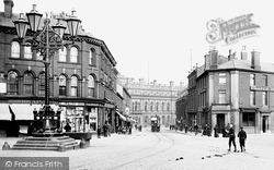
The shops behind the big lamp in the centre of the road are interesting.
A motor car can be seen in the centre of the picture, driven by a uniformed chauffeur. This is the 20th century, after all, and sophisticated technology is here to stay.
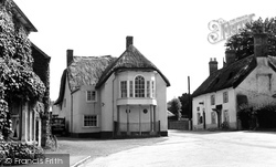
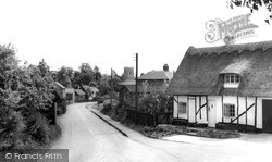
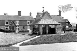
The attractive thatched house with the bow window supported by pillars dominates the centre of the village.
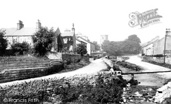
In this picture we can see the small stream that runs down from Waddington Fell and the Moorcock Inn as it runs right through the centre of the village to join the Ribble.
The Duke of York public house can be seen in the centre of our picture.
In the centre of the picture, an open-topped bus picks up passengers next to a theatre billboard. The cart (right foreground) is loaded with what looks like animal hides.
But the history of Gatesbury goes back further, for Braughing was a Roman industrial centre for the manufacture of pottery. Examples can be found all over Roman Britain.
Wilson's Garage (centre) was the first to be established in Formby - although not on this particular site.
Since then the house has been used as a training centre for stonemasons, and it is opened to the public on certain weekends during the summer months.
Behind the Barley Mow pub in the centre of the picture, the northern and southern branches of the River Wey unite.
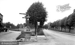
The fountain in the centre of this photograph was erected in 1886 to mark the efforts made by Dr W F Clarke to get Southborough a healthy water supply.
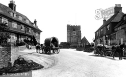
This view looks south down the main street towards the church of St Thomas and St Nicholas - we can see its 14th-century crossing tower (centre).
On the right is the half-timbered frontage of The Star and Eagle Inn, which was a centre for this nefarious trade and is connected to the church by a secret underground passage.
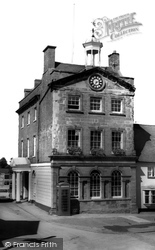
By this time the Moot Hall was in use as a museum and Tourist Information Centre, with the Mayor's Parlour still operative on the top floor.
Sited on an old cattle market, the Sands Leisure Centre was opened in 1983 to provide much valued modern gym and leisure facilities, as well as acting as a well-used venue for theatre and musical
The pump house, dated 1900, was a centre of village life before piped mains water supplies. An iron cage protects the ornate lead pump head.
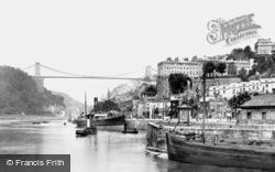
Bristol developed to become a major centre for the importation of timber for use throughout the west of England.
The third building away from the camera on the right was Manchester's first Town Hall, started in 1825; it was the centre of municipal administration until the new town hall opened in 1877.
The square tower of St Mary's can be seen peeping out at the centre back of the picture.
which was founded by a local farmer, John Lyon, in 1572, has brought fame, but at the same time has undoubtedly contributed to the present fossilisation of the village as a self-supporting commercial centre
Places (57)
Photos (98)
Memories (1250)
Books (2)
Maps (316)


