Places
26 places found.
Those places high-lighted have photos. All locations may have maps, books and memories.
- Cemmaes Road, Powys
- Six Road Ends, County Down
- Road Weedon, Northamptonshire
- Severn Road Bridge, Gloucestershire
- Roade, Northamptonshire
- Berkeley Road, Gloucestershire
- Harling Road, Norfolk
- Road Green, Devon
- Builth Road, Powys
- Cross Roads, Yorkshire
- Steele Road, Borders
- Cross Roads, Devon
- Four Roads, Dyfed
- Road Green, Norfolk
- Biggar Road, Strathclyde
- Clarbeston Road, Dyfed
- Five Roads, Dyfed
- Eccles Road, Norfolk
- Grampound Road, Cornwall
- Morchard Road, Devon
- Wood Road, Greater Manchester
- Four Roads, Isle of Man
- St Columb Road, Cornwall
- Clipiau, Gwynedd (near Cemmaes Road)
- New Road Side, Yorkshire (near Silsden)
- New Road Side, Yorkshire (near Cleckheaton)
Photos
14,329 photos found. Showing results 3,881 to 3,900.
Maps
476 maps found.
Books
5 books found. Showing results 4,657 to 5.
Memories
11,058 memories found. Showing results 1,941 to 1,950.
A Wartime Evacuee
During the war I was evacuated with my family to Dunsmore and we lived in Appletree Cottage, opposite The Fox. I attended Wendover School and returned to London in 1946. At the time Robert Donat lived in ...Read more
A memory of Dunsmore in 1940 by
Trevelyan Road Tooting
I was born on 8th May 1945 (the day the war ended) at 61 Trevelyan Road Tooting. My mum told me that there was a heatwave on the 8th May and whilst she was trying to get some rest there was a street party going n which she ...Read more
A memory of Tooting in 1945 by
Payne Family Knaphill / Bisley
I have enjoyed reading the 'Memories of Knaphill' contributions, and though I have not lived there myself, my Payne family did, so thought I might share a few of their memories! In the 1890's, Captain George Payne and ...Read more
A memory of Knaphill
My Years At Woodford Bridge
I lived in Canfield Road, Woodford the very last house on the left hand side, right next to the cricket field. I went to the little mission (The Bridge) run alongside the tie factory. I remember Grants the shoe ...Read more
A memory of Woodford Green in 1957 by
Dr Smallshaw
Just a little way down Fir Tree Road from where this was taken, was the home and surgery of my childhood doctor - Dr Smallshaw. I remember him as a kindly man, and his surgery smelt of surgical spirit and his waiting room had dark leather chairs.
A memory of Epsom in 1960 by
British Home Stores
I worked further down the road in BHS at this time as a Saturday girl. I thought it was great and earned about £1 which bought my dinner and stockings and bus fare and I still had money in my pocket.
A memory of Brixton by
Plympton Station Holiday Memories
My grandparents, my mother's parents, lived in Vicarage Road, Plympton until 1962 when they moved to Moorland Avenue. As children we always spent our holidays with them and I have early memories of accompanying ...Read more
A memory of Plympton in 1958 by
Bennetts Shop Brook Street
Hi Does anyone remember the old fashioned style local shop half way down Brook Street in between the Coylers Lane and Belmonth Road junctions? The shop is still there but in a very diffferent form. The ...Read more
A memory of Northumberland Heath by
Marsh's Pie Shop
Marsh's pork pie shop was opposite Labour Club Number One, at the end of Old Whint Road. The pies were known as the best in the world and we kids at Jagger's (Richard Evans Junior School, West End Road) used to sing 'Marsh's, they ...Read more
A memory of Haydock in 1960 by
Nefyn Primary School, War Memorial, Doctor's Surgery
This is a photo of all three named "institutions" with the Red Garage and Church Hall just off to the left. I thought this was an ENORMOUS road and we never crossed it by the Memorial! That is ...Read more
A memory of Nefyn in 1960 by
Your search returned a large number of results. Please try to refine your search further.
Captions
5,036 captions found. Showing results 4,657 to 4,680.
Trindle Road runs across the centre of the picture, whilst the corner of Hall Street can be seen centre right.
Horse-drawn ambulances, taxi cabs, flat wagons, and even a horse bus were used to convey the patients down to the new Royal Infirmary on Oxford Road.
An open-topped bus trundles along the Ewell Road towards the crossroads of the village, passing the petrol pump of the small garage near the entrance to Park Lane, and with the trees on the edge of Nonsuch
Teas are still being served on the corner of The Village and Arrowe Park Road at the Stone House Café (U36010, right), and the Horse and Jockey Hotel still occupies the junction of Rake Lane
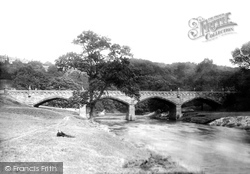
Two bridges crossed the Usk at Llanfoist: the medieval stone-arched road bridge is dwarfed by the railway bridge, which was demolished shortly after the Abergavenny to Merthyr line closed in the
The village of St Boswells borders the main road from Jedburgh to Edinburgh. The 5th Duke of Buccleuch was just a boy when inherited his title in 1819.
There is a road crossing nearby.
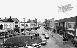
The traffic islands and the roads were being replaced by a brick surface. It all had to be finished before the Tulip Parade in early May. The shops are still there, but all have changed owners.
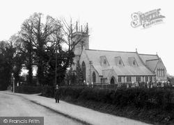
St Peter's is Early English in style and is appropriately in Church Road, Earley, now part of Reading.
Two bridges crossed the Usk at Llanfoist: the medieval stone-arched road bridge is dwarfed by the railway bridge, which was demolished shortly after the Abergavenny to Merthyr line closed in the early
but the stone mullion and transom windows have gone in favour of unattractive modern replacements; strangely, the bell-cote now resides in the garden of School House on the oppo- site side of the road
The bridge was constructed to give road access to the railway station built on the St Martin's side of the river in 1846; it was designed in the same Gothic Revival architectural style, and the parapet
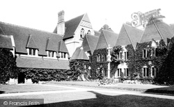
Off Moat Road is the former St Margaret's Anglican Convent. It was founded by the Rev John Mason Neale, who was among other things a prolific hymn writer, the author of 'O come, O come, Immanuel'.
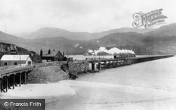
It is 800 yards long and has a road for foot passengers, who can enjoy the freshness of the air and the sublime vistas of Cadair Idris.
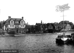
To the left of the hotel, the road apparently entering the water is a public slipway for private boats.
During that time it suffered the highest losses of any squadron, and there is a monument to that effect beside the road in the middle of the village.
The house with the butcher's shop on the right was demolished in the 1960s for road improvement.
The town is now by-passed by both the A1 Great North Road, which crossed the bridge, and the Fosse Way (the A46).
Iron electricity poles line the road; they are of a type only seen in this part of Sussex.
This very pretty village with its flint and brick houses and cottages runs south from the main road to its parish church of St Mary and St Peter, which is set high above the lane with the ruins of Wilmington
Note the road with its stone setts rather than tarmac.
On the corner of Station Road is a three-storey block of Victorian shops. The gable beyond is Thurlows the draper's in Friars Street.
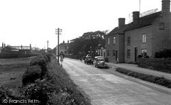
There appears to be only one car on the road; however, in the left- hand corner there is a wheeled vehicle on the pavement.
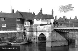
On the right, carrying the road from Ramsgate, is the swing bridge over the River Stour of 1863, which replaced the original drawbridge of 1757.
Places (26)
Photos (14329)
Memories (11058)
Books (5)
Maps (476)


