Places
9 places found.
Those places high-lighted have photos. All locations may have maps, books and memories.
Photos
20 photos found. Showing results 61 to 20.
Maps
1,296 maps found.
Books
2 books found. Showing results 73 to 2.
Memories
613 memories found. Showing results 31 to 40.
Fondest Memories Of Gt Oakley 1938 To 1961
That was when I was born along with a bunch of other kids who grew up with me and with whom I played during the WW2 years and eventually went to C of E school together. Mr Porter was a teacher there, ...Read more
A memory of Great Oakley by
Boarding School
I went to st Roses convent in Stroud when I was eleven years old . The boarding house was up the lane called merrymeads. It was named st Bedes . I can remember going to the Holy Rosary church which was next to the convent . ...Read more
A memory of Stroud by
Weekends At Chapel Row
I didn't live in Bucklebury but was born in Cold Ash where I lived prior to moving to Thatcham. Unfortunately my father died as the result of a motor cycle accident when I was eight years old, and social care being what it ...Read more
A memory of Bucklebury by
100 Melody Road. Wandsworth S.W.18
In 1943/4 My mother, brother and myself were bombed out of our home in Summerly Street. In that house we had a Morrison shelter and the night the bomb hit, a few houses away from our house, it affected our shelter ...Read more
A memory of Wandsworth by
Ellis Street, Crewe
Although I was born in Nantwich (1956), in the Barony hospital, I grew up in Crewe until the age of about twelve. We lived in Ellis Street, which then, if memory serves me right, only had three houses, even though we were in number 8! ...Read more
A memory of Crewe by
Perhaps A Year Or Two Early
I'm not absolutely sure the garden was as spick and span as this at the turn of the sixties, but it wasn't that long before it became this way. It had been a ruin until the early fifties when a brutalist electricity sub ...Read more
A memory of Timperley by
I Lived At 45 Warrington Ave
I was born in Taplow in 1957, my parents shared a house (a semi) with my grandparents. They lived downstairs and us obviously upstairs. I attended St Anthony’s Catholic School on the Farnham Rd and at that time they had ...Read more
A memory of Slough by
Selby Infants School
Hello, I have some fond memories of my old school....but also some not so fond ones! Remember Miss Hingley bringing me to the front of the class after an assembly as I had been spotted chatting!....she slapped me on the legs so much ...Read more
A memory of Selby by
New Years Eve At Didgemere
My parents farmed in Hertford Heath, only a short drive from my Uncles home in Roydon, as did my Grandfather from Nazeing. An uncle and aunt lived in Ashridge Park in Hemel Hempstead so rather further away from Roydon ...Read more
A memory of Didgemere Hall by
The Low Davidson Family
My sister and I are from Canada and came to Scotland this past month, August, 2009, to see where our mother, Kathleen Low, and her family were born and raised in their youth. After many years of hearing them describe ...Read more
A memory of Johnshaven in 1900 by
Captions
157 captions found. Showing results 73 to 96.
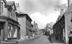
This view looks north along the High Street past the now 'improved' junction with West Lane.
The next four views were taken in the High Street, which runs westward to Hemplands Lane with the site of the railway station beyond.
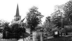
In Church Road there are some older houses and the parish church; the south churchyard boundary runs along Church Lane to the left.
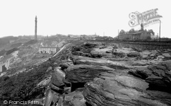
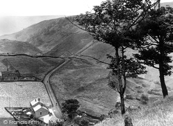
In the distance is Wainhouse Tower, 253ft high, with over 400 steps and weighing in at about 9000 tonnes.
In this picture, the camera is looking down Church Street from High Street (renamed Stoke Road in 1959).
Beyond Cundys Lane is High Bank, a medieval hall-house; then comes the thatched 17th-century Tudor Cottage and the former post office.
In the main, the village now lacks either grace or inspiration in its buildings; to some extent, relief can be gained at its western end through the high-walled Bernays Gardens, a few houses around Old
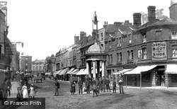
The High Street itself was filling up. Some of the freeholders had been setting up stalls in the middle of the road that were now becoming permanent structures.
The High Street itself was filling up. Some of the freeholders had been setting up stalls in the middle of the road that were now becoming permanent structures.
is an ancient market-town which grew into a busy industrial centre on the River Darent, at the point where it was crossed by the Roman Watling Street, parts of which lie buried four feet beneath the High
is an ancient market-town which grew into a busy industrial centre on the River Darent, at the point where it was crossed by the Roman Watling Street, parts of which lie buried four feet beneath the High
High up above Todmorden, half of which used to be in Lancashire, we find this small Pennine village with a surprising number of mills for its size.
During the 18th century, the roads Cherry Bounce, Chapel Street, Bell Road (now St Mary's Road), and George Street were all developing on the east side of the of the High Street and were in
Western Cross is the junction of the High Street, Alton Road, Dunleys Hill and West Street.
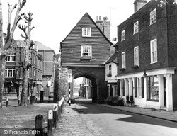
This is the College Yard side of the gate, looking through to the High Street and Northgate (formerly Pump Lane).
East of the M25 and the older River Wey Navigation, Byfleet is a suburban village; although it is built along winding lanes, it is architecturally disappointing.
Here we look along the High Street towards the junction with Church Lane. At the end is the Hind's Head Hotel. The Ringers on the right is now the Fat Duck Restaurant.
Still on the green, the camera points south to Steventon Road, the south lane from the High Street, already in 1955 closed to traffic.
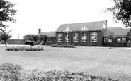
Along Padleys Lane, which curves north out of the village amid 1950s and later estate houses, we pass Burton Joyce Primary School.
The church is in one such hamlet with a pub, the Six Bells, nearby; this view looks uphill towards Church Lane at the crest.
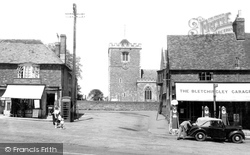
Off the north side of the High Street, the buildings are encroachments on the market place; Bletchingley had been a borough by the 13th century.
By now, the High Street was crammed with houses: all the plots had been filled.
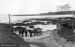
It stands on an islet, surrounded by the sea at high tide, and approached by a stone causeway.
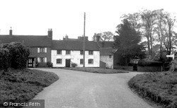
East of the park is the village, a figure of eight of winding lanes. This view looks east along Ashby Road to the small green at its junction with Station Road and High Street (to the right).
Places (9)
Photos (20)
Memories (613)
Books (2)
Maps (1296)


