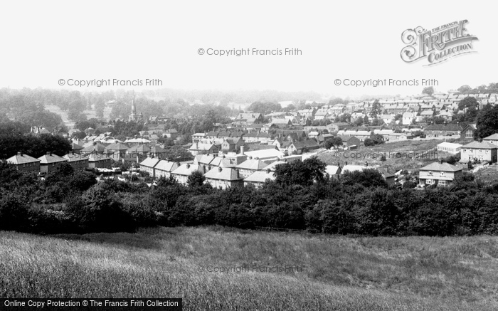
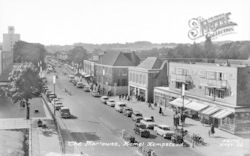
Hemel Hempstead, View From Adeyfield Road c.1960
Photo ref:
H255017


More about this scene
During the 18th century, the roads Cherry Bounce, Chapel Street, Bell Road (now St Mary's Road), and George Street were all developing on the east side of the of the High Street and were in effect extensions of the main street. At the southern end of the High Street the road branched to the east into Saffron Lane, later known as Queen Street. At one time the High Street stretched to the west, to the south of Gadebridge Park, when the land there formed the grounds of the Bury. This short stretch of road, which joined Bury Road to the west with Queen Street, now Lower Queensway, became known as Broadway. It obtained the name because it was a 'broad way' when compared to the narrow High Street. With the wide expanse at the top of Marlowes, this area became an overflow for the cattle market. By the end of the 18th century, however, the cattle market was dismantled and the London entrance to the town, as it was known, was improved. The cattle market was moved to a meadow behind the Rose and Crown. As the last specialised market of Hemel Hempstead, it survived up to the Second World War. Marlowes itself was gradually developed with several fine villas and shops appearing amongst speculative building and shabby cottages.
Add to Album
You must be signed in to save to an album
Sign inShare This Photo
Buy a Print
Unframed, Mounted, Framed and Canvas prints in a range of sizes and styles.
View Sizes & Prices
A Selection of Memories from Hemel Hempstead
For many years now, we've been inviting visitors to our website to add their own memories to share their experiences of life as it was, prompted by the photographs in our archive. Here are some from Hemel Hempstead
Sparked a Memory for you?
If this has sparked a memory, why not share it here?

 Before
 After
After