Places
26 places found.
Those places high-lighted have photos. All locations may have maps, books and memories.
- Cemmaes Road, Powys
- Six Road Ends, County Down
- Road Weedon, Northamptonshire
- Severn Road Bridge, Gloucestershire
- Roade, Northamptonshire
- Berkeley Road, Gloucestershire
- Harling Road, Norfolk
- Road Green, Devon
- Builth Road, Powys
- Cross Roads, Yorkshire
- Steele Road, Borders
- Cross Roads, Devon
- Four Roads, Dyfed
- Road Green, Norfolk
- Biggar Road, Strathclyde
- Clarbeston Road, Dyfed
- Five Roads, Dyfed
- Eccles Road, Norfolk
- Grampound Road, Cornwall
- Morchard Road, Devon
- Wood Road, Greater Manchester
- Four Roads, Isle of Man
- St Columb Road, Cornwall
- Clipiau, Gwynedd (near Cemmaes Road)
- New Road Side, Yorkshire (near Silsden)
- New Road Side, Yorkshire (near Cleckheaton)
Photos
14,329 photos found. Showing results 1,481 to 1,500.


Maps
476 maps found.
Books
5 books found. Showing results 1,777 to 5.
Memories
11,058 memories found. Showing results 741 to 750.
Salfords School
I was born in 1951 in Copsleigh Avenue (No 42). I must have started at the 'old' Salfords School in 1956. (My sister Jennifer was born in 1947 and was there too.) The photograph shows its location being just about deserted, apart ...Read more
A memory of Salfords by
The Salford Girl
I was born in 1947 and lived at 52 West St, Lower Broughton, Salford 7. I attended St. John's School for girls, just off Chapel St. My parents were Annie and David Johnson. I had an older sister, Jean, and a younger brother, David. My ...Read more
A memory of Salford by
Milner Memories.
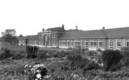
The photograph of the front of the Sir Frederick Milner School brought back memories. I taught English there from 1963 to 1970 in the second classroom to the left of the entrance. This was my first teaching post although I knew Retford ...Read more
A memory of Retford by
Into The Woods
As a child of the Fifties I spent many a school holiday and weekend exploring and playing in our local woods with two chums. We knew them separately as Bostall, Abbey and Lesnes woods, before they were known collectively as Lesnes ...Read more
A memory of Bexleyheath by
Wanting To Find Out Information About Walter Cyril Lansley
My Dad lived in Hounslow in the 1930s, in Ellerdine Road soon after the estate was built. His name was Walter Cyril Lansley and was born in 1919. He moved to Hounslow in the 30's with his ...Read more
A memory of Hounslow by
Brampton Road Primary School
I began my school days during the 1950's at Brampton Road Primary School, Bexleyheath. My over-riding memory is a time of innocence, wonder and happiness, where we were given freedom to learn and be creative in a ...Read more
A memory of Bexleyheath by
Born In 1941 Redhill A Wonderful Place To Have Grown Up
I was born and raised in Redhill. It was a wonderful childhood and many great memories. I was born in 1941 at Thornton House. We lived on Ladbroke Road, and remember the fish and chip shop, ...Read more
A memory of Redhill in 1950 by
Fir Tree Inn
I remember the Fir Tree Inn in its hey day. My Aunty Peggy was the landlady; she was a wonderful person; she always wore spectacular dresses when behind the bar. The Inn was at the top of the village just where Wellfield Road began. ...Read more
A memory of Wingate by
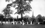
Cemetery
This is actually the chapel in the Ruabon Road cemetery used until about 1995 for burial services.
A memory of Wrexham by
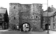
The Great North Road
How great was the Great North Road when it squeezed through these ancient gates until the early 1970s? Traffic built up on both sides waiting to get through. For a child this was the spot that marked where our holidays began, ...Read more
A memory of Alnwick in 1968 by
Your search returned a large number of results. Please try to refine your search further.
Captions
5,036 captions found. Showing results 1,777 to 1,800.

The Hunmanby road on the left quickly leads to North Burton Hall. This view has changed little in forty years.

This is the main road southwards, at the junction with Church Street (right). We are looking from North Street into Larmer Street.

The village grew thanks to railway workers and commuters, and shops moved onto the ribbon development on the Bristol to Bath road - we can see a post office, an optician's, a chemist's, a Co-op and a petrol

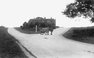
Originally the site of the village pump, this cross is at the junction of five roads. The George Inn, behind the cross, and the King's Arms (left) are now just houses.

Cars now line both sides of the road, and it would be hard to argue that they do not detract from the visual appeal of the Georgian street scene.

Our Lady of Lourdes' Church is situated on Leasowe Road, Moreton. Built in 1957, it features a strong architectural style.

`Accommodation for TEA PARTIES`, the sign reads. `Ginger Beer Lemonade Sold Here.` Francis Long, in Bradpole Road, was the local soft drinks manufacturer.

This stretch of coast is one of Cornwall's famous beauty spots, with dramatic cliffs and islands all accessible by road from Newquay and Padstow alike.

These children may well have been from the old National School, built on nearby St Thomas Road in 1840. There is an odd division between the well-dressed children (teacher's pets, perhaps?)

This photograph was taken 2 years before the famous statue of King Alfred was erected in the middle of the road, commemorating the 1000th anniversary of his death - albeit belatedly, as he died in

The road layout has been radically improved.

Looking north at the junction of the Crawley and Godstone roads we see the Star Inn, a much re-built 17th-century timber framed house, although little altered since the 19th century.

Then, it was a small town serving an agricultural area, but the arrival of the iron road changed all that. This picture was taken when the railways were at the height of their popularity.

Pensby Road has changed little since the mid 1960s.

Facing a bend in the road is the Horseshoe Inn; the date 1626 is carved on the jettied cross wing of the inn. In the yard behind is a blacksmith's shop. The barn on the corner has just been thatched.

Just behind the 'Keep Left' road sign there is a shop called The Fifty Shilling Tailor (left); a suit for fifty shillings would be excellent value – that translates as £2.50.

Patrons using the outside seating in what used to be the car park can now watch the traffic flow across this busy junction with the Over/Rampton road.

The busy A21 road goes right through the village, and the demand for a bypass is still ongoing.

St Georges Road is to the left, opposite Obelisk Street.

LOWICK BRIDGE, The River Crake L462009 Lowick Bridge is the second road bridge to span the waters of the River Crake after it leaves Coniston Water, and is close to the pub.

its old cottages with their bright gardens, the clear waters of its streamlet, all these go to the making of a gem among villages, a place where one could linger long were it not for the call of the road

A view east down Euston Road. To the right we can see the cupola of St Pancras's Church peeping above the Friends' Meeting House.

The village lay on the A4 Bath road, but it is now a by- passed backwater with the roar of the M4 within quarter of a mile. Traffic levels are almost back to those of the 1950s.

This bleak view from the Pelham Bridge shows the influence of modern road improvement on a city landscape.
Places (26)
Photos (14329)
Memories (11058)
Books (5)
Maps (476)

