Merry Christmas & Happy New Year!
Christmas Deliveries: If you placed an order on or before midday on Friday 19th December for Christmas delivery it was despatched before the Royal Mail or Parcel Force deadline and therefore should be received in time for Christmas. Orders placed after midday on Friday 19th December will be delivered in the New Year.
Please Note: Our offices and factory are now closed until Monday 5th January when we will be pleased to deal with any queries that have arisen during the holiday period.
During the holiday our Gift Cards may still be ordered for any last minute orders and will be sent automatically by email direct to your recipient - see here: Gift Cards
Places
11 places found.
Those places high-lighted have photos. All locations may have maps, books and memories.
Photos
54 photos found. Showing results 1,501 to 54.
Maps
494 maps found.
Books
25 books found. Showing results 1,801 to 1,824.
Memories
9,978 memories found. Showing results 751 to 760.
Cononley
I was born in Buttershaw in Bradford. I moved to Cononley at the age of 5 and have spent happy times in and around the village. Living just outside the village parish lines at this time our family became very involved in the village ...Read more
A memory of Cononley in 1977 by
Growing Up In Greenford 1957 1970s
Wow! Thanks for those memories. A million miles away in rural East Anglia, remembering growing up in Greenford. Stanhope Infants and Juniors, Mr Bishop, Mrs Avery, anybody went there remember them? ...Read more
A memory of Greenford by
Mossford Garage
I started work at the age of 15 years as 'the boy', apprentice mechanic at Mossford garage. I remember going down the High Street to Pither's bakeries to get ham and cheese rolls, as well as pies for the mechanic's tea breaks. ...Read more
A memory of Barkingside in 1965 by
Alton 2003
A quite recent memory but I visited in 2003 thanks to the kindness of my relative Josephine Dixon [dec.]. We are both related to the Byatt and Collis families from Alton. It was great to see where our family lived and ...Read more
A memory of Alton in 2003 by
A Lost Childhood
My beloved late mum grew up and lived in the stunning village of Rode, way back in the late thirties I think. Sadly she's gone now, and I wish I had written down more of her memories of Rode. Her family name was Humphries, and she ...Read more
A memory of Rode by
Railway Station Yard
My parent's business on Whitefield Road backed onto the sidings of the rail station. The coal wagons were shunted onto a track alongside the public pathway. The Coal Merchants had their office shacks on the entrance way to ...Read more
A memory of New Milton in 1950 by
Early Years
I was born at 37, Ravenshill Road in 1955. I can remember a man on a bike sharpening knives and scissors on a grinding wheel attached to the front, also a man with a pony and trap would take you for a ride round the block for a ...Read more
A memory of West Denton by
Memories From 1982
I have fond memories of a garden fete held in the church grounds in 1982. I was staying at the farm camp nearby, picking fruit etc during the summer. Since me and a friend had such a wonderful time, we came back and spent ...Read more
A memory of Leverington in 1982 by
Place Where I Was Born
Sowerby holds many happy memories for me. I was born there in April 1935 and left for pastures new in 1957. Over the years I have made many visits back to my homeland from Australia. The village has changed very little ...Read more
A memory of Sowerby in 1940 by
The Cafe School
We moved to Alton from Somerset in November 1958. The primary school was closed for refurbishment. Mr. and Mrs. Carnwell who owned the garage and cafe played host to the village school, it all seemed quite strange to ...Read more
A memory of Alton in 1958 by
Captions
2,019 captions found. Showing results 1,801 to 1,824.
The first known reference to the chapel was found in a document of 1552, though the original structure probably dated back to the 14th century.
This illustrious and sublime town is on the east bank of the River Ouse, two miles from the Wash.
The Butter Market of 1853 (centre) is now Achurch Hardware Store, and the snack bar next door is now a pizza and kebab house.
Photographs taken before 1965 reveal it to have been a truly magnificent structure; documentary records indicate that it was built about 1600, though its predecessors can be tracked back as far as 1460
Just above the horse's back is the narrow entrance to Cheyne Lane (S177062, page 24).
Its first house, Green Bank, is bigger than the rest and has a bay window, being built for a mill manager or the owner of the row.
Second left is the Pilot Boat Inn, where the publican's dog, Lassie, licked back to life one of the sailors from the battleship HMS 'Formidable' on 1 January 1915.
Horley is now firmly back in Surrey, but for some years prior to 1974 it, along with Gatwick Airport, was within Sussex.
The hotel façade has not changed, but Boots have moved further along the High Street and the Halifax Bank has replaced Boots.
It is the wealth created by the years of shipping which has given Wisbech two of the most perfect Georgian streets in England - the Brinks on the banks of the River Nene.
Here the photographer looks across the back of the Victorian elementary school and schoolmaster's house at the left of the hay ricks.
The biggest docks were the Royal group east of Canning Town on the north bank of the Thames. The Royal Victoria Dock opened in 1855, enclosing 94 acres of water.
The Red Lion dated back to at least 1792, when it was called Blackwater. It originally faced onto the lower part of Blackwater Street, which later became Lord Street.
Unlike Staines on the north bank, the river plays no part in Egham's townscape. This view looks east along the High Street.
Across the A3, Puttenham village lies just south of the narrow chalk ridge of the Hog's Back.
Built on slightly higher land away from the river, it turns its back on it, and this view looks north-west along the High Street to the Church Street crossroads.
On the right is the elegant Georgian frontage of Lloyd's Bank, complete with a fanlight over the door and a decorated gable at the roofline.
Photographs taken before 1965 reveal it to have been a truly magnificent structure; documentary records indicate that it was built about 1600, though its predecessors can be tracked back as
The mill, on the south bank of the Great Ouse, later became a hosiery factory, and has now been converted into a prestige housing complex.
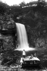
Once the Settle to Carlisle railway had opened, which ran to the east of Ingleton, Victorian entrepreneurs laid out the 4-mile walk along the banks of the River Twiss towards Pecca Falls, Hollybush
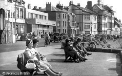
The projecting section of promenade shown in both photographs is known as the Donkey Stand, because it was possible to take donkey rides along the sands from here as far as South Slip and back.
Records of the existence of this street go back at least to the 15th century and it is known to have been used by travellers and pilgrims on their way to the Abbey.
By AD410, all remaining troops were withdrawn as the Romans trudged back to deal with unrest in their homelands. Many artefacts have been since found within the site of the fort.
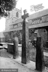
The porch to the church dates back to Norman times (13th century), the aisle from the 14th and the tower from the 15th century.
Places (11)
Photos (54)
Memories (9978)
Books (25)
Maps (494)

