Places
36 places found.
Those places high-lighted have photos. All locations may have maps, books and memories.
- Shanklin, Isle of Wight
- Ventnor, Isle of Wight
- Ryde, Isle of Wight
- Cowes, Isle of Wight
- Sandown, Isle of Wight
- Port of Ness, Western Isles
- London, Greater London
- Cambridge, Cambridgeshire
- Dublin, Republic of Ireland
- Killarney, Republic of Ireland
- Douglas, Isle of Man
- Plymouth, Devon
- Newport, Isle of Wight
- Southwold, Suffolk
- Bristol, Avon
- Lowestoft, Suffolk
- Cromer, Norfolk
- Edinburgh, Lothian
- Maldon, Essex
- Clacton-On-Sea, Essex
- Norwich, Norfolk
- Felixstowe, Suffolk
- Hitchin, Hertfordshire
- Stevenage, Hertfordshire
- Colchester, Essex
- Nottingham, Nottinghamshire
- Bedford, Bedfordshire
- Bury St Edmunds, Suffolk
- Aldeburgh, Suffolk
- St Albans, Hertfordshire
- Hunstanton, Norfolk
- Chelmsford, Essex
- Bishop's Stortford, Hertfordshire
- Peterborough, Cambridgeshire
- Brentwood, Essex
- Glengarriff, Republic of Ireland
Photos
9,106 photos found. Showing results 10,381 to 9,106.
Maps
181,006 maps found.
Books
11 books found. Showing results 12,457 to 11.
Memories
29,058 memories found. Showing results 5,191 to 5,200.
Townsend Rd
I Was born in No 39 Townsend Rd until 1956 went to a private school by Southall Park then Beaconsfield Rd Primary School then on to Dormers Wells Secondary School. Remember at the top of the road was an ice cream shop used to take a basin ...Read more
A memory of Southall by
Sutton In The 1950/ 1960,S
I attended the Infants/Junior school at New Oscott by the Princess Alice Orphanage before going to Boldmere High School 1953 /1957. On leaving school I joined the railway at Sutton Park Station home of the sorting ...Read more
A memory of Sutton Coldfield by
Family History In Langwith
I have a photograph taken about 1950 of myself about 4 years old on a three wheeler bicycle with my parents next to the garage and opposite the gate hotel.I remember having my haircut at the shop at the bottom of pit Hill. ...Read more
A memory of Langwith by
1960s In The Parakeet
Spent a lot of my teen age life in the parakeet when Doug and Pam barker owned it. I have very fond memories of my time there. There are so many. I am Dave Kaye known as Danny then. The loss of Doug at the age of about 42 I ...Read more
A memory of Cliftonville by
Researching My Family In Pembroke Dock
As a six year old in 1949 I was taken to Pembroke Dock to visit my Grandparents, from whom we were almost estranged. My only memory of the visit is looking out of the upstairs window above their butcher’s ...Read more
A memory of Pembroke Dock by
O J Brown & Son Butcher
I have no memories of Blackwood as such. My interest started when I retired and took on my Genealogy! Anyway, I knew about Ossie Brown and the family butcher's shop in High St but especially his father, Arthur J Brown, my ...Read more
A memory of Blackwood by
Happy Days In Finchley
I lived at 8 Avondale Road from 1953 until 1959 and like many others spent loads of happy summer days with my friends at the Finchley Pool. During the winter we would go nearly every night to the indoor pool in Squiers Lane. I ...Read more
A memory of Finchley by
Pub In Victoria Road South
Does anybody remember the name of a pub that was in Victoria Road South? It was on the left hand side around 75 yards from Duke Street on the way to where the police station can now be found. It formed part of the island ...Read more
A memory of Chelmsford by
Desperate To Find My Grandad Jack Price And Siblings
I visited Bedlinog during the late 1960's when my Grandmother Elsie Price (ne Phillips) would travel from Windsor Road, Edwardsville with me and my identical twin sister Jane to visit my ...Read more
A memory of Bedlinog by
Family At Tainfield
My Father, Patrick D'Arcy Trevor Mungovan, grew up at Tainfield House. He lived there with his Grandfather, Alfred Chapman, his Mother Audrey (nee Chapman) and his sister Peggy. He told me of his wonderful childhood. A ...Read more
A memory of Tainfield Park by
Your search returned a large number of results. Please try to refine your search further.
Captions
29,158 captions found. Showing results 12,457 to 12,480.
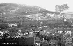
This panoramic view is very evocative of two major factors in the city's history: the rolling hills which surround it, and the rows of terraced worker's cottages, which testify to the city's once significant
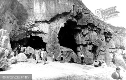
Tilly Whim Caves, on the coast west of Swanage, are a strange mixture of quarrying and erosion.
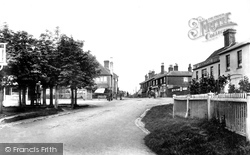
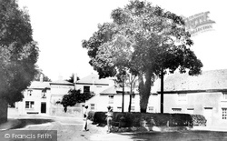
The youthful trees on the left are in the centre of the square, where the inn sign for the old-established Duke of York Hotel is just visible.
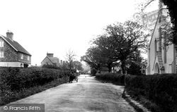
The only traffic is a horse-drawn conveyance in this view of the cross-roads village on a ridge of the High Weald above the River Rother. Today, Stonegate is close to the Bewl Bridge Reservoir.
Now a northern suburb of Worthing, Broadwater was once a small coastal settlement.
Within the lead-mining area there were smelting mills at a number of locations, including Blagill, Nenthead, Allenhead, Jeffries, Tynehead, and Bollihope.
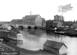
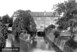
The sturdy building on the opposite bank of the river was put up in the 1850s as a flour mill; later it was used for textiles. After a period of dereliction, it was converted into apartments.
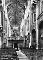
Here we have a closer view of the pulpitum screen. Little of the original 15th-century stonework survived Anthony Salvin's 'restoration' in 1833.
Maiden Newton's mill is probably situated on the site of many earlier mill buildings. There are records of settlements here dating back to the Roman occupation.
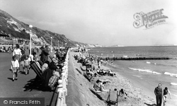
Southbourne maintains an air of tranquillity compared to the bustle of nearby Bournemouth.
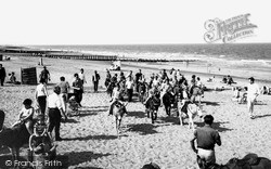
This is holiday perfection, with breakwaters, windbreaks, donkeys, buckets, spades and plenty of sand, plus the bonus of the sunshine. What more could one ask for?
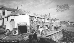
This view shows Pednolver Walk, (Lambeth Walk), its railings now firmly in place, and groups of holidaymakers enjoying the Cornish sunshine.
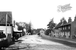
Walton is now part of the suburbs of Felixstowe, but a hundred years ago it was very much a village in its own right, with the occasional pony and trap the only concession to heavy traffic!
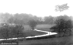
Here is a view of the River Chess winding along the floor of its flat but narrow valley, through its Chiltern landscape towards Rickmansworth near Loudwater Farm, an area much changed since this view was
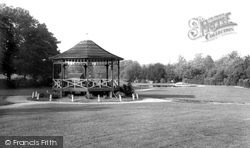
An ornamental lake and a bandstand may seem to be anachronistic in a rural community, but the park has been at the heart of many successful events and family outings for most of the 20th century.
The opposite side of the road from A19709 (above) shows the new frontage of Altham's, now very much a travel firm; the tea sales are a distant memory, although the shop still occupies
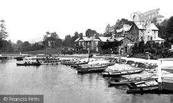
This view of Waterhead shows the Waterhead Hotel, built to serve the increasing numbers of tourists who were arriving by train at the lakeside station at Bowness, and catching a steamer up
St Peter's Hill climbs out of the village towards Caversham's striking parish church of St Peter, which occupies a pleasant setting above the Thames.
The 'Queen of Hampshire Villages', Twyford, now a very large settlement, belonged to the See of Winchester from Saxon times.
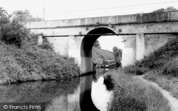
In 1846 the Shropshire Union Canal Co was formed by the amalgamation of several companies.
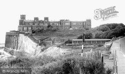
This view looks towards Kingsgate Castle—now cleaned of its ivy—some 60 years after the above photograph was taken.
Some of the shops on the right of this photograph have Georgian fronts, while others date from the Queen Anne period.
It took a number of years to carry out the process of dividing up the land, laying out roads, digging drains, planting thorn hedges, improving the land, and harvesting the crops from more and more
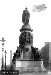
The famous statue of Daniel O'Connell (1775 - 1847), the 'Liberator', which stands at the foot of O'Connell (in those days, Sackville) Street.
Places (6814)
Photos (9106)
Memories (29058)
Books (11)
Maps (181006)


