Merry Christmas & Happy New Year!
Christmas Deliveries: If you placed an order on or before midday on Friday 19th December for Christmas delivery it was despatched before the Royal Mail or Parcel Force deadline and therefore should be received in time for Christmas. Orders placed after midday on Friday 19th December will be delivered in the New Year.
Please Note: Our offices and factory are now closed until Monday 5th January when we will be pleased to deal with any queries that have arisen during the holiday period.
During the holiday our Gift Cards may still be ordered for any last minute orders and will be sent automatically by email direct to your recipient - see here: Gift Cards
Places
36 places found.
Those places high-lighted have photos. All locations may have maps, books and memories.
- Cardiff, South Glamorgan
- Barry, South Glamorgan
- Penarth, South Glamorgan
- Rhoose, South Glamorgan
- St Athan, South Glamorgan
- Cowbridge, South Glamorgan
- South Molton, Devon
- Llantwit Major, South Glamorgan
- Chipping Sodbury, Avon
- South Chingford, Greater London
- South Shields, Tyne and Wear
- Ayr, Strathclyde
- St Donat's, South Glamorgan
- Llanblethian, South Glamorgan
- Thornbury, Avon
- Llandough, South Glamorgan
- Fonmon, South Glamorgan
- St Nicholas, South Glamorgan
- Jarrow, Tyne and Wear
- Penmark, South Glamorgan
- Font-y-gary, South Glamorgan
- Maybole, Strathclyde
- Yate, Avon
- Oxford, Oxfordshire
- Torquay, Devon
- Newquay, Cornwall
- Salisbury, Wiltshire
- Bournemouth, Dorset
- St Ives, Cornwall
- Falmouth, Cornwall
- Guildford, Surrey
- Bath, Avon
- Looe, Cornwall
- Reigate, Surrey
- Minehead, Somerset
- Bude, Cornwall
Photos
5,054 photos found. Showing results 1,401 to 1,420.
Maps
2,499 maps found.
Books
1 books found. Showing results 1,681 to 1.
Memories
1,580 memories found. Showing results 701 to 710.
The Ship Inn, Aveley, Essex, England
My grandparents, Arthur Andrew Rush & Lilian Maud Rush 9nee Sayers0 had this pub, The Ship Inn, from 1940 -1955. They had two daughters, my Mother, Lilian Beatrice Gough (nee Rush) & Gladys Barker (nee Rush). ...Read more
A memory of Aveley in 1940 by
Tantobie And Tanfield Lea
Hi, I lived in Tantobie in John Street, then we moved to Derwent Street. I went to Tanfied Lea School, I remember the snow quite well and walking to Tanfield Lea School and sliding in the school yard. I say people do not ...Read more
A memory of Tantobie in 1966 by
The Top Woods And The Tunnel Beneath The Wittingto Estate
My Dad was a sergeant in the RAF; along with Mum (Jean), brother Robert, and sister Carol we lived in married quarters in Medmenham. I remember Roddy Banks and Chris Waillin and the big ...Read more
A memory of Medmenham in 1959 by
Kelly's The Bakers
Does anyone remember Kellys The Bakers of South Moor? Any information, would be very grateful.
A memory of South Moor
Gainers Terrace
I lived in Gainers Terrace in the 60's with me ma, da, and brother Tom. I loved seeing the ships being built from my bedroom window, late at night the room would be all lit up with the light from the welders! My mother's cousin ...Read more
A memory of Wallsend in 1860
Living In Oulton
I lived in Oulton until I was 11. We then emigrated to South Australia but I have great memories of England and long to return, which I'm hoping to do in the next couple of years. We lived in St Johns St and I remember a rag and ...Read more
A memory of Oulton in 1949 by
1970 South Beach
Does any one remember the cinema on the South Beach by the Jubilee Park?
A memory of Saundersfoot by
Trehafod 1931 To 1955 And Beyond
I was born in 1930 at Rhydyfelin but moved to 37/38 Trehafod Road during 1931 and 1932 via Llwyncelyn. Both my father and grandfather worked at the colliery for a number of years. My grandfather, George Richards, ...Read more
A memory of Trehafod in 1930 by
Fond Memories Of Old Coulsdon
Remember Old Coulsdon well, moved there when I was 9 or 10 in 1963. My father worked for the CEGB in Croydon. We left Old Coulsdon in 1972 for South Africa where I still stay today. Went to Keston Primary and ...Read more
A memory of Old Coulsdon in 1964 by
Arnold Road School
I lived in Coombes Road, Dagenham and started school in 1950 at Arnold Road infants school. I have fond memories of Mrs Owen who taught history at this school. In 1952 my family moved to the prefabs in Goresbrook Road but I ...Read more
A memory of Dagenham in 1950 by
Captions
2,444 captions found. Showing results 1,681 to 1,704.
In this view, looking south just past the junction of Cavendish Road and Albion Road, the two large houses on the left remain, but flats and a close of small modern houses, Milestone Close
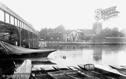
The celebrated village of Cookham, a mile or so south of Bourne End, is seen here from the boatyard on the Buckinghamshire bank, although curiously until 1992 a strip of about 30 feet along
Park Road eventually became Park Street, and is now fully developed through to its link with the modern relief roads to the south of Luton.
It is regrettable that the Pavilion is clearly visible from London Road as one arrives from the south, and it may be that a tree screen could be considered helpful.
Th A415 heads south along the 15th-century causeway above the marshy river meadows to Culham Bridge, built in 1416-22 by Abingdon's Fraternity of the Holy Cross, but now by-passed by a modern bridge.
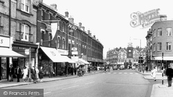
The service road alongside The Parade has now been incorporated into the busy A217, looking south towards today`s traffic lights at the junction with Reigate Road.
Given the Earl of Scarbrough's family name, Lumley Road is a straight road with the old High Street winding along south of it, diverging to the left of the trees to meet again at Lumley Square in front
This view looks south down the High Street from near High Bridge. The 11th-century tower of St Mary le Wigford church peers out amid the later commercial architecture.
To the south, across the Sleaford to Skegness Road, an alley leads to Lord Cromwell's College just beyond the road frontage buildings; it is another 15th-century brick building, known as the Old College
This 1940s view from the station, which is some way south of the town, shows just how many trees were still left then.
Here, the High Street splits into three roads: to Leicester; to South Back Way and to Stockerston. The rather crude signpost has now gone and there is no entry from this direction.
Among the church's interesting curiosities are a sundial on the south wall, a stout Norman tub font and a delicately carved 15th-century pulpit.
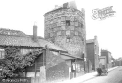
The Blackfriars, otherwise known as the South-East Tower, was used in the 19th century as a shop at street level with accommodation above—there was even a small cottage built on top.
On the south side of the palace was a huge deer park, Somersham Chase, that survived until the enclosures.
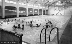
The baths were donated in 1914 by Sir William Gray, the famous local shipbuilder who had also founded the South Durham Steel and Iron Company in 1898.
On the right is a glimpse of the electricity showrooms which bound the open frontage to the Town Hall on its north side, while to the south are the gas showrooms.
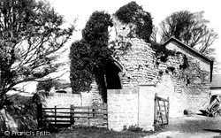
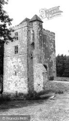
There is no known record of the history or appearance of this castle, which is situated eight miles south-west of Cardiff.
South-eat of Chesham town centre the road runs alongside the River Chess in its flat-bottomed valley.
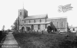
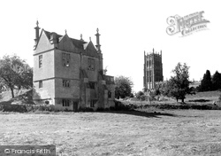
The 120-foot tower of St James' dominates this view from the south-east. The church is notable for its 15th- century frontals, which are said to be the earliest set in the country.
Hopton is a diminutive village resort on the A12 just south of Great Yarmouth.
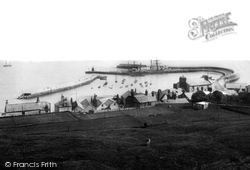
We are looking at the medieval Cobb harbour (centre) from the tennis ground on the cliffs south of Langmoor Gardens.
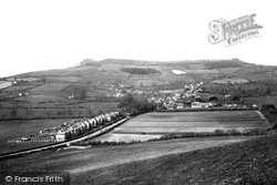
From the slopes of Quarry Hill, above Park Farm (centre), we look south-westwards to Golden Cap (left of centre) and Langdon Hill.
Half a mile south-east of Dicker we reach Michelham Priory, the buildings set within a large rectangular wet moat fed by the Cuckmere River, which forms the moat's north-west arm.
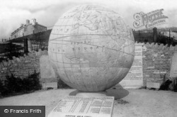
Newly-built Durlston Castle (top left) and the 40-ton Great Globe, also dating from 1887, are seen here from the south-east.
Places (15471)
Photos (5054)
Memories (1580)
Books (1)
Maps (2499)


