Places
26 places found.
Those places high-lighted have photos. All locations may have maps, books and memories.
- Cemmaes Road, Powys
- Six Road Ends, County Down
- Road Weedon, Northamptonshire
- Severn Road Bridge, Gloucestershire
- Roade, Northamptonshire
- Berkeley Road, Gloucestershire
- Harling Road, Norfolk
- Road Green, Devon
- Builth Road, Powys
- Cross Roads, Yorkshire
- Steele Road, Borders
- Cross Roads, Devon
- Four Roads, Dyfed
- Road Green, Norfolk
- Biggar Road, Strathclyde
- Clarbeston Road, Dyfed
- Five Roads, Dyfed
- Eccles Road, Norfolk
- Grampound Road, Cornwall
- Morchard Road, Devon
- Wood Road, Greater Manchester
- Four Roads, Isle of Man
- St Columb Road, Cornwall
- Clipiau, Gwynedd (near Cemmaes Road)
- New Road Side, Yorkshire (near Silsden)
- New Road Side, Yorkshire (near Cleckheaton)
Photos
14,329 photos found. Showing results 2,941 to 2,960.


Maps
476 maps found.
Books
5 books found. Showing results 3,529 to 5.
Memories
11,058 memories found. Showing results 1,471 to 1,480.
Sunday Treat
I remember travelling over to Nantymoel in an Austin 7 from the Western Valley. It was very cramped with my mother and father, younger brother and a friend of the family. This was a regular family outing to see my grandparents, ...Read more
A memory of Nant-y-moel in 1948 by
Patricroft , Liverpool Road
There was a fish shop named Tommy Cockers' I think and old Tommy used to come out and chase us with a wet, slimy fish.
A memory of Patricroft in 1953 by
Llanddona
Went to Llanddona as a baby and still going. Every year we went in the October holiday and stayed for a week. When I was 1year old a cat had attached herself to us and as we left she jumped in the car so home she came. She passed away ...Read more
A memory of Llanddona in 1963 by
During Wwii
I lived on Seal High Street (pretty well opposite the half timbered building & the horse trough in the photograph) from 1939 to 1951. My father was in the fire brigade. In those days you auditioned to become a choirboy. The Church ...Read more
A memory of Seal in 1940 by
Once My Home
I lived here for two years in 1941/42. My father rented it from Mrs Switzer who owned Bell Court. I was ten years old and together with my parents was escaping the Birmingham bombing. I used to fish from that very unstable ...Read more
A memory of Bidford-on-Avon in 1941 by
Wonderful Bucks!
My mum first came across Bucks Mills when we went for a bodyboarding holiday in Westward Ho! before the march of the mobile homes..! Next year we stayed in Driftwood in Bucks itself and did so for the next 7/8 years until my ...Read more
A memory of Buck's Mills in 1965 by
Living In North Boarhunt 1965 1968
My parents moved to North Boarhunt in 1964/65. We lived at the top of Trampers Lane - sideways to what was then Doney's Garage. Our house was called "Tryfan". I went to Newton Primary School and have very ...Read more
A memory of North Boarhunt in 1965 by
Wonderful Memories
What an unexpected pleasure it was stumbling quite by accident upon this website this evening! I was born in Croydon in 1948 and lived in West Croydon till 1955. I have very vivid memories of the high street, even of being ...Read more
A memory of Croydon in 1954 by
The Slate Islands Easdale
THE SLATE ISLANDS By Walter Deas Some 24k (15 miles) south and west of Oban lies an area with interesting old ...Read more
A memory of Easdale in 2005 by
When It Was An Aerodrome !
Ok, so it may have been a little later than 1955, but we used to live in Southbourne Grove, and used to thrash our bicycles across the fields (over the arterial road) and make our way to the back of the airport ...Read more
A memory of Southend Airport in 1955 by
Your search returned a large number of results. Please try to refine your search further.
Captions
5,036 captions found. Showing results 3,529 to 3,552.

There was no bus station in the town, so buses parked in designated ranks painted on the road surface.

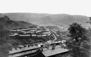
Looking southwards, this photograph gives an indication of the many businesses along this aptly named road.

The pub sign is for the Ship, always, it seems, a locals' watering hole as opposed to the other inns and cafes that have catered for travellers on the London to Portsmouth road.

Around Cricket Green and along Church Road are some good late 18th- and early 19th-century houses.

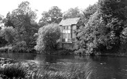
This view is from the Buckinghamshire bank, looking north from the A4 Bath Road immediately east of the bridge.

The expense of maintaining roads was met by payment of tolls. Across is the Saracen's Head Inn with its unusual massive stone sign.

Coningsby, on the south bank, has lost much of its historic character: in this view of Silver Street the house in front of the mill survives, but not the mill; all to the left has gone, and the road at

Note that on the left-hand side of the road the old trees are now obliged to sink their roots in tarmac.

Set off the main road, this square accommodates considerably more parked cars today.

There is a story that when Charles Dickens lived at nearby Gadshill, he had a tunnel constructed that led under the main road and came up in his garden on the other side in the parish of Shorne; here he

The parade of shops which lined this section of Upper Mulgrave Road on the approach to the entrance to Cheam Station, which is behind the trees on the left, includes on the extreme right a branch of the

This view is at the less interesting east end of Main Road, away from the parish church, the moat, the Georgian rectory and Shakespeare Farmhouse, where the bard is reputed to have stayed.

Oving, west of Whitchurch, lies off the main road, and is a very pretty village on the Portland limestone ridge.

At the heart of the old village to the west of the Doncaster Road is the parish church with its fine Anglo-Saxon west tower.

In Church Road there are some older houses and the parish church; the south churchyard boundary runs along Church Lane to the left.

Beyond the Esso petrol logo of Stevenson`s Garage are road signs, pointing into Barrack Street, for Beaminster and Crewkerne.

Until the mid 19th century this vista was closed by a town hall in the middle of the road. Apart from this loss, little has changed.

Built at the end of Washbank Road, Eynesbury, on the site of one of the earliest St Neots` crossings of the Ouse, Conygear takes its name from the nearby rabbit warren owned by Margaret, Countess of

The parked lorry belongs to Jones & Co, Corn and Seed Merchant; perhaps it is more than mere coincidence that a transport café is just across the road.

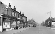
In 1949 the shops along Hagley Road were all taken. Booksellers and stationers T W Atkinson even operated a library from which books could be loaned at 2d a time.

Here we see the 13th-century Buddle Bridge (centre) and the buildings of Bridge Street which crossed it until demolitions for road widening in 1913.

This 7-foot-tall inscribed stone is shown here on the B3269 road - it was moved here from Castle Dore, but has since been moved nearer the town. It is reputed to be of the 6th century.

The Working Men`s Club, opened in 1902, is on the other side of the road.

The main road turns past the imposing church, whose churchyard is entered by two 17th-century gateways.
Places (26)
Photos (14329)
Memories (11058)
Books (5)
Maps (476)

