Places
Sorry, no places were found that related to your search.
Photos
Sorry, no photos were found that related to your search.
Maps
Sorry, no maps were found that related to your search.
Books
Sorry, no books were found that related to your search.
Memories
3,644 memories found. Showing results 371 to 380.
Cranbrook Fisheries
My dad used to run the fish shop in Cranbrook Road (Cranbrook Fisheries), it was opposite Gaysham Avenue, with Warwick Doubles on the corner. I went to school at Gearies Junior School and grew up in and around Barkingside and ...Read more
A memory of Barkingside
Ordiquish Parish Of Bellie
My grandparents, Robert (Bob) and Margaret (Maggie) Urquhart, moved from the Braes of Enzie, parish of Rathven, to Ordiquish, parish of Bellie, probably in 1941. However, their tenanted croft at Ordiquish was soon to be ...Read more
A memory of Fochabers by
Gas Works Also Public Baths In Adderley Road Saltley
I lived in Ash Road Saltley, you could see the Gas Works from our back garden. My dad worked there for years, he used to stand on some steps and wave to me. I also remember the public baths in ...Read more
A memory of Saltley in 1957 by
Morris Dancing In The Streets At The Winchester May Fest
On Friday 15th & Saturday 16th May 2009, Winchester celebrated traditional and contemporary music, dance and song in venues all around the city. Many events featured Morris Dancing and ...Read more
A memory of Winchester in 2009 by
Growing Up In Fordingbridge
I grew up in Fordingbridge between 1949 when I was born and 1967 when I left for University. I have so many memories that I couldn't possibly put them all down here, so I am just selecting a few good or striking ...Read more
A memory of Fordingbridge in 1960
Crichel House During The War Years
Dumpton House (Preparatory) School was evacuated to Crichel during the Second World War from Broadstairs in Kent. My older brother (Paul Cremer) was already at the school and due to the war my parents sent me ...Read more
A memory of Crichel Ho in 1940 by
Snodland School
I was at Holmesdale School from 1952 to 56, then returned in 1960 as head grounds man, when it had a farm run by Mr Baker, nice man. I remember Mr dodd and lots of the old teachers. I married a local girl and still live in Snodland. ...Read more
A memory of Snodland in 1952 by
My Mothers Memories Of Brambridge
My mother's aunt, my great-aunt Annie was the house keeper at Brambridge during the 1920s. My great-uncle Ernest, great-aunt Annie's brother, was the chauffeur and responsible for the running and maintenance ...Read more
A memory of Colden Common in 1920 by
The Original Grove Hotel In Stapenhill
When I was about 4 years old in 1948 my Auntie Jess and Uncle Albert (Haynes) ran the Grove Hotel at Stapenhill. It was the original one, not the one which is there now. It was a really lovely old building ...Read more
A memory of Stapenhill in 1948 by
Childhood
Funny how seeing Memories of Kingstanding title, it brought back so many thoughts of living there in childhood to my 20s. The Geman plane that dropped its bomb on a house in Hurlingham Road, hiding under stairs at school as the planes ...Read more
A memory of Kingstanding by
Captions
1,151 captions found. Showing results 889 to 912.
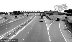
That much-maligned but vital facility of the motorway network, the service station, was an early landmark.
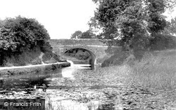
The Grand Western Canal was a 19th-century dream, planned to run from Taunton to the river Exe near Exeter.
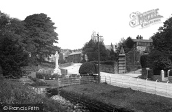
The war memorial is centrally placed in the village alongside the winding street by the stream. The roots of tradition run deep here, and some old customs were observed until the 19th century.
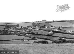
This is another view of Lower Eype from further to the south-west, closer to the cliff above Lyme Bay, looking inland to Mount Lane and St Peter's Church (centre).
This is another view of Lower Eype from further to the south-west, closer to the cliff above Lyme Bay, looking inland to Mount Lane and St Peter`s Church (centre).
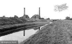
At the end of Soss Lane, beyond the railway line, are two former pump houses with tall chimneys; their steam-powered beam engines are situated on the Mother Drain which runs parallel to the River Idle
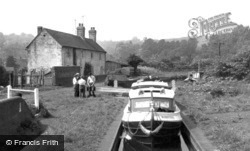
Though it passes through an industrial landscape, this canal has many quiet rural stretches where the narrow boats chug along under a dense canopy of green.
Barnoldswick is pronounced 'Barlick' by the locals.This is another village that has moved with boundary changes.
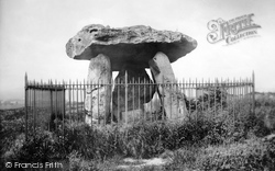
Kits Coty House, a prehistoric burial monument, is sited on a crest of the North Downs a mile or two to the north of Aylesford village.
Born in Cambridge in 1882, Sir John Berry 'Jack' Hobbs was undoubtedly the world's greatest cricket batsman of his time.
Gallowtree Gate runs out of Granby Street and London Road as it drops down to the Clock Tower.
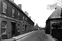
This view typifies the unforgettable appeal of Kersey: brick, timber and plastered houses are raised to allow for the slope, with higher and higher steps to the front doors, and there is
West of Sutton Courtenay the route reaches Drayton. The older houses are mostly along the High Street, Church Lane and Abingdon Road.
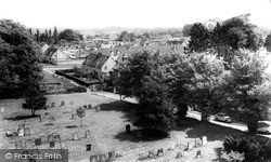
The last view in Marcham was taken from the parish church tower looking south-east towards Parkside, a large estate of 1950s former council houses.
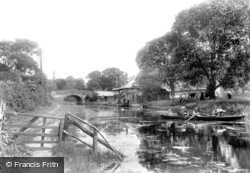
This canal was constructed in 1796; it runs for nearly forty miles through northern Hampshire.
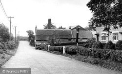
On the left we can see a line of old-fashioned telegraph poles. Not all post offices in the Fylde had a telegraph office early in the 20th century, nor could they deal with postal orders.
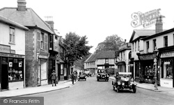
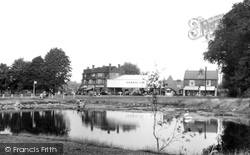
This view, showing the centre of Ewell village, was taken looking north towards the Horse Pond and Spring Corner, and includes several splendid examples of the motor vehicles of the period.
Epsom is famous for two things: Epsom Salts, and the two great classic flat races run on the Downs south of the town, the Derby and the Oaks, both inaugurated in the late 18th century.
This is a quiet moment, on what in pre-bypass days was one of the busiest roads in Dorset, apart from the postman calling at No 12 (right).
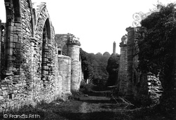
Following Godric's death, Finchale passed into the hands of the priors of Durham Cathedral. A Benedictine priory was built here around 1196 by Henry Pudsey, son of Hugh, Bishop of Durham.
From Newstead Abbey the route heads four miles south to Hucknall, which also has Byronic associations: in this church Byron was buried in the family vault after his body had been brought home from Greece
Here we see a peaceful open carriage ride on a hot Edwardian summer's day; the lady, protected by an umbrella, passes the 1850s east lodge to Offington House.
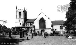
Close to the road, the solid but impressive ashlar tower dominates the immediate street scene with its substantial angled buttresses and crocketted finials; these are not 15th-century, but were added
Moving north-west from Albert Park to the Faringdon Road, the town tour finishes at the School of St Helen and St Katherine, as it is now named.
Places (0)
Photos (0)
Memories (3644)
Books (0)
Maps (0)


