Places
26 places found.
Those places high-lighted have photos. All locations may have maps, books and memories.
- Cemmaes Road, Powys
- Six Road Ends, County Down
- Road Weedon, Northamptonshire
- Severn Road Bridge, Gloucestershire
- Roade, Northamptonshire
- Berkeley Road, Gloucestershire
- Harling Road, Norfolk
- Road Green, Devon
- Builth Road, Powys
- Cross Roads, Yorkshire
- Steele Road, Borders
- Cross Roads, Devon
- Four Roads, Dyfed
- Road Green, Norfolk
- Biggar Road, Strathclyde
- Clarbeston Road, Dyfed
- Five Roads, Dyfed
- Eccles Road, Norfolk
- Grampound Road, Cornwall
- Morchard Road, Devon
- Wood Road, Greater Manchester
- Four Roads, Isle of Man
- St Columb Road, Cornwall
- Clipiau, Gwynedd (near Cemmaes Road)
- New Road Side, Yorkshire (near Silsden)
- New Road Side, Yorkshire (near Cleckheaton)
Photos
14,329 photos found. Showing results 1 to 20.


Maps
476 maps found.


Books
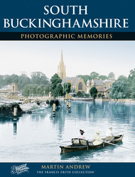
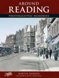
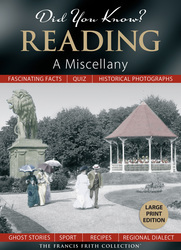
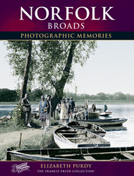
5 books found. Showing results 1 to 5.
Memories
11,058 memories found. Showing results 1 to 10.
Grandmother
Born Glasgow 1952, visited my granny at 249a Edgware Road on many occasions, she lived above Barclays bank.
A memory of Colindale by
Indigo
Hi, Anyone remember a shop called Indigo in Dartford? I used to go to Dartford on the train, with my mum, once in a while, and I remember a shop called indigo, I can’t remember what it sold (I’m guessing jeans) It’s a memory that’s stuck in ...Read more
A memory of Dartford
Timber
I lived in Malvern Road and remember the winter of '47 when we had six weeks of snow and wonderful tobogganing on the slopes. My dad was the manager of Park&Brown Jeffery Street and a skilled wood man who was able to build me an ...Read more
A memory of Gillingham by
My Early Days
My family was one of those temporarily housed in one of the old Nisan huts used by those stationed there during WW2. My mother was Doreen and my adoptive father Ivan Nobbs. In October 1953, we were joined by my brother, Stephen. I still ...Read more
A memory of Hethel by
Harrow Driving School Rayners Lane 1985 1986 Approx
Memories of getting the tube from Arnos Grove to Rayners Lane and then the long walk up Imperial Drive - until reaching the driving centre. The set up included traffic lights, zebra crossings, ...Read more
A memory of Harrow by
1944 Vi Flying Bomb
This isn't really a memory because I was too young at the time. I was born in a timber bungalow called "Midway" on Lowford Hill, Bursledon in April 1942. Dad was working at the Follands aircraft factory at that time, building ...Read more
A memory of Bursledon by
Bryn Road Tondu
Members of my Thomas family built a number of houses in Bryn Road and sometime lived at Nos. 64, 66, 70 and 84. I have a photo of early family members that I would like to identify if anybody knows of these, Edith, Elizabeth Blodwen, ...Read more
A memory of Tondu by
British Legion Miners Welfare Club
I have many fond memories of the Legion in Grendon Road Polesworth. It was demolished sometime in the 1980s, does anyone have any pictures of it or its members and committee, Many thanks, Neville
A memory of Polesworth in 1970 by
1834 Yeoman John Greenfield Or Grinfield's Family Lived In Horne
This building is still there in Church Road, not far from where John Greenfield lived in the nineteenth century with his wife Mary and daughter Sarah and sons James & John. John ...Read more
A memory of Horne by
High Street Wilburton
This is the other side of the road from the Post Office, with a very old car parked in front of Hazel's shop, which sold all sorts of things including penny chews and sweets. You can see the old tree, and the bus stop and the ...Read more
A memory of Wilburton by
Your search returned a large number of results. Please try to refine your search further.
View More MemoriesCaptions
5,036 captions found. Showing results 1 to 24.

It stands where two essentially residential roads cross: Prince's Road and King's Road.

Burgh Heath is very suburban, and its east side is blighted by the roaring traffic of the dual carriageway A217 Reigate road, which merges with the A23 Brighton road at Horley, south of Redhill

A longish walk east along King's Road leads to its junction with London Road and Wokingham Road.

The railway line to Huncoat and Burnley crosses the road here. There was at one time another line down to Rawtenstall, joining what is now the East Lancashire Preserved Railway.

The houses on the right are Nos 18 and 20 Downs Road, formerly called Fanfare Road when built on the northern slopes of Farthing Down.

Travelling towards Church Hill we come to Brackendale Road; this is a pretty road, with many pine trees. Before the opening of the M3, it used to run right through to the Portsmouth Road.

Travelling towards Church Hill we come to Brackendale Road; this is a pretty road, with many pine trees. Before the opening of the M3, it used to run right through to the Portsmouth Road.

The Heads of the Valleys Road had not been built when this picture was taken, as it shows the A465 old Merthyr road leading into King Street, Brynmawr.

This is one of the oldest parts of Shirley, where Stratford Road meets Olton Road and Haslucks Green Road.
This is one of the oldest parts of Shirley, where Stratford Road meets Olton Road and Haslucks Green Road.

Behind the buildings of Hambury Farm (foreground) are Church Road and Bindon Road (centre) with Main Road snaking through the picture.

Once one of several turnpike roads around the town, today Hagley Road is the main road leading out of Stourbridge to the south; it also links up with a number of other major road systems

The road traverses a ridge, as we can see in this photograph.

The school was in Hill Road, between Pound Road and West Hill Road, with a view across the town, including St Michael's Church (centre right), to Golden Cap (centre) on the eastern seaboard of Lyme

Situated on the junction of Telegraph Road, Brimstage Road, Barnston Road and Chester Road, one of the busiest in West Wirral, this atmospheric pub has changed little in appearance since

Manor Park Road runs along the east side of Manor Park. This view is taken a little way north of its junction with Carshalton Road.

A Manchester Corporation tramcar stands at the Altrincham terminus in Railway Street, its route back to Manchester being by way of Stamford New Road, Sandiway Road, Manchester Road, Washway Road, Cross

Looking South This photograph shows the wide carriageway of Cricklade Road leading to Stratton Crossroads, with the junction of Beechcroft Road to the left and Whitworth Road to the right.

The brick buildings at the far end, their six windows facing the camera, were demolished in the 1970s for the widening of Sutton Court Road.

The road to the right is Hatton Hill Road, and leads to the London Road.

This road runs between Coggeshall Road and Bradford Street; it replaced the old road, which ran 30 or 40 metres back from the left-hand side of this picture, when Sydney Courtauld built Bocking Place
This road runs between Coggeshall Road and Bradford Street; it replaced the old road, which ran 30 or 40 metres back from the left-hand side of this picture, when Sydney Courtauld built Bocking Place

We are looking from the Frimley Road up a busy Osnaburgh Parade, with Barclays Bank on the corner. The road rises quite steeply towards Camberley, and there is a lack of road markings.

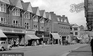
A busy parade of shops with distinctive gables line the road at this point. Several prams can be seen outside, and a child rides happily on the pavement on a tricycle.
Places (26)
Photos (14329)
Memories (11058)
Books (5)
Maps (476)

