Places
5 places found.
Those places high-lighted have photos. All locations may have maps, books and memories.
Photos
9,649 photos found. Showing results 2,241 to 2,260.


Maps
18 maps found.
Books
13 books found. Showing results 2,689 to 13.
Memories
4,612 memories found. Showing results 1,121 to 1,130.
Looking For My Great Grandmother
I doubt very much if I will get a reply or if anyone can help. I am researching my family tree, I am looking to what happened to my great grand mother Alice Waring (nee Reed). Alice married Walter ...Read more
A memory of Southwood in 1880 by
Phythian Cres 1970
I was brought up in Phythian Crescent - with our own playing field. Many comments were made - is it a council property? I asked my parents - no it isn't. I believe the house behind ours was a farm - Phythian Farm, at the end is ...Read more
A memory of Penketh in 1970 by
Swiming Outdoors And Wardown Park
I have fond memories of Luton, I came with my mates from Markyate village on the 364 London transport bus to Park Sq. we would then board a red corporation bus for the swimming pool off the New Bedford road at ...Read more
A memory of Luton in 1952 by
Born And Bred Stanwellian
I was born at my Grandparents House in Long Lane Stanwell in 1966, my Grandad Jack/John Thornton helped deliver me. My Grandad was well known in the Community and Catholic Congregation of both St Michaels in Ashford and ...Read more
A memory of Stanwell in 1966 by
Walter Self And Mary Maria Draper
I have been to this village but did not know this was the house my gt grandparents and grandparents lived it, my gt grandparents were Walter Selfe and Mary Maria Draper they married in Garbolidsham in 1877. I hope to be able to return again soon. kind regards, Lesley
A memory of Garboldisham by
Glebe Avenue Parade Of Shops
..or 1959 to 1964 The other grocers on that parade may have been the DeHond family, I think that they originated in Belgium? A very pleasant, kindly, hardworking family. I used to help out by driving their ...Read more
A memory of Ickenham in 1959 by
Lemington Upon Tyne, Scouting
Scouting Life during the Forties I was born in January 1936 in a large village, Lemington in Northumberland, England. Lemington bordered on the limit of the city of Newcastle upon Tyne. It was a working class ...Read more
A memory of Lemington in 1944 by
My Very Cold Mornings
Hi its Doug again I was born in vicarshall lane like I said in my fist memory we never had central heating in winter I remember when it was cold or snowing when I woke in a morning I had to melt jack frost of the ...Read more
A memory of Caister-on-Sea in 1954 by
Walking Up Lane To See Gran And Grandad Foot
I walked Trampers Lane so many times as a child to see my Grandparents George and Jane Foot who lived in Oak View Cottage, also my dear Great Aunts, the Misses Mabel, Hilda and Hazel Foot, who ...Read more
A memory of North Boarhunt by
Corner Cottage. 1950 To Now
My parents moved to Blebo from Dura Den in 1950 when I was six. A windmill for electricity with 12 volt light bulbs. Paraffin lamps and a cesspool. It was several years before the pumping station at Clatto was built ...Read more
A memory of Blebocraigs in 1950 by
Captions
5,016 captions found. Showing results 2,689 to 2,712.

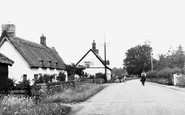
The ancient name for the village is Barelegh (meaning 'wasteland'), but lush meadows now support flocks of sheep.

Some things never change: in a rather dull street of 19th- and early 20th-century buildings, on a Midland Red bus route, the Council is digging up the pavement!

The main entrance to the pub is at the other side, but there is a gate giving access from the churchyard.

OF ALL the villages in this collection, Nether Alderley perhaps gives us the best impression of what a north-eastern Cheshire village was like before the Industrial Revolution changed both the

Nestling in the shelter of Lythe Bank, the ancient village holds the homes of many of the men who worked in the alum industry and on local estates.

The name Accrington means 'community where the acorns grow'.

This lovely village extends from Highwood Hill to the north to Mill Hill East underground station in the south.

The fine Perpendicular windows have exceptionally beautiful tracery and were added in about 1450, but their glass was shattered by a flying bomb which landed in the churchyard in 1944.

This wonderfully atmospheric pub, now an Everards house, is photographed before the universal advent of lager and 'Kids Welcome'.

Belford is just one of many places in Northumberland that suffered during the cross-border raids that were a feature of life in the North for several centuries.

By the 1920s, many smiths had ceased to tend horses, but tended cars instead – they had made the transition from farrier to motor mechanic.

Not far from Stroud, the village of Chalford clings to the steep wooded hillside of the Golden Valley.

The mansion and the church sit amid a park of over 200 acres, in an estate of more than 10,000 acres.

The village has been given a sweeping bypass, Broughton Way, on its north side, reducing the volume of traffic negotiating Main Street and the area around St Mary's Church and Old Mill

The A50 bypass now divides the village from its castle, of which only the motte survives; the remainder was demolished in the later 12th century.

Re-crossing the Trent at Gunthorpe, the route turns back towards Nottingham along the busy A612 to Burton Joyce, where the river sweeps close to the road.

Here we have the old centre of the village, now by-passed by the main road. The Roman Catholic church of St Mary of the Angels with its free-standing spire dominates the centre of our photograph.

West of Dorking up on the chalk and just inboard of the North Downs escarpment, and west of the valley cut by the River Mole, is Ranmore Common.

Piddletown was the official name of the village until Major-General Charles William Thompson succeeded in having it changed after the Great War.

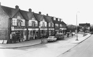
The white-painted single-storey building in the middle of the row of shops originally had a thatched roof and was Irby's only shop, doubling also as the village post office.

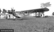
The 450-acre Finningley Park Estate was sold in 1935, and within a year a new RAF airstrip was built on its flat land.

The placename is derived from Haecc or gate. The village is on the north-west edge of Pinner Park, itself a 14th-century deer park owned by the Archbishop of Canterbury.

East of Camberley, the route moves on to the villages between Bagshot and Guildford along the A322 on the east side of the sandy heathland of the Bagshot Sands; on the map we see army firing

Monton had been a separate village until the incorporation of Eccles, when it was taken under the new council's wing. Monton Green is also the name of the road in our photograph.
Places (5)
Photos (9649)
Memories (4612)
Books (13)
Maps (18)

