Places
36 places found.
Those places high-lighted have photos. All locations may have maps, books and memories.
- Bangor, County Down
- Newcastle, County Down
- Greyabbey, County Down
- Donaghadee, County Down
- Downpatrick, County Down
- Portaferry, County Down
- Dromore, County Down
- Hillsborough, County Down
- Downings, Republic of Ireland
- Killyleagh, County Down
- Ardglass, County Down
- Rostrevor, County Down
- Dundrum, County Down
- Newtownards, County Down
- Warrenpoint, County Down
- Ballygowan, County Down
- Ballywalter, County Down
- Ballyward, County Down
- Bishops Court, County Down
- Boardmills, County Down
- Culcavy, County Down
- Katesbridge, County Down
- Killough, County Down
- Millisle, County Down
- Portavogie, County Down
- Saul, County Down
- Seaforde, County Down
- The Diamond, County Down
- Audleystown, County Down
- Kearney, County Down
- Annaclone, County Down
- Ballyhalbert, County Down
- Ballymartin, County Down
- Clare, County Down
- Conlig, County Down
- Dollingstown, County Down
Photos
945 photos found. Showing results 1,181 to 945.
Maps
459 maps found.
Books
49 books found. Showing results 1,417 to 1,440.
Memories
8,163 memories found. Showing results 591 to 600.
Chelmsford, Infirmary, 1895.
This may well have been called the Infirmary, so its use didn't change a great deal for many people lots of decades later. It then became the London Road Hospital, and the A. & E. section were accessed down the ...Read more
A memory of Chelmsford by
Chelmsford, Shops In The High Streeet, 1919.
This view is taken from outside the island where the current Lloyds Bank stands, and shows the view down the High Street. In the background can be seen the spire, which was the Wesleyan Church, and ...Read more
A memory of Chelmsford by
Memories Of Raf Lichfield
My father was an officer in the RAF and was based in RAF Lichfield from 1954 - 1956. My brother and I went by bus to St. Christopher's School in Alrewas. The school building was on the side of the canal and from one ...Read more
A memory of Lichfield by
Tree In Brinkworth Church Graveyard
I cannot remember what year it was. I climbed the tree that was in the graveyard while watching my mum who was in the school playground supervising the children in the playground at dinnertime. The only ...Read more
A memory of Brinkworth by
The Day We Topped Out £12m New Leisure Centre In Wednesfield!
£12m Wednesfield Leisure Pool. It has been a very big week for both myself and Mary, we have attended 11 individual events as well as trying to hold the day jobs down! On Monday ...Read more
A memory of Wednesfield by
Pilmuir
My father was gardener at Pilmuir in about 1939- 40 and we lived in the lodge house.A wire-haired fox terrier dog seemed to go with the house. I remember seeing a German airplane being shot down almost over our house and I collected ...Read more
A memory of Haddington in 1940 by
Lovely Friendship At Raf Compton Bassett
When I was posted to Compton Bassett in 1951 I was feeling rather low, and remained so until I formed a friendship (just friendship) with a lovely girl, a member of the WRAF known as 'Woodie' My ...Read more
A memory of Compton Bassett in 1951 by
Growing Up
my memory of living in "God's Village" is of days roaming round the grange, going down the fields to the beck, getting to the top of the "Red Ash Pit Heap", coming back round the coke works and spending loads of time messing around the TMS garage, most week nights and all day Saturday and Sunday.
A memory of Trimdon Grange in 1959 by
The Railway Inn
My Gran - Katherine Thomas - ran the Railway Inn (the Tap) for many years. My grandfather Thomas died shortly after I was born. My mother Hilda Jeffery (nee Thomas), my father William Jeffery and myself lived there. My mum died ...Read more
A memory of Llansamlet by
Trolley Bus Routes 630 And 612
These routes passed along the road which comes down to the right hand corner to Croydon following that road or to Hammersmith etc. passing round the Majestic to London.
A memory of Mitcham in 1940 by
Captions
2,258 captions found. Showing results 1,417 to 1,440.
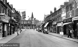
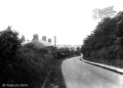
Despite additional building and road widening, this scene is still easily recognisable, although a walk down the centre of the road (as the two men are doing) is not advisable.
Owing its rapid development to the Industrial Revolution, the town's streets and buildings tended to be functional rather than attractive.
This view was taken from underneath the railway bridge looking down towards the Wharfe and the next village, Middleton.
As we walk down Northgate Street from the cross, and turn right by Debenhams, we will enter the relatively new area of Kings Square.
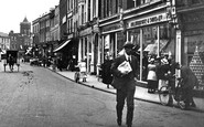
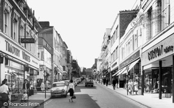
A little further down the street, a boy carries a billboard advertising 'Hilton's Boot Sale'. Note the building in the centre by the attractive street lamp - we will see it again.
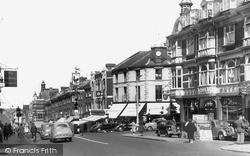
Most shops still have awnings, ready to pull down if the sun gets strong. Leons Café, in the distance on the right, offers luncheons and teas.
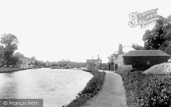
Along this stretch of the river, the tan-sailed barges carrying cargoes of paper and timber, and the 'stumpies', or narrow boats, used to convey bricks from the kilns down river, were once a familiar
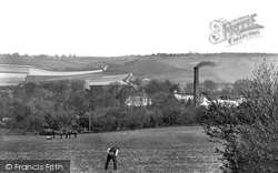
A splendid panoramic view, taken early in the year, of the Stour Valley looking across to the Julliberrie Downs, with the 14th-century tower of Chartham church rising above the trees.
The bypass on the south side of town was opened in 1926; it was much needed to relieve the narrow streets of both local china clay and through traffic.
Weeke Primary School is down this road - today it has about 280 pupils.
Now all of that has changed, and so has Bridge Street, for it has virtually all been knocked down for redevelopment. On the left is now either cleared or a car park, and the road is much wider.
This photograph is taken further down Market Street.
We are looking down from the Triangle, and we can see the Freeman, Hardy & Willis shoe shop on the left, AJ Perham's Hair Cutting Rooms on the right, and the South Western Gas Board at the end of the street
The descent from Barkway, the second highest point in Hertfordshire, down to Royston, one of the lowest places in the county, was a nightmare for horse-drawn traffic and cyclists.
The occasional soldier can still be seen marching down the street.
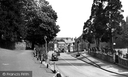
This view is taken further down West Street, with the churchyard on the left and the boundary walls of the Victorian Baptist Church on the right.
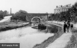
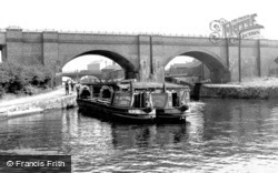
Here we see a barge loaded down with hay, with the two horses taking a break as the photographer creates his picture.
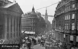
Mappin and Webb's corner premises, together with the section of Queen Victoria Street down to Cannon Street, were completed in 1869.
The terrace of shops stepping down the High Street, beyond the busy junction with Carshalton Road and William Pile Ltd (the stuccoed corner building), was erected in 1880.
The town originally grew up around the burial place of the Celtic Saint Tydfil.
There were ten locks at the end of the Bridgewater Canal linking it with the docks below; figures for 1883 show that in that year alone 60,300 craft passed up and down.
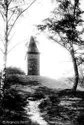
Unfortunately, the Beacon fell down during as storm in the 1930s, and was replaced by a simple memorial plaque.
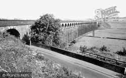
This 29-arch viaduct carries the Sheffield to Huddersfield railway over the River Don. It was built in 1849 a short distance from Penistone station.
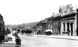
Here the photographer looks down West Street to Colmer's Hill (left), with the Lily Hotel projecting into the highway as it narrows to a normal width near the bottom of the hill.
Places (198)
Photos (945)
Memories (8163)
Books (49)
Maps (459)

