Places
36 places found.
Those places high-lighted have photos. All locations may have maps, books and memories.
- Cardiff, South Glamorgan
- Barry, South Glamorgan
- Penarth, South Glamorgan
- Rhoose, South Glamorgan
- St Athan, South Glamorgan
- Cowbridge, South Glamorgan
- South Molton, Devon
- Llantwit Major, South Glamorgan
- Chipping Sodbury, Avon
- South Chingford, Greater London
- South Shields, Tyne and Wear
- Ayr, Strathclyde
- St Donat's, South Glamorgan
- Llanblethian, South Glamorgan
- Thornbury, Avon
- Llandough, South Glamorgan
- Fonmon, South Glamorgan
- St Nicholas, South Glamorgan
- Jarrow, Tyne and Wear
- Penmark, South Glamorgan
- Font-y-gary, South Glamorgan
- Maybole, Strathclyde
- Yate, Avon
- Oxford, Oxfordshire
- Torquay, Devon
- Newquay, Cornwall
- Salisbury, Wiltshire
- Bournemouth, Dorset
- St Ives, Cornwall
- Falmouth, Cornwall
- Guildford, Surrey
- Bath, Avon
- Looe, Cornwall
- Reigate, Surrey
- Minehead, Somerset
- Bude, Cornwall
Photos
5,607 photos found. Showing results 141 to 160.
Maps
2,499 maps found.
Books
23 books found. Showing results 169 to 23.
Memories
1,580 memories found. Showing results 71 to 80.
The Horse And Cart
I had the perfect Job for me when I was 10. John (Jacky) Robinson had me working for him on the horse and cart. Fridays and Saturdays you could hear us walking the streets of Easington - our famous yell was "ANY ...Read more
A memory of Easington Colliery in 1969 by
My Memories Of New Road, Chatham
I was 4 years old when my parents moved to 17 New Road, Chatham. It was 1937 - my father had a Radio and Electrical Business (Wholesale) he had been a traveller previously and wanted to have a more settled existance ...Read more
A memory of Chatham in 1940 by
Life Until 40.
My family returned to South Ockendon in 1964, although both sets of grandparents were in South Road and Broxburn Drive. First lived in Clayburn Gardens, then in 1969 we moved to 34 Cruick Avenue. Small cul-de-sac, originally ...Read more
A memory of South Ockendon by
My Memories Of Farncombe
I was born at 44 The Oval in June 1941 and later moved to 85 Pondfield Road. Our neighbour's name was Hill, Mr Hill's name I think, was Fred. If my 72 year old memory is okay their son was Tony and daughter was Sylvia. I ...Read more
A memory of Farncombe in 1944 by
Brantwood Oval
I was born 1966 and grew up on an estate (cant remember the name) and lived in Brantwood Oval, just off Haworth Road. My dad's family all lived close by. I remember picking bluebells and searching for frog spawn and getting fish ...Read more
A memory of Bradford by
Great, Great Grandfather
My great great grandfather came from Hayes Rd, Callington. He was a stone mason. His name was Thomas James. I know my great grandfather came to Merthyr Tydfil for work in the coal mines. I'd like to know if I've any ...Read more
A memory of Callington by
Swimming Lagoon
south side gt west rd..aerial photo 1937 by east side Sutton lane lower..beside ace spades petrol garage...looks like hotel complex.1937 2 marquees tents..long oblong pool..bathers .people on bikes pull up to watch...opposite master ...Read more
A memory of Heston by
Born In Lincoln,1957
I was born in Lincoln May 26, 1957 to American parents. My father was in the United States Air Force and we lived at 65 South Park. I was born just a few doors down at the Eastholme Maternity Home. My family returned to ...Read more
A memory of Lincoln in 1957 by
Morgan Family
Hi this is a stab in the dark but maybe someone will know of something. My Nanna was a small girl during the war. She was born Annie Elizabeth Gordon in 1935 in Gateshead. Her and her older brother Luke Skelly Gordon B 1932 ...Read more
A memory of Tir-y-berth in 1940 by
Childhood Treasured Places
Visiting Box Hill brings back many happy family memories. I come from Manchester & we used to visit my aunt & uncle who moved from Kingston to Leatherhead. I loved swimming & this has always been one of my ...Read more
A memory of Box Hill in 1967 by
Captions
2,476 captions found. Showing results 169 to 192.
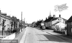
The last view in the book looks south-east along the High Street past the long terrace of 1850s cottages on the left. Market Square is in the far distance.
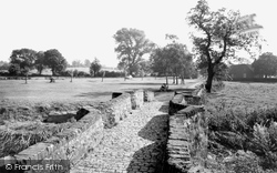
On the south-east side of the village the five-arch stone bridge, perhaps of the 16th century, steps quietly across the very reedy Rotherby Brook.
Hinckley and the South-West
Great Easton lies in the south-east corner of the county, to the south of Eye Brook Reservoir, and to the north of industrial Corby, on the very edge of the Welland Valley.
A mile or so south of Quorn, the camera looks north towards the weir, with Hawcliff Hill and Buddon Wood to the left.
Burgh Heath is very suburban, and its east side is blighted by the roaring traffic of the dual carriageway A217 Reigate road, which merges with the A23 Brighton road at Horley, south of Redhill
During 2005 Lincolnshire Development, part of Lincolnshire County Council, prepared a bid for European funding under Objective 2 for the Boston Southern Enterprise Zone in the Marsh Lane area south
Immediately south of the church whose spire can be seen behind, is The Bury.
The military presence in the town and the museum of the South Wales Borderers - even the 13th-century cathedral was semi-fortified, which is most unusual - has perhaps helped maintain a sense of order.
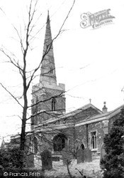
This wintry shot of the 13th-century ironstone church looks from the south east at the dominant 15th-century tower and its recessed crocketed spire.
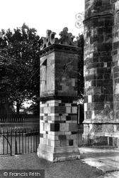
The sundial was removed from its original mounting on the gable of the south transept in 1891 and re-erected near the west tower three years later.
The village sits astride an ancient, pre-Roman trackway which ran from Burrough Camp, some six miles south of Melton Mowbray, into Nottinghamshire, with to its south the escarpment of the Wolds
It looks north over the wide, flat, formerly marshy valley of the River Arun and the Amberley Wild Brooks, and west to the narrowing valley as the river cuts through the South Downs.
The village sits astride an ancient, pre-Roman trackway which ran from Burrough Camp, some six miles south of Melton Mowbray, into Nottinghamshire, with to its south the escarpment of the Wolds
The next sequence of views shows the Victorian and later development of Sutton to the south of the railway line.
Previously a journey from London to Portsmouth entailed one of two options: to go to Croydon and then to Brighton, with a change there onto the South Coast line to Chichester and Portsmouth, or
In 1899, the South Eastern and the London, Chatham & Dover Railways combined to become the South Eastern & Chatham Railway, nicknamed 'the slow, easy and comfortable railway'.
Still on the green, the camera points south to Steventon Road, the south lane from the High Street, already in 1955 closed to traffic.
Continuing south towards Worksop on the A60, the route reaches Langold, situated a mile south of Oldcotes.
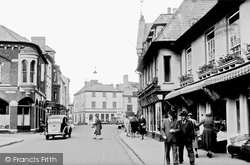
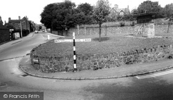
This traffic island at the south end of the High Street, with its random stone walling, double yellow lines, and Festival of Britain-style sign, somehow epitomises a rather unlovely village.
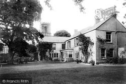
The Rectory in South Street, on the south side of St Mary's Parish Church, was the home of the Rural Dean, Rev Henry Richard William Farrer, who was an honorary canon of Salisbury Cathedral.
This is an attractive village ranged along its north-south street about a mile to the south of Kibworth Beauchamp.
In 1637 an L-shaped addition was made to the south-east corner. The last Thomas Metcalfe was involved in the South Sea Bubble, and on his death the house passed out of the family.
South-west of Oxted, and on the course of a Roman Road across the Weald, the route turns left at Blindley Heath, a hamlet on former heathland in the south of Godstone parish.
Places (15471)
Photos (5607)
Memories (1580)
Books (23)
Maps (2499)


