Places
26 places found.
Those places high-lighted have photos. All locations may have maps, books and memories.
- Cemmaes Road, Powys
- Six Road Ends, County Down
- Road Weedon, Northamptonshire
- Severn Road Bridge, Gloucestershire
- Roade, Northamptonshire
- Berkeley Road, Gloucestershire
- Harling Road, Norfolk
- Road Green, Devon
- Builth Road, Powys
- Cross Roads, Yorkshire
- Steele Road, Borders
- Cross Roads, Devon
- Four Roads, Dyfed
- Road Green, Norfolk
- Biggar Road, Strathclyde
- Clarbeston Road, Dyfed
- Five Roads, Dyfed
- Eccles Road, Norfolk
- Grampound Road, Cornwall
- Morchard Road, Devon
- Wood Road, Greater Manchester
- Four Roads, Isle of Man
- St Columb Road, Cornwall
- Clipiau, Gwynedd (near Cemmaes Road)
- New Road Side, Yorkshire (near Silsden)
- New Road Side, Yorkshire (near Cleckheaton)
Photos
14,329 photos found. Showing results 1,581 to 1,600.
Maps
476 maps found.
Books
5 books found. Showing results 1,897 to 5.
Memories
11,058 memories found. Showing results 791 to 800.
A Butcher's Lad
Mr Purvis the butcher, whose shop stood on the corner of Talke and Audley Roads, was my Saturday morning employer. He always wore a striped apron and a straw boater hat and sported a rather slick moustache. His manner with the ...Read more
A memory of Alsager in 1954 by
Growing Up In A Small Village
My parents moved to Twycross from London in the early 1960s. We lived on Sheepy Road next door to Mr Charlie Brooks and Louie Jones. On the opposite side were Stan and Ilma Jones and Len Gibbs and his daughter Joan. ...Read more
A memory of Twycross by
Cherished Memories
Finding this site has brought many wonderful memories back to me. I was born in St Mary's Hospital, Croydon. My maiden name was Chappell. I lived in Purley Road, South Croydon not far from the Red Deer until 1957. Every Saturday ...Read more
A memory of Croydon in 1953 by
Raf Radar At Inverbervie
I was based in Inverbervie from March 1957 till March 1958 with 977 Signals Unit of the Royal Air Force. 977 SU operated radar from an underground site on the hill a couple of miles north of the village. Height finding ...Read more
A memory of Inverbervie in 1957 by
Rayne In 1950 1960
I was born in Rayne and in the 1950s.I have fond memories of being able to play various sports in the road at School Road with my brother Peter and friend Richard Dodd, gaining a few more players as word got around! We used to ...Read more
A memory of Rayne by
Memories Of Sneinton
Betty and I were brought up in Davidson Street, Sneinton just before the Second World War. It was a small back-to-back terraced house with an outside toilet. One of my first recollections was being bathed in the small kitchen ...Read more
A memory of Sneinton in 1930 by
Netherley House Hinckley Road
Hi Can anyone help me? Was there a Netherley House in Hinckley Road in the late 1930s/early 1940s? I have a relative who was born there in November 1940 but I cant see any record of the place. Any help would be appreciated. Regards Tracey
A memory of Hinckley by
Growing Up In Greenford In The 1960s And 1970s
Here are some random memories: Lists Bakeries on Greenford Broadway. Lovely aroma, tasty bread. The paper bags all used to have the slogan 'Good Flavour Always Finds Favour'. The covered market ...Read more
A memory of Greenford by
Cheadle In The Second World War
I think that we must have moved to Cheadle around 1938, because I was born in Newcastle under Lyme, but my younger sister was born in Cheadle in 1939. At that time we lived on Leek Road. We had various ...Read more
A memory of Cheadle in 1930 by
The Rone Clarke Family Rose Cottage Bristol Road Bournbrook Birmingham
My great-great-grandfather was CHARLES RONE CLARKE born 6 March 1837 at 13 Court, Smallbrook Street, Birmingham. He was a master woodturner and sixth great-grandson of Henry ...Read more
A memory of Bournbrook in 1860 by
Your search returned a large number of results. Please try to refine your search further.
Captions
5,036 captions found. Showing results 1,897 to 1,920.
carriage with a liveried coachman make their way along George Street past the imposing façade of the Wilts and Dorset Bank, on the left, and the Brooklyn Cycle Depot across the unsurfaced road. A
Horbury's Grammar School was in Highfield Road, where older pupils were provided with a smoking room.
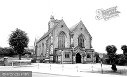
The more recent road sign was no doubt meant to ensure free access to the church for weddings and funerals.
It was essentially a wool town, and its great market was held in the wide stretch of road we see here.
And this one, the Heol Maengwyn, also carries the main A489 road from the east. The street came to life, and still does, on Wednesday market day.
The King William IV public house, dating from 1862, is the first in a row of noteworthy buildings in Vantorts Road.
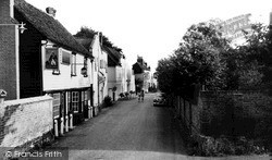
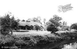
The thatch has been removed from one of the cottages and the little wicket gate next to the road has been removed for safety reasons. You can still see the line of the gate in the brickwork.
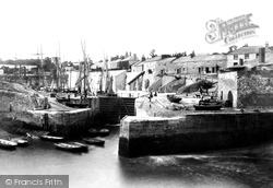
Chutes descend from Quay Road in front of the terraced houses for loading china clay. On the extreme right is a disused limekiln with two arches.
As it lies outside the ring road it may yet escape engulfment, though many residents are unhappy at the expansion of nearby Coventry Airport, from which thomsonfly.com now operates low-cost
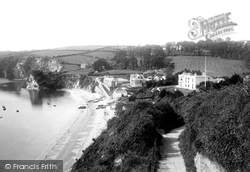
The cliffs below the road in the foreground were the scene in 1952 of two notorious murders.
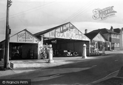
Gear's Garage, above the Queen's Armes Hotel, was the major motor engineers for this section of what became the strategic A35 Folkestone to Honiton trunk road.
The Romans mined Droitwich salt on a large scale, and this is the road they built running east from Droitwich through Feckenham to Alcester.
Warlingham School is seen from Westhall Road one hundred years ago. It was opened in 1874 with 75 pupils, some of whom came from Whyteleafe.
The retaining wall along Torquay Road was the 1886 halfway meeting place of the 'Flatpole' and 'Dicky Bird' bands of warring youths! In the centre is St Paul's Church, built in 1939.
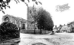
The east end of St Peter's church is seen from Church Road. St Peter's dates from 1833.
The road and rail bridge were built in 1856; today another bridge, built in 1970, runs alongside it, built with money from the Bridge Trust of 1391.
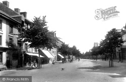
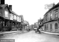
Although there were many shops in this road few people are visible in this scene, though a cart turning into the High Street brings it to life.
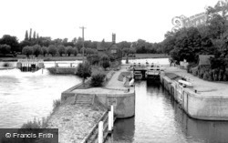
Seen from the road bridge, its balustrades recently brutalised by the Oxfordshire County Engineer, the lock, rebuilt in 1922, is little changed, although the Victorian former lock-keeper's cottage is
village, which consisted of about eighteen houses, lay to the south-west of Belsay Castle - or rather it did until the early 19th century, when Sir Charles Monck had it demolished and moved to the main road
Rectory Road was extensively redeveloped in the 1970s, and many of its small shops were closed.
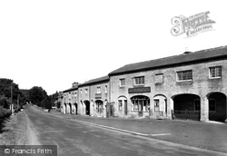
The buildings on both sides of the road have been extensively altered over the years. Note the Bush Hotel on the right (no longer trading).
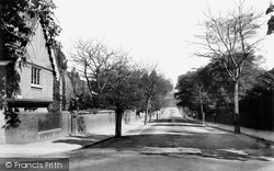
In 1901, Hermitage Road was a pleasant, open avenue. The building on the left in view 46642, left, is the Hermitage, home of Frederick Seebohm; very little of it still remains.
In 1901, Hermitage Road was a pleasant, open avenue. The building on the left in view 46642, left, is the Hermitage, home of Frederick Seebohm; very little of it still remains.
These cottages stand at the top of Pack Hill, near its junction with Church Road and Mayfield, in Upper Wanborough. The Cottage Shop was once a shoemaker's premises.
Places (26)
Photos (14329)
Memories (11058)
Books (5)
Maps (476)


