Places
18 places found.
Those places high-lighted have photos. All locations may have maps, books and memories.
- Hythe, Kent
- Hythe, Hampshire
- Small Hythe, Kent
- Bablock Hythe, Oxfordshire
- Methwold Hythe, Norfolk
- Hythe, Somerset
- Hythe, Surrey
- Hythe End, Berkshire
- The Hythe, Essex
- Egham Hythe, Surrey
- West Hythe, Kent
- New Hythe, Kent
- Broad Street, Kent (near Hythe)
- Horn Street, Kent (near Hythe)
- Newbarn, Kent (near Hythe)
- Newington, Kent (near Hythe)
- Broad Street, Kent (near Hythe)
- Stone Hill, Kent (near Hythe)
Photos
360 photos found. Showing results 1,841 to 360.
Maps
101 maps found.
Books
10 books found. Showing results 2,209 to 10.
Memories
4,406 memories found. Showing results 921 to 930.
Distant Memories Of An Evacuee
My name is Nigel Redding and I was sent to Llangynwyd about 1942/43? as an evacuee. I was aged about 3 or 4 years old and accompanied by my older brother Alan who was 5 years older. (Both born in Rogerstone , ...Read more
A memory of Llangynwyd by
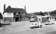
Cowplain In The 60s
My family moved to Cowplain in March 1961. I was 10 years old and went to Stakes Hill Junior School. From there I went to Cowplain Seconday School for Girls from 1962 to 1967. On the corner of Sylvester Road was Pine Tree Stores. ...Read more
A memory of Cowplain
My History
I was born in Park Royal Hospital in November 1951. Lived for a while in Willesden High Road. We then moved to Severn Way, which was off Denzil Road. I went to school at Dudden Hill Infants School. Then I went to St.Marys Junior school. ...Read more
A memory of Willesden by
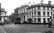
West Street
I was born in West Street in 1953 - my father was the manager at Lovibond's wine merchants. This photo is the closest to it. I remember the Black Horse, which was down the road from where we lived, and The Swan, which was half way up West ...Read more
A memory of Horsham
Brierley Hill Girls Memories
I was born in Chapel Street, in 1947. My uncle, Len Gray, had a newsagents in the town, near the bus stop by the Old Post Office, as was. My Grandad used to sell papers on the Five Ways and as a girl I would stand ...Read more
A memory of Brierley Hill
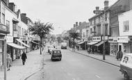
Home Sweet Home
At the time this photograph of the High Street was taken I was 15 years old. Not knowing then, I would be walking down this road some years later with my first girlfriend and now my wife of 51 years. Where the ...Read more
A memory of Teddington by
Adele Avenue/Harmer Green Lane
This photograph actually shows Adele Avenue off to the left and the road going down the Beehive is Harmer Green Lane. Just before the Beehive there is a road off to the right which goes under the railway bridge and ...Read more
A memory of Digswell by
Farnham 1945 To 1965
So many memories of Farnham. Although I was born in Aldershot much of our shopping was done in Farnham. I recall the joys of the Christmas card display in a basement below the stationers that was under the colonnade. My first ...Read more
A memory of Farnham by
Born In Upper Boat 1943
Ken Beard speaking. My parents were evacuated to South Wales from Bermondsey London during the 2nd. war. I wish I had some dates, as there is no one alive to ask. We lived at 63 Crwys Crescent where I was born in 1943.I'm ...Read more
A memory of Upper Boat by
Memories Of An 'outsider'
I was born in Colindale in 1937. My memories of Twickenham are of a piscatorial nature. I took up angling aged 10 or 11, a friend and I decided to have a go on 'The River', we had fished the Grand Union Canal and river Gade ...Read more
A memory of Twickenham by

Captions
4,899 captions found. Showing results 2,209 to 2,232.

The growth of Lowestoft in Victorian times was largely down to construction by the civil engineer Samuel Morton Peto, who lived in the splendid Somerleyton Hall nearby.

The story goes that he was given shelter here by the miller before seeking exile in France. The mill later became a private house.

Close to the county's southern boundary, the village of Yardley Gobion is flanked by the Grand Union Canal and the River Tove.

The view along the grass-verged straight street is closed by the dignified 15th-century tower of St Guthlac's Church.

The Old Crown Inn and the adjoining cottages are faced by the Georgian houses on the other side of the green.

The Ilfracombe Hotel (centre left) was built by the Ilfracombe Hotel and Esplanade Company.

The raised site chosen for his castle by the Norman Hamelin de Ballon in the late 11th century can be clearly seen here from Castle Meadows.

Cyfarthfa Castle was built in 1825 for the Crawshay family, the ironmasters; then it was bought by the Merthyr Tydfil Corporation in 1909 for £19,700.

The funds needed to build it were raised by the people of Romford, who were justly proud of the medical facility which gained a fine reputation.

By the middle of the 19th century, the farms around Saffron Walden had largely converted from sheep to grain. The Corn Exchange (right) replaced the old Woolstaplers' Hall in 1849.

By the 1840s it boasted 'many mansions and good residences, occupied by London businessmen and others'.

In 1800, Aberaeron was little more than a farm and inn by the main coast road where a bridge crossed the Aeron.

By 1857 it had virtually become a suburb of Liverpool, with the resort being invaded by the working classes and not by its intended patrons, the members of the industrial aristocracy and bourgeoisie.

The latter is now used by the Mid Cheshire College. The war memorial, however, has been moved.

The grace of Fleet Street in the previous picture is counterpointed by the timeless nature of this rural view, taken the same year on the outskirts of Torquay, possibly at Cockington.

Silting of the waterway presaged the decline of Cley's influence, and coastal vessels now pass it by. The fine old windmill dates from 1713, and guards the town from the open marshlands.

The handcart with its large hamper which was parked by the pavement in picture 76862 (p.42-43), is still in the same spot.

It was built in about 1790, but was almost derelict by the 1930s. It has been restored - but developments have now encroached on the once isolated site.

Nearby is Wicken Fen, a major wetland conservation area covering 330 acres owned by the National Trust.

It was described as 'long desired', and was provided by the North Riding County Council in conjunction with Eston Urban District Council.

A traditional seaside pastime for children is paddling about in pools left behind by the falling tide.

Duporth Beach is just around the corner from Charlestown, and is separated from it by the headland and Polmear Island offshore.

was still open and a focus for community life in Lyme Regis.With its congested, narrow streets, this is by far the oldest part of the town, having been built on land given to Sherborne Abbey by the

The beach at Charmouth is a mecca for geologists and fossil hunters, and explanatory walks take place from the heritage centre by the mouth of the Char.
Places (18)
Photos (360)
Memories (4406)
Books (10)
Maps (101)

