Places
7 places found.
Those places high-lighted have photos. All locations may have maps, books and memories.
Photos
52 photos found. Showing results 221 to 52.
Maps
55 maps found.
Books
Sorry, no books were found that related to your search.
Memories
646 memories found. Showing results 111 to 120.
Sunday At The Dell
During the long summer Sundays of 1947, the pleasures that were afforded by many Doncastrians were few and far between.Sunday, being a non-work day for the man of the house (if not the woman, Sunday dinner to make, pots to ...Read more
A memory of Doncaster in 1947 by
The Good Old Days
I was born in Luton in the 1940s and remember well the shops in Manchester Street with WG Durrants butchers on the corner of Manchester Street and Bridge Street. Next door in Bridge Street was a garage and further along Manchester ...Read more
A memory of Luton by
Jtbells
This is the year I started on the building sites in 1963, I got a job on J. T. Bell's site in Whickam, the site hadn't been running long then as it was in the first stage. All the lads were mainly from Newburn, Lemington, and Throckley. If ...Read more
A memory of Newburn in 1963 by
The Shakey Bridge
My mother left Yorkshire with me in 1945 when I was four years old. She worked for a Mrs Curzon at Arrochar house in Rothiemay as a cook and general help. I think the owners were titled people. I remember ...Read more
A memory of Rothiemay Crossroads in 1945 by
Earith Was In Huntingdonshire And Still Is
I was born in St Ives in 1939 but lived in Earith at what is now number 43. Next door was my Grandad's grocer's shop - Bert Russell. I moved to Peterborough in 1958 where I still live in Werrington ...Read more
A memory of Earith in 1940 by
Steamtrains, Servicemen And Central Station.
The journey up to and across London to King's Cross Station in 1944 for a 4-year old boy was exciting enough, but our adventure had only just begun. Holding my mother's hand tightly, we ...Read more
A memory of Newcastle upon Tyne in 1940 by
My Memory Of Chopwell
After reading the other accounts of Chopwell I decided to add my own, I hope I have got the names and dates right as I am doing this from memory, apologies if I get some of it wrong. All my mother’s side of the family were from ...Read more
A memory of Chopwell by
A Trip Down Memory Lane
I am very pleased to have found this site, I was on Friends Reunited but it closed. I was born in 19 Chester Street in 1947, went to Lawson infants school, Smeaton Street and Middlesbrough Tech. My sister, Pat, grew up ...Read more
A memory of Cargo Fleet by
Halcyon Days
My family moved from south London when I was about 4. We moved into no 5 cruick-avenue. Those were the days when only the odd family had a car, you would go to a neighbours house and pay to use there phone. All adults were mr ...Read more
A memory of South Ockendon in 1960 by
Captions
329 captions found. Showing results 265 to 288.
This remarkable photograph, looking north- eastwards along Bridge Street, shows weather-boarded buildings on the ancient Buddle Bridge.
The main port lay north of this point, since a medieval three- arched stone bridge blocked the further passage of tall craft upstream along the River Parrett; even in the early 20th century,
The village had a pub, the Bridge Inn, which was designed to look like an old coaching inn, but opened as a temperance hotel. Lever allowed villagers a vote about a licence.
Along Thames Street, east of the town's medieval river bridge, abbey buildings remain. Note the gabled 13th-century chimney stack to The Chequer.
It closed in 1974 with the opening of the M5 bridge, which carried a walkway and cycle track along with the motorway. Little commercial traffic now passes through to Bristol.
Station Road led down to the railway station, now long gone.
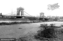
Kingston Buci had probably already taken over further along the shingle spit. What a tragic loss this superb 1833 suspension bridge was. Designed by William Tierney Clarke, it was replaced in 1923.
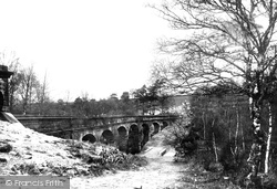
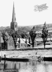
The main Huddersfield to Manchester railway makes its way along the steep side of the valley, and it has to cross many side valleys.
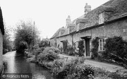
It is easy to understand why this quarter of South Cerney, with its squat stone cottages ranged along the banks of the River Churn, are often photographed by day trippers.
The bridge itself fell into disrepair; in 1931 it was closed to vehicular traffic, although people could continue to walk across it if they paid their penny.
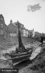
A fishing boat lies in the tidal section of the canal that linked it to the River Nene, which can be seen under Sluice Bridge.
Moving east off the Limestone Cliff, our route descends towards the clay vale that runs along the western edge of The Wolds.
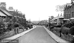
It is a workaday street - the white railway bridge in the distance has now gone, along with the railway track.
Moving east off the Limestone Cliff, our route descends towards the clay vale that runs along the western edge of The Wolds.
The castle, much enlarged by the Dukes of Norfolk, along with their Roman Catholic cathedral, dominates this picturesque hill town, giving it a distinctly French character in distant views.The bridge over
Fishing has been popular on the Teise since Victorian times, with grayling and barbel sought from Finchlock's Bridge along to Hope Mill.
Just along the canal from Bridge 104, the boat is emerging from a turning point in the canal basin.
Warehouses and industry flourish along the banks of the river. In 1968, when work was underway on a new Devon Bridge, timber piles and some stonework were discovered on the river bed.
Here the photographer looks north along the High Street, towards its junction with Bridge Street to the right, and Desborough Road curving left.
Just along the canal from Bridge 104, the boat is emerging from a turning point in the canal basin. The bank to the right, where the car is parked, now houses a boat hire firm, Castle Narrowboats.
Reaching Littleborough from Sowerby Bridge in 1788, it was completed through to Manchester by 1804. An Act of 1952 closed the waterway to traffic along most of its length.
The bus in the distance has just passed Ford Bridge. Once called Stratford (the `street ford`), this was where the Roman road crossed the River Chelmer.
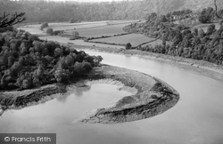
Just up river from the bridge and the castle, this would appear to be a view from Wintour`s Leap of the beginning of the great Horseshoe Bend which encompasses the peninsula of Lancaut.
In the new millennium, it is now time to update the town centre's image by developing high quality, long lasting Visionary Buildings and Open Spaces During the severe flooding in September
Places (7)
Photos (52)
Memories (646)
Books (0)
Maps (55)

