Places
26 places found.
Those places high-lighted have photos. All locations may have maps, books and memories.
- Town End, Derbyshire
- Town End, Buckinghamshire
- Town's End, Somerset
- Towns End, Dorset
- Town End, Merseyside
- Town End, Cambridgeshire
- Town's End, Buckinghamshire
- West End Town, Northumberland
- Bolton Town End, Lancashire
- Kearby Town End, Yorkshire
- Town End, Cumbria (near Grange-Over-Sands)
- Town End, Cumbria (near Bowness-On-Windermere)
- Town End, Yorkshire (near Huddersfield)
- Town End, Yorkshire (near Wilberfoss)
- Town End, Cumbria (near Appleby-in-Westmorland)
- Town's End, Dorset (near Melbury Osmond)
- Town's End, Dorset (near Swanage)
- Town End, Cumbria (near Ambleside)
- Town End, Cumbria (near Lakeside)
- Town End, Cumbria (near Kirkby Lonsdale)
- Town End, Cumbria (near Ambleside)
- Town's End, Dorset (near Bere Regis)
- West-end Town, South Glamorgan
- Townend, Derbyshire
- Townend, Strathclyde (near Dumbarton)
- Townend, Staffordshire (near Stone)
Photos
23 photos found. Showing results 4,061 to 23.
Maps
195 maps found.
Books
3 books found. Showing results 4,873 to 3.
Memories
3,719 memories found. Showing results 2,031 to 2,040.
Lane End Born Bred From 1956
I grew up in Park Lane, this is the eastern side of Lane End, and then consisted of mostly 1940s- & 1950s-built council houses. I grew up in Coronation Crescent, a semi, 3 bed council house. These ...Read more
A memory of Lane End by
Update On Castle Street
The houses in Castle Street have been knocked down some 20 years ago. I used to live in no 18 and used to play in the castle grounds since we had no garden.
A memory of Guildford by
Life On The Farm At Kettlethorpe
We moved to Park Farm Kettlethorpe when I was 7. The family at this time was reduced to Mum and Dad, Eileen, Brian, Maureen and Gillian. At first we lived in a semi detatched house at the top of ...Read more
A memory of Kettlethorpe in 1955 by
Huntcliffe Cottages
On this photograph there is a little 'bump' on the horizon just below Warsett. That 'bump' is 3 railway cottages and my Dad lived in No. l with his parents and brother and sister around 1912 - 13ish when he was ...Read more
A memory of Saltburn-By-The-Sea in 1947 by
420 Rimmington Row My Home
I lived at the above address with my mum Evelyn and dad Jim Hoyle who for a time was the caretaker at the Stocksbridge C Of E school just across the road. My sisters Valerie and Vivien and I lived with with our ...Read more
A memory of Stocksbridge in 1956 by
Forge Farm
Just found this site while looking for Chinley which I believe is close by. Forge Farm memories of the fun times we had as children hop picking with nan and gran-dad, dad and mum, aunts and uncles and of course my siblings. At that ...Read more
A memory of Goudhurst in 1953 by
1940 To 1945
My name is Orin, Belgian born, and I lived at 68 Hazelmire Road, we lived right behind Petts Wood woods, there was a tree which we called the Crocodile, I still have a piece of this fallen tree...so many beautiful memories, although ...Read more
A memory of Petts Wood by
Summer Holidays
I was born in Brewery Yard, Great Haywood. After the war my mum moved to Notting Hill, London, so in the summer holidays my sister and I would stay at Nan & Grandads in the village. Mum {Eileen Bailey} played the piano in ...Read more
A memory of Great Haywood in 1954 by
Hatchford Church
My father, Capt. F.C. Dyer used to play the organ at Hatchford Church until his death in 1950. It was a pump organ and Bubbles was the name of the hunchback who pumped the organ. We lived in the Semaphore Tower up on Chatley Heath ...Read more
A memory of Cobham in 1940 by
Grandads Pig Farm
My memories of Mitcham are primarily those of days spent at my grandparents' house. My grandad was Sidney Clark, my nan for some reason unknown to me was "Nanny Mick". My grandfather had a pig farm at the bottom end of Aberdeen ...Read more
A memory of Mitcham by
Captions
5,054 captions found. Showing results 4,873 to 4,896.

Our photographer is standing in Church Street.The early markets were held in this area of the town.The White Lion Hotel on the right is still there today, and so is W D Cunliffe the grocers and bakers.Three

Combe Martin`s early prosperity came from its lead and silver mines, which were worked from prehistoric times.

These were horse-drawn and, instead of locks, used slopes called inclined planes. Power was provided at these points, and the tubs were hauled up (or down) to change water levels.

A fine panoramic view of east Coulsdon shows the extent of the development in the late 1920s and 1930s in Marlpit Lane, Bradmore Way and neighbouring roads.

This is a view of the same street looking down the hill. Notice how in this and the other pictures of Whitchurch, the street lights are suspended above the centre of the street.

We are looking south along the High Street past the Olde Place Hotel, whose brick and flint façade disguises a 16th-century half-timbered building.
To reach this popular bathing cove with its old inn, travellers must thread a path down a deep lane between hills bright with heather and wild flowers.

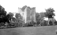
The impressive and imposing ruins of Malmesbury Abbey look down on the river Avon 60 feet below.

Polperro is the archetypal Cornish fishing village - a higgledy-piggledy maze of narrow streets leading down to a perfect, tiny harbour.

The cannon has now gone, but Davis' four pedestrian entrance gateways, two surmounted by Egyptian lions, remain: elegant and Soane-like architecture in a pared-down Greek style.

Looking west from Bathampton Down, past the villas of Bathwick across the northern half of the city, we can see how the formality of the ramrod-straight Great Pulteney Street to the left contrasts with

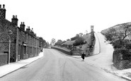
Looking south down Scale Hill, once known as Church Lane. The first building on the right is the tramps boarding house, on the site of the Chequers Inn.

The hilliness of these parishes was often cited as the cause of the 'Pure Air and Good Health' lauded in the property advertisements.

This sublime abbey, scene of many coronations down the centuries, is probably the most famous of English religious buildings, and considered the pinnacle of European Gothic architecture.

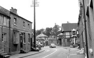
Looking south down the main road towards Wilmslow, with the road over to Macclesfield going off to the left, affluent Cheshire is driving towards the viewer and the young couple wait for

The lovely timber porch was left relatively untouched, however; and a grave-slab from an earlier church has recently been discovered beneath the pews. The rectory burned down in the 1950s.

The lorry coming down the hill (left) is a sign of changing times; by the fifties most goods were being moved by road, and the ketches seen in photograph 63963 (p.73) were long gone.

A small village, built to house Parham Estate employees, Cootham is situated near to the foot of the downs.?

Here we have a later view down Poultry and Cheapside, with Christopher Wren's spire of St Mary-le-Bow dominating the street.

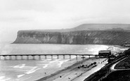
This fine view along Budleigh's strand looks towards the mouth of the River Otter and the bulbous cliff top of Otterton Ledge.

It says a lot for this landscape that artists of all kinds have responded to it and interpreted it in diverse ways.

This view was taken from the top of Brunel's railway viaduct and looks down New Road to the bridge and the beginning of the High Street.

A major redevelopment in 1870 brought many new shops and arcades to the thoroughfare.

The Waveney forms a natural boundary between Norfolk and Suffolk. Along the river frontage are boat yards, moorings and maltings.
Places (26)
Photos (23)
Memories (3719)
Books (3)
Maps (195)

