Places
17 places found.
Those places high-lighted have photos. All locations may have maps, books and memories.
- Bridge End, Oxfordshire
- Bridge End, Lincolnshire
- Bridge End, Essex
- Bridge End, Bedfordshire
- Bridge End, Clwyd
- Bridge End, Warwickshire
- Bridge End, Surrey
- Bridge End, Durham (near Frosterley)
- Bridge End, Northumberland (near Hexham)
- Bridge End, Hereford & Worcester (near Tirley)
- Bridge End, Hereford & Worcester (near Bosbury)
- Bridge End, Shetland Islands
- Bridge End, Cumbria (near Carlisle)
- Bridge End, Northumberland (near Hexham)
- Bridge End, Devon (near Kingsbridge)
- Bridge End, Devon (near Sidmouth)
- West End, Yorkshire (near Pateley Bridge)
Photos
38 photos found. Showing results 1,101 to 38.
Maps
520 maps found.
Books
Sorry, no books were found that related to your search.
Memories
1,928 memories found. Showing results 551 to 560.
A Game Of Soccer In The River
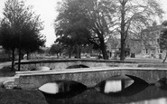
Every year there would be a game played in the river in the village using the bridges as goal posts and is, as far as I am aware still played today. It would be around 1955 that my late father, Frederick ...Read more
A memory of Bourton-on-the-Water in 1955 by
Home Base
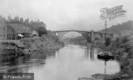
This pic was taken from Tunnel Terrace looking over the old iron bridge coming from The Tunnel Hotel. The building closest after the slag heap is the old Police station with the Bandroom next door to it. My Grandmother and Grandfather Loveday lived in number 5 Tunnel Tce. Sadly no longer there.
A memory of Blaengwynfi in 1957 by
Childhood Dreams
I came across this website by accident, what a treat. I was raised in Croydon, actually Addington. My nana and granddad lived at 195 Purley Way in Wadden. I spent many happy hours there as a child. I would spend several weeks ...Read more
A memory of Croydon in 1955 by
Last Public Hanging
I think it took place in 1818 opposite the church and what is now the Phillips Memorial, on the other side of the river . ( Llamas Lands?) The depression made in a horse shoe shape was where the crowd stood to watch the event! ...Read more
A memory of Godalming by
River Side Living
As a child who was born in 1924 I lived with my family (name of Rogers) just down stream of the bridge I attended the "Blue School"and St.Lukes Church as did all my Brothers and Sisters climbing the 100 or more steps past ...Read more
A memory of Ironbridge in 1930 by
Living In Tanner Street Barkng
When I was four years old our family moved from Benfleet Essex to Barking. M y Farther took a position as Manager of a Corn Chandlers In Tanner Street, and we lived at number 81 next door. I can recall starting school ...Read more
A memory of Barking in 1930 by
Happy Days
The corner shop was Tyler's, a sweet and grocers shop. They sold 1d iced lollies made from a juice drink similar to Ribena. You were allowed out to play all day except Sundays, and we would very often go around in a little gang. We ...Read more
A memory of Wigston in 1957 by
Happy Summer Days At The Pool
This photo' reminded me of those carefree summer days when we would cycle from Myland to the pool, leave our bikes, unlocked, in a heap outside, pay our 6d and go to the dank, cold, changing room under the bridge. ...Read more
A memory of Colchester in 1954 by
Parkinsons Store
I have very fond memories of holidays spent with my Aunt Susan Parkinson and my cousins Jane and David Boggia and their daughters Mel and Bev. I helped out in the store one holiday and had my first romance with a lad from the ...Read more
A memory of East Harling in 1965 by
Napier Terrace
I was born in Wisbech in 1937 in Ramnoth Road, we moved to Napier Terrace on the canal until after the war when we moved to Wales. I have fond memories of living in Napier Terrace, we lived in the last house, No 37. My father was in ...Read more
A memory of Wisbech by
Captions
1,755 captions found. Showing results 1,321 to 1,344.
We are looking north-westwards up Spring Head Road from its junction with Mill Lane (foreground, right) and the bridge over the River Lim.
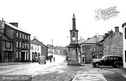
Originally there were three Broughs, and this view shows what is properly known as Market Brough.
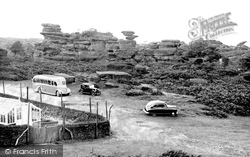
Cars and buses are no longer allowed to park among the weird and wonderful gritstone formations of Brimham Rocks, near Pateley Bridge in Nidderdale, as they were when this photograph was taken.
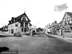
This road junction is just to the south of the centre of Wellington, and sits astride the London to Holyhead road that was built by Thomas Telford in the early 1800s.
Cars and buses are no longer allowed to park among the weird and wonderful gritstone formations of Brimham Rocks, near Pateley Bridge in Nidderdale, as they were when this photograph was taken.
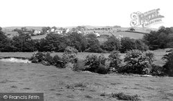
Rows of stone cottages and rolling farmland characterise Brookhouse, which is close to Caton with Littledale and a popular retreat for commuters to Lancaster.
Tree-lined, and with lush green river banks, the River Ribble runs through pretty villages and on to Clitheroe, joining with the River Calder and the River Hodder.
During the 19th century the town centre had shifted westwards to the Bridge and Park Street.
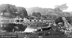
Beside the stone causeway and bridge, rowing boats invite anglers or sightseers to venture out on the water.
Up until 1977 this station was shared with Hants & Dorset motor services. Bristol K5G buses ran into Woolston, and Corporation buses served the floating bridge.
The stores and post office, right, were once an essential part of this village.
As the road approaches the level crossing, we can see a signal box and a foot bridge - in recent years the signal box has been demolished.
The bridge was built over the Bridgewater Canal in 1778, but it has been widened and strengthened many times since.
The shops between Pottle's and Poole Corner were demolished to make way for the old post office and an ironmonger's.
Aveley is a small village situated a few miles to the east of Rainham and close to the Thames and Essex Marshes.The parked bicycles on the right, no cars to be seen and the crowd waiting for the bus
The bridge started to show its age soon after our photograph was taken, and by the mid 1960s it was declared unsafe.
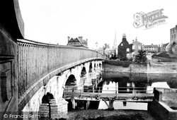
This seven-arched road bridge was built in 1775 to carry the Great North Road over the river. It replaced earlier crossings dating from 1190.
Just along the canal from Bridge 104, the boat is emerging from a turning point in the canal basin.
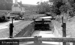
The bridge immediately beyond the lock used to take a railway into Pirbright army camp, just behind the trees to the right.
Bathpool is now very much a suburb of Taunton, with the spread of the Somerset town on one side and the M5 motorway on the other.
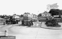
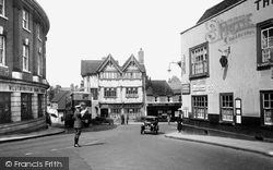
An RAC patrolman guides an early Austin saloon around the junction of Church Street and the High Street, as a 408C double-decker bus emerges from the top of Bridge Street.
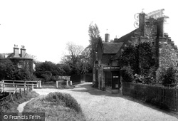
The rustic bridge parapets over the brook also look like John Hicks's work.
The rustic bridge parapets over the brook also look like John Hicks's work.
The bus in the distance has just passed Ford Bridge. Once called Stratford (the `street ford`), this was where the Roman road crossed the River Chelmer.
Places (17)
Photos (38)
Memories (1928)
Books (0)
Maps (520)

