Places
36 places found.
Those places high-lighted have photos. All locations may have maps, books and memories.
- Bangor, County Down
- Newcastle, County Down
- Greyabbey, County Down
- Donaghadee, County Down
- Downpatrick, County Down
- Portaferry, County Down
- Dromore, County Down
- Hillsborough, County Down
- Downings, Republic of Ireland
- Killyleagh, County Down
- Ardglass, County Down
- Rostrevor, County Down
- Dundrum, County Down
- Newtownards, County Down
- Warrenpoint, County Down
- Ballygowan, County Down
- Ballywalter, County Down
- Ballyward, County Down
- Bishops Court, County Down
- Boardmills, County Down
- Culcavy, County Down
- Katesbridge, County Down
- Killough, County Down
- Millisle, County Down
- Portavogie, County Down
- Saul, County Down
- Seaforde, County Down
- The Diamond, County Down
- Audleystown, County Down
- Kearney, County Down
- Annaclone, County Down
- Ballyhalbert, County Down
- Ballymartin, County Down
- Clare, County Down
- Conlig, County Down
- Dollingstown, County Down
Photos
856 photos found. Showing results 1,461 to 856.
Maps
459 maps found.
Books
2 books found. Showing results 1,753 to 2.
Memories
8,167 memories found. Showing results 731 to 740.
Starting School
This is my first school, Dunston Hill Infant & Junior School, I started school the year the photo was taken, I fell off a small wall first day, I remember it vividly. Favourite teacher in the junior school was a Ms ...Read more
A memory of Dunston in 1955 by
Growing Up.
Lensbrook house and Lensbrook Tea Gardens are the same house. I lived in Lensbrook Cottage which was farther down the lane, from the time I was born until my marriage at 20 years old.
A memory of Blakeney
My Beloved Bonk
I have loads of memories of village life as a kid. I was born in 1961 and still live on the Bonk. I will probably die here as well. There were many old characters back then. Iron Bates the vegetable cart man (did some boxing ...Read more
A memory of Cheslyn Hay in 1969 by
Walk About
Now living in Australia - Arriving back to visit relatives, a previous life time of my walk about ways seems so dream-like. Living at The Greig Farm above the Wier Farm (The Wier which had been in my family forever) was the best ...Read more
A memory of Ewyas Harold in 1965 by
Upbringing
I went to school first at Tondu infants and then to the Primary school, I remember when we had the school photographs taken in the play yard (where are they now?). I had a really great and happy childhood there living with all the ...Read more
A memory of Aberkenfig by
The Flying Horse
I worked at the pub on Parson Street. Banbury is a great town, to remember crazy memories, like when you did not have any money then there would be no electric or TV. I remember St Mary's church bell practice was on Wednesday ...Read more
A memory of Banbury in 1977 by
Royal National Hospital Ventnor
I worked as a nurse at the hospital from 1955 to 1956 and went back for the first time in June of this year. It was really nostalgic to be there again, even though the hospital has long gone the Botanic Gardens are ...Read more
A memory of Ventnor in 1956 by
The Fleetwood I Left Behind
I was born in Fleetwood in 1947 but seemed to oscillate between there and Malaya for a number of years up to the age of 12 just before dad died. My first memories are of starting at Stella Maris convent and then ...Read more
A memory of Fleetwood in 1970 by
Cappels Shop
I remember going into Cappels shop in the late 1970s and buying kali and liquourice. I also remember going down to Coach bridge, swimming with my friends, and a man called malcolm used to come over on his penny farthing, good times were had by all.
A memory of Nether Heyford by
Happy Days
I was born in 1953 and lived in Nelson until 1978 when I moved to Scotland with my husband. I've lived in Hampshire for 26 years now. I used to live in High St and from the early 60s in Ashgrove Tce, by the bus station. The ...Read more
A memory of Nelson by
Captions
2,242 captions found. Showing results 1,753 to 1,776.
We are on the slope of the Downs between Eastbourne and Polegate. A nearby vantage point at Combe hill is 638 feet high.
The wall on the right was knocked down and a garage built. This disappeared in 1997, replaced by a pretty park. The Post Office has gone, and the Westward Ho!
This view looks down towards the Cross from the A46 Bath Road. At the bottom of the slope is the clock tower and George Street, in which is found one of the largest kettles in the country.
We are looking east down the wide sweep of Swaledale, where we can reflect on the beauty of this, the quietest of the northern dales.
From this view it is obvious that the town occupies a ridge between the two rivers: the land drops to the Great Ouse (see the previous views) and to the Ouzel, as we see here - this view was
The building is of about 1300 with an unbuttressed west tower of 1707, when its spire was taken down. As
During World War II it and the distinctive iron railings were dismantled and stored, thus escaping being melted down for Spitfires, and reinstated in 1949.
The Town Hall is down Duke Street on the right.
The old town of Cliffe, destroyed by fire in 1520, was revived briefly by the cement industry in the second half of the 19th century.
Most of the shops on the right have awnings pulled down to protect their wares and produce from the sun.
The building seen in the photograph appears as an atmospheric drinkers' dream pub, with its low doorway stepping down into a dark panelled bar, with its inevitably yellowy-brown smoke-stained ceiling.
This view down Silver Street, widened here at the junction with Gold Street in the 1930s, looks towards Dalkieth Place.
The Village 1902 Here we look south down the main road into the village as it nears the estuary.
Boats travelling down the Thames estuary from London were met by stagecoaches here, and their passengers were transported onward by road to Dover.
The sign next to H A Furr's confectionery shop advises traffic for Bedford and Luton to use Tilehouse Street, while traffic for Baldock is directed down Sun Street.
Here the photographer looks down St Thomas Street into Friary Walk, with the corner of the churchyard wall on the right.
Now a crowded suburb of Folkestone, this once rural village on the heights of the Downs just behind Sandgate has been transformed by the construction and rail links accompanying the building of
Since the opening of the railway, Swanage has vastly increased in favour as a watering-place; it is situated in a beautiful bay, and commands a glorious prospect of down and sea and cliff.
This unusual view of the harbour looks down on the moored boats, and offers insight into their rarely-seen deck gear.
Local dry stone walling, brick and Swithland slate are all here in abundance, as the road drops down from Maplewell Hall to the village centre.
A vintage tram makes its way down Clifton Drive to Lytham St Anne's. Before the sand dunes were levelled, sand blown on the tram tracks caused trouble.
To the right, Spout Lane goes round to the other side of the village; as the name suggests it is another watery place and there is still a spring that can be reached down some steps from beside the roadway
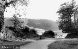
The design of this huge, ancient giant, on the South Downs near Eastbourne, is cleverly elongated vertically to counteract the effect of foreshortening when viewed from below the hillside.
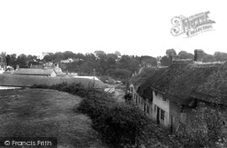
A range of three 16th-century thatched cottages in banded flint and Hamstone is down to the right.
Places (198)
Photos (856)
Memories (8167)
Books (2)
Maps (459)

