Places
36 places found.
Those places high-lighted have photos. All locations may have maps, books and memories.
- North Walsham, Norfolk
- North Berwick, Lothian
- North Chingford, Greater London
- Harrogate, Yorkshire
- Whitby, Yorkshire
- Filey, Yorkshire
- Knaresborough, Yorkshire
- Scarborough, Yorkshire
- Clevedon, Avon
- Weston-super-Mare, Avon
- Selby, Yorkshire
- Richmond, Yorkshire
- Ripon, Yorkshire
- Scunthorpe, Humberside
- Pickering, Yorkshire
- Settle, Yorkshire
- Skipton, Yorkshire
- Saltburn-By-The-Sea, Cleveland
- Norton-on-Derwent, Yorkshire
- Rhyl, Clwyd
- Chester, Cheshire
- Llandudno, Clwyd
- Grimsby, Humberside
- Durham, Durham
- Nailsea, Avon
- Southport, Merseyside
- Brigg, Humberside
- Colwyn Bay, Clwyd
- Redcar, Cleveland
- Bath, Avon
- Grange-Over-Sands, Cumbria
- Cleethorpes, Humberside
- Sedbergh, Cumbria
- Barrow-In-Furness, Cumbria
- Barmouth, Gwynedd
- Dolgellau, Gwynedd
Photos
2,569 photos found. Showing results 1,941 to 1,960.
Maps
9,439 maps found.
Books
Sorry, no books were found that related to your search.
Memories
1,548 memories found. Showing results 971 to 980.
Anyone Remember
I remember going to buy vegetables from Mr and Mrs Clitheroe (sp)?. They ran a smallholding in North Street, opposite what used to be the cricket field. They grew their own vegetables and kept chickens and rabbits. In those days ...Read more
A memory of Stilton in 1955
My Memories Of Lifton
My Memories of Lifton. I was born in 1946 lived in Lifton until I got married in 1971. I lived in Fore Street, next door lived Mr Brown, he used to repair shoes in his little shed in the garden and I used to watch him ...Read more
A memory of Lifton in 1960 by
Where I Used To Get The Bus To School
This picture (e199012) must be mid-afternoon judging by the shadows but there is surprisingly little traffic. The bus stop on the right, with a shelter, is where the 17 and 104 would stop on their way ...Read more
A memory of East Finchley in 1965
Grandparents
In the 1950s every summer school holiday my parents used to drive up to Ackworth, drop us kids off with our grandparents and pick us up 6 weeks later. I loved every minute of it. Coming from the hustle and bustle of Portsmouth it was ...Read more
A memory of Ackworth in 1958 by
Howdendyke As A Child In The 1950s
My family moved into Howdendyke upon completion of the Airey Houses when I was two years old. We lived at 4, Ferry Road which was the main street into Howdendyke. As I grew, reaching nursery school age and ...Read more
A memory of Howdendyke by
Herons Ghyll Rcprimary School
My memories are of Herons Ghyll R.C. Primary School, as I attended between 1949 and 1956,w hen Mrs Mary White was the headmistress, and Miss Duval was the teacher of the juniors. I shall remember also, Mrs Goody ...Read more
A memory of Heron's Ghyll in 1956 by
Those Were The Days 3
There was a flower shop a fruit and veg shop furniture and household shops. It all smelled so rainy in there all the time. Next to Wallis's was the long alley entrance to Barking Football Club (Vicarage Field) and Barking ...Read more
A memory of Barking in 1950 by
My Mum Was Born In Borth Y Gest
My mum was born in Borth y Gest and went to school there too and eventually marry at the church on the harbour front in 1956. My Grandad continued living there with my Grandmother until he died in 1984. Every ...Read more
A memory of Borth-y-Gest in 1957 by
Wartime Evacuation
The small private school I was attending in Westcliff on Sea was evacuated to Manuden in July 1940. We were established in Cleeve Hall,which became my home and centre of learning until around August 1941, when the school closed ...Read more
A memory of Manuden in 1941 by
Footdee ( The Squares )
My father-in-law was living with his aunt Elsie Jenkins at 17 North Square during the Second World War years. He was in the Navy at the time so he was not a permanent resident for that period. But as a boy he and his brothers ...Read more
A memory of Aberdeen in 1943 by
Captions
2,645 captions found. Showing results 2,329 to 2,352.
The River Thames curves eastward north of the village and then converges towards Church Street, some of whose gardens have a water frontage.
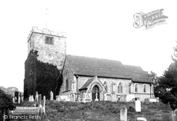
Church Lane runs north from the High Street towards its eastern end, with St Peter's Church a short way along it. The tower is 15th-century, but most of the rest was rebuilt in Victorian times.
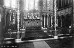
St Mary's has been called 'the Cathedral of North Hampshire' and it is said that the arcaded walling around the sanctuary was inspired by Salisbury Cathedral.
The Norman church of St Giles is at the north end of the village. Along a footpath nearby is a well-restored watermill with a wooden overshot waterwheel.
It is cruciform, with a Norman nave, aisles and north transept.
Two railways touched the town: the North West line was followed by the famous Settle-Carlisle line in 1876.
From North Curry, we skirt the south edge of West Sedge Moor to the town of Langport on the east bank of the River Parrett.
To the north of Newbury, on the edge of the downs, lies Hampstead Norris, surrounded by hills and woodland.
The picture is north- eastwards to the gable ends of the Cedars and Garston (centre right).
Much of the village lies on the north bank of the Thames, in the vicinity of the Henley road.
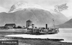
Corpach lies to the north of Fort William, where Loch Linnhe turns sharply to the west, narrowing and then widening out again to form Loch Eil.
Leaving the sprawl of Worthing behind, we move west along the coast and inland to Angmering, a village much expanded to the north and east but retaining its historic core relatively intact.
An expansive village, it sits on the River Devon, about a mile north of the Grantham Canal of 1797. This view looks south, away from the church.
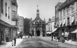
With a plan based on its Roman predecessor, Noviomagus, this fine walled city is divided into quarters by North, South, East and West Streets, which all meet at the splendid Market Cross in the centre
The biggest docks were the Royal group east of Canning Town on the north bank of the Thames. The Royal Victoria Dock opened in 1855, enclosing 94 acres of water.
This fine photograph of Malmesbury Abbey was taken from the north, with the abbey mill buildings below.
Unlike Staines on the north bank, the river plays no part in Egham's townscape. This view looks east along the High Street.
Built on slightly higher land away from the river, it turns its back on it, and this view looks north-west along the High Street to the Church Street crossroads.
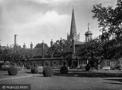
The almshouse set was completed by Twitty's Almshouses on the north side of the churchyard, founded in 1707.
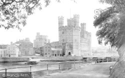
The tower, which is considered by many to be a keep, was possibly built as a residence for Sir Otto de Grandison (1238-1328), the first justiciar of North Wales.
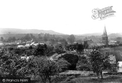
The village of Bradpole is shown here from the north-east, looking south-west from above Hole House Farm and the valley of the Mangerton River across to Holy Trinity Parish Church (right) and the fields
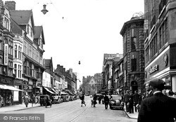
The link between London Road and Gallowtree Gate, this short north-south road is visually of the later 19th century.
This photograph shows the view north-westwards up Church Street from beside the Old Monmouth Hotel, with the churchyard railings on the right.
The Chequers (left) has become a tea rooms, whilst next door the North Metro Engineering Works provide service for all kinds of motor vehicles.
Places (9301)
Photos (2569)
Memories (1548)
Books (0)
Maps (9439)


