Merry Christmas & Happy New Year!
Christmas Deliveries: If you placed an order on or before midday on Friday 19th December for Christmas delivery it was despatched before the Royal Mail or Parcel Force deadline and therefore should be received in time for Christmas. Orders placed after midday on Friday 19th December will be delivered in the New Year.
Please Note: Our offices and factory are now closed until Monday 5th January when we will be pleased to deal with any queries that have arisen during the holiday period.
During the holiday our Gift Cards may still be ordered for any last minute orders and will be sent automatically by email direct to your recipient - see here: Gift Cards
Places
36 places found.
Those places high-lighted have photos. All locations may have maps, books and memories.
- Cardiff, South Glamorgan
- Barry, South Glamorgan
- Penarth, South Glamorgan
- Rhoose, South Glamorgan
- St Athan, South Glamorgan
- Cowbridge, South Glamorgan
- South Molton, Devon
- Llantwit Major, South Glamorgan
- Chipping Sodbury, Avon
- South Chingford, Greater London
- South Shields, Tyne and Wear
- Ayr, Strathclyde
- St Donat's, South Glamorgan
- Llanblethian, South Glamorgan
- Thornbury, Avon
- Llandough, South Glamorgan
- Fonmon, South Glamorgan
- St Nicholas, South Glamorgan
- Jarrow, Tyne and Wear
- Penmark, South Glamorgan
- Font-y-gary, South Glamorgan
- Maybole, Strathclyde
- Yate, Avon
- Oxford, Oxfordshire
- Torquay, Devon
- Newquay, Cornwall
- Salisbury, Wiltshire
- Bournemouth, Dorset
- St Ives, Cornwall
- Falmouth, Cornwall
- Guildford, Surrey
- Bath, Avon
- Looe, Cornwall
- Reigate, Surrey
- Minehead, Somerset
- Bude, Cornwall
Photos
5,054 photos found. Showing results 1,941 to 1,960.


Maps
2,499 maps found.


Books
1 books found. Showing results 2,329 to 1.
Memories
1,580 memories found. Showing results 971 to 980.
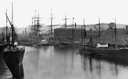
Bristol At Sea
Over a thousand years ago Bristol's harbour developed around the lowest bridging point of the River Avon. The exceptional tidal range of the Severn Estuary and Avon carried laden ships into the city and scoured the river of ...Read more
A memory of Bristol by
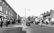
Crystal Radio In Chingford.
Back in the early 1950s my girlfriend lived in South Chingford. I'd stay with her and her parents for a weekend every 8 weeks when I got a pass home from the Hydro Electric Construction job in Scotland. Often we'd ...Read more
A memory of South Lambeth in 1950 by
Old Times
I was born at Gwaenfarren House in Merthyr Tydfil and lived at 70 Bryncelyn Ave with my father, step-mother and brother Barrie until I left to join the RAF in 1970. I can remember the old prefabs being knocked down and the ...Read more
A memory of Nelson in 1953 by
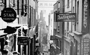
Bristol's Christmas Steps, Lewins Mead Bs1
This is one part of ancient Bristol that has survived, virtually unchanged apart from the signs but the city beyond is very different. At one time sailing ships moored at the bottom of these steps ...Read more
A memory of Bristol by
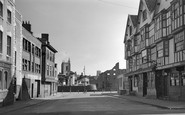
The Llandoger Trow History
Bristol's historic King Street. The Llandoger Trow inn on right of photograph.King Street is a 17th-century street in the historic city centre of Bristol. The street lies just south of the old town wall and was laid out ...Read more
A memory of Bristol by
Rock
Underdown was a magical place, a narrow island of rock left by quarrying at some time in the past. This photo is taken from the western end. At the eastern end there was a copse and the top of the island merged back into the side of ...Read more
A memory of Sampford Peverell in 1956 by
Ormston
My dad John lived in Broomhill and married my mother Evelyn Crackett from Amble in 1947. I don't now anything about my dad's family other than his mother who's name i don't know died in1958 and he had a sister, Mary Stewart, still ...Read more
A memory of North Seaton in 1947 by
November 5th 1954
I, at the tender age of fourteen, arrived in Croglin on November the 5th, 1954. It was 'Bonfire Night' and as strangers in the village I did not know a single soul. However the bonfire for the celebrations had been situated in the ...Read more
A memory of Croglin in 1954 by
Reminiscence
Yvonne Colwell's notes brought back memories of a few families, but I can't place St John's Lane, even though I lived in Pantycelyn until I moved in the late sixties after the prefabs were demolished. Both my parents are ...Read more
A memory of Nelson by
My School
I was born at Filleigh and went to Filleigh Infants School. But then at eleven years old went to school at South Molton Secondary Modern. It was 1953 and the school was quite new, opening in 1952 if I remember correctly. As I ...Read more
A memory of South Molton in 1953 by
Captions
2,444 captions found. Showing results 2,329 to 2,352.

In the church tower close to the south porch is a most eccentric monument erected by J C Louden to the memory of his parents.

Seaton is situated on Rutland's south- eastern edge, about half a mile from its border with Northamptonshire, overlooking the Welland Valley.

Another view of the south front shows the extent of the alterations and extensions carried out by Richard Chaloner and his wife Margaret, who was also instrumental in the laying out of the

It is ashlar-faced, and so is the upper part of the flint and stone south aisle.

In the days when sail reigned supreme, this was once the main harbour town in south-east England, servicing ships moored in the shallow waters of the Downs, between the treacherous Goodwin Sands and

This view is south-eastwards, towards Bridport, from Gear's Garage with its AA and RAC signs (far right).

Photograph H73065, pages 66-67 was taken look- ing south along Bell Street as it curves towards the Market Place cross-roads.

Middle-class holidaymakers enjoy the sea air, surrounded by their chil- dren, without any distractions or noise from the variety of entertainments found at other South coast resorts.

The Monks' Pond (or lake) lies to the south east of the priory ruins on Whitby Lane.

The organ pipes are visible on the south side of the chancel. The church had gas lighting at the time of the photograph.

Eastley was a tithing in the large parish of South Stoneham, which was where births, marriages and deaths had to be registered.

The railway line was on the Manchester South Junction & Altrincham Railway, which had opened in 1849.

Facing south, Bury Villas are on the corner of Church Street (centre), which leads to the High Street.

A field known as Joiners Hill on the south corner of St Nicholas Lane at the entrance from High Road is shown on the 1839 Laindon Tithe Map, and it is thought that the route via Laindon High

The main street of Alllington village (bottom left) leads into this panorama of Bridport town, looking south-east from Allington Hill, with the outer parish's St Swithun's Church being the prominent building

A classic west Dorset view, showing Seatown and Golden Cap which, at 618 feet above sea level, is the highest cliff on the South Coast of England.

Kirby's Hotel was at the other end of the Royal Hotel, beyond that we can just see South Terrace.

A local labourer and his dog obligingly pose for the camera on the sandy path leading from the summit of Leith Hill, at 967ft the highest point in the south-eastern counties.

This unusual view shows the priory arch from the south; in the foreground are gardens which became a formal rose garden laid out for Margaret, later the first Lady Gisborough (see photograph

It is said that he chose the village as his home when he noticed a tombstone in the churchyard which reads: 'Mary Ann South, born 1825, died 1895.
 Dry Dock 1908, Southampton")
It was also from the Empress that the Cape Line mail boats for South America and the West Indies departed.

Then comes a pub, the Cottage Inn, and the boathouse of the Henley Rowing Club, established in 1839, who took over an old warehouse in 1903; they moved to the Berkshire side south of the bridge in

Dunchurch, 4 miles to the south- west of Rugby, is a small village of thatched cottages and popular public houses and restaurants.

A few yards south of the paper mill, the trackway crosses the River Rib through a gently flowing ford.
Places (15471)
Photos (5054)
Memories (1580)
Books (1)
Maps (2499)

