Merry Christmas & Happy New Year!
Christmas Deliveries: If you placed an order on or before midday on Friday 19th December for Christmas delivery it was despatched before the Royal Mail or Parcel Force deadline and therefore should be received in time for Christmas. Orders placed after midday on Friday 19th December will be delivered in the New Year.
Please Note: Our offices and factory are now closed until Monday 5th January when we will be pleased to deal with any queries that have arisen during the holiday period.
During the holiday our Gift Cards may still be ordered for any last minute orders and will be sent automatically by email direct to your recipient - see here: Gift Cards
Places
36 places found.
Those places high-lighted have photos. All locations may have maps, books and memories.
- North Walsham, Norfolk
- North Berwick, Lothian
- North Chingford, Greater London
- Harrogate, Yorkshire
- Whitby, Yorkshire
- Filey, Yorkshire
- Knaresborough, Yorkshire
- Scarborough, Yorkshire
- Clevedon, Avon
- Weston-super-Mare, Avon
- Richmond, Yorkshire
- Selby, Yorkshire
- Ripon, Yorkshire
- Scunthorpe, Humberside
- Pickering, Yorkshire
- Settle, Yorkshire
- Skipton, Yorkshire
- Saltburn-By-The-Sea, Cleveland
- Norton-on-Derwent, Yorkshire
- Rhyl, Clwyd
- Chester, Cheshire
- Llandudno, Clwyd
- Grimsby, Humberside
- Durham, Durham
- Nailsea, Avon
- Southport, Merseyside
- Brigg, Humberside
- Colwyn Bay, Clwyd
- Redcar, Cleveland
- Bath, Avon
- Grange-Over-Sands, Cumbria
- Cleethorpes, Humberside
- Sedbergh, Cumbria
- Barrow-In-Furness, Cumbria
- Barmouth, Gwynedd
- Dolgellau, Gwynedd
Photos
2,953 photos found. Showing results 1,981 to 2,000.


Maps
9,439 maps found.


Books
39 books found. Showing results 2,377 to 2,400.
Memories
1,550 memories found. Showing results 991 to 1,000.
Happy Childhood Memories Of This Lovely Village.
In the Easter of 1959, I was six years old and that is when I moved into Church Croft, Church Street, Davenham. On the day that we moved, I recall my dad telling the driver of the removal van that ...Read more
A memory of Davenham in 1959 by
Family Holidays In The 1950s
I was born in 1942 and brought up in Walthamstow in NE London. We were a working class family and Dad always managed to provide us with 2 weeks' holiday somewhere. How we came to holiday in Wroxall is still a bit of a ...Read more
A memory of Wroxall by
Neil Havelock
Greyhounds 1939, when did it close? Martinware end of Havelock. Dominion. Most us lived north. See southallknowhere site
A memory of Southall by
Falling In The Pond
Rod Swift remarked (in a previous memory) about falling in the pond - well I was one of these. Rod must be my cousin's son, as my aunt and uncle lived in the house referred to. Around 1953 on an icy cold day in winter, a ...Read more
A memory of Lingfield in 1953 by
Sheriff Hill
I lived in Southend Road from 1940 till 1947 then moved to Kent. My grandparents lived at 16 Charnwood Gardens. I lived with my mother and older brother Byron, my father was away at war and I never saw him until 1945. I went to ...Read more
A memory of Sheriff Hill in 1940 by
Littleton
My father was farm manager at Orange Court Farm from 1964-1967. We lived in one of the cedar wood bungalows put up in Littleton, I suspect in the early 1960s, by the More-Molyneux family for estate workers - they also owned the ...Read more
A memory of Guildford in 1964 by
St James Barton Bristol Bs1 The History
The old St James Barton area of the city was demolished in the late 1950s to make way for Bond Street and the bus station. The rebuilding of the city started almost as soon as the Second World War had ended. ...Read more
A memory of Bristol by
The Llandoger Trow History
Bristol's historic King Street. The Llandoger Trow inn on right of photograph.King Street is a 17th-century street in the historic city centre of Bristol. The street lies just south of the old town wall and was laid out ...Read more
A memory of Bristol by
Rock
Underdown was a magical place, a narrow island of rock left by quarrying at some time in the past. This photo is taken from the western end. At the eastern end there was a copse and the top of the island merged back into the side of ...Read more
A memory of Sampford Peverell in 1956 by
Living In North Street In 2008 After The Fire In 2005
This photograph is wonderful for me to see having just moved back into Bumblebee Cottage on the far right of the picture after the catastrophic fire on 22 December 2005 that destroyed 4 ...Read more
A memory of Bradford Abbas by
Captions
2,676 captions found. Showing results 2,377 to 2,400.

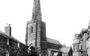
In the distance is the spire of St John the Evangelist's, completed in 1868 to serve the expanded north of the town.

It was from here that some of the biggest smack and ketch-rigged trawlers sailed to fish grounds ranging from the North Sea, the Irish Sea and the Western Approaches.

The principal import was Lancashire and North Staffordshire coal from Runcorn. A vessel arriving from Runcorn would discharge at a coal berth and then move over to a china clay berth to load.

The remainder of the church is dull, but the north transept was added in 1852 by William Parsons (1796- 1857), an interesting local architect.

In the far north-west of the county, and almost in Derbyshire, this village must deserve small town status.

The photograph looks north, with Pool House glimpsed on the extreme right, while the granite quarries are beyond the trees.

Dragwell, adjacent to A R Tarlton's chemist's shop (left), runs between Derby Road and Nottingham Road on the north side of the church, which stands prominently above the River Soar.

It is a rarity among North London centres in that it stands well away from underground and railway stations, which may or may not account for the survival of such very fine groups of late 19th-century

This view looks north. The High Street, fashioned in the 1930s, drops down to the original village centre, with the graveyard to St Martins church on the immediate right.

North of Fir Tree Road and just beyond Banstead railway station is Cuddington Park Golf Course; the name is a reminder of the parish and village of Cuddington, which was cleared for Henry VIII's Nonsuch

Apart from the gatehouse, the Checker and the Long Gallery (we see their north side here), and an attached range, probably a granary or bakehouse, nothing survives above ground.

The north side has a timber-framed upper floor which was in fact a gallery in front of a range of lodgings, possibly for abbey guests, possibly for minor monastic officials.

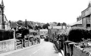
This view is looking north up Alderley Edge`s main shopping street, the little gardens in front of the premises can clearly be seen.

A bracing north-easterly catches flags and furls the lugsails of three packed boats entering harbour.
The remainder of the church is dull, but the north transept was added in 1852 by William Parsons (1796- 1857), an interesting local architect.
In the far north-west of the county, and almost in Derbyshire, this village must deserve small town status.

The line on the left, beyond the trees, is the London and North Western Railway Cambridge to Bletchley line that was closed in 1968.

George's Hall dominates the left side of our photograph, and the London North Western Hotel the right side.

The north side of the Market Place was the drinking heart of Wisbech, whose taste for alcohol saw one hundred inns, taverns and pubs recorded around the town.

It looks north over the wide, flat, formerly marshy valley of the River Arun and the Amberley Wild Brooks, and west to the narrowing valley as the river cuts through the South Downs.

At one time the North Eastern Railway ran three or four special fish trains a week out of Staithes.

On the north-east side of the county, Hose is situated close to the Nottinghamshire border in the Vale of Belvoir.

At one time, North Quay (on the left) would have been crowded with boats, but by 1891 the railways had taken over, leaving Severn trade to stagnate.

Among the monuments on the north side of the chancel is a Purbeck marble tomb with canopy and three hanging arches on twisted columns marked by an 18in brass on the short tomb chest.
Places (9301)
Photos (2953)
Memories (1550)
Books (39)
Maps (9439)

