Merry Christmas & Happy New Year!
Christmas Deliveries: If you placed an order on or before midday on Friday 19th December for Christmas delivery it was despatched before the Royal Mail or Parcel Force deadline and therefore should be received in time for Christmas. Orders placed after midday on Friday 19th December will be delivered in the New Year.
Please Note: Our offices and factory are now closed until Monday 5th January when we will be pleased to deal with any queries that have arisen during the holiday period.
During the holiday our Gift Cards may still be ordered for any last minute orders and will be sent automatically by email direct to your recipient - see here: Gift Cards
Places
26 places found.
Those places high-lighted have photos. All locations may have maps, books and memories.
- Town End, Derbyshire
- Town End, Buckinghamshire
- Town's End, Somerset
- Towns End, Dorset
- Town End, Merseyside
- Town End, Cambridgeshire
- Town's End, Buckinghamshire
- West End Town, Northumberland
- Bolton Town End, Lancashire
- Kearby Town End, Yorkshire
- Town End, Cumbria (near Grange-Over-Sands)
- Town End, Cumbria (near Bowness-On-Windermere)
- Town End, Yorkshire (near Huddersfield)
- Town End, Yorkshire (near Wilberfoss)
- Town End, Cumbria (near Appleby-in-Westmorland)
- Town's End, Dorset (near Melbury Osmond)
- Town's End, Dorset (near Swanage)
- Town End, Cumbria (near Ambleside)
- Town End, Cumbria (near Lakeside)
- Town End, Cumbria (near Kirkby Lonsdale)
- Town End, Cumbria (near Ambleside)
- Town's End, Dorset (near Bere Regis)
- West-end Town, South Glamorgan
- Townend, Derbyshire
- Townend, Strathclyde (near Dumbarton)
- Townend, Staffordshire (near Stone)
Photos
26 photos found. Showing results 221 to 26.
Maps
195 maps found.
Books
160 books found. Showing results 265 to 288.
Memories
3,720 memories found. Showing results 111 to 120.
Norton Manor
I joined the army at the age of 15 and was posted to Norton Manor Camp on the outskirts of Taunton. At first we were not permitted to go out of the camp but when we did it was always Taunton that we visited. I have fond memories of ...Read more
A memory of Rumwell in 1961 by
My First 21 Years
I was born on 5th July 1948, we lived in one of the houses behind the Wheatsheaf hotel. Our neighbours there were the Wilcocks and the Browns. My Dad, worked as a driver for a furniture company and a coalman and I remember he ...Read more
A memory of Queensbury by
Raf Honnington Bury St Edmunds
Hello, we lived at R.AF Honnington, from 1956-1963, before moving to Aden, we loved going to town each Saturday on the bus, visiting the park, shops and "Purdy's" cafe. I have such lovely memories from living ...Read more
A memory of Lawshall in 1956 by
Air Raids
These memories are as fresh in my mind as if they happened last week. Boston had its share of air raids, the first one was on a rainy Monday, it was July, the first day of our summer school holidays. It would be about 7.15 am when we ...Read more
A memory of Boston in 1940 by
Best Days Of You Life?
I was lucky enough to attend Bede Hall. We had a terrific staff team in those days - Clive Bell, Peter Dixon, the late Annie Woodward et al. The whole experience was mind blowing, as the mix of administered and self ...Read more
A memory of Billingham in 1967 by
Keep Off The Grass
I remember sitting under these trees in the summer of 1976, with my mates and smoking some grass. Funny thing was, the only thing we got told off for was being on the grass, not smoking it. Obviously the New Towns Commission had their ideals in the right places...
A memory of Welwyn Garden City
From Woodland Road To Cheshire Via The Penllwyn
On June 11th 1952 in the front downstairs room, (or close by) of 14 Woodland Road I let out my first cry. My early days of Pont are blurred, because they were not happy days. But I do remember ...Read more
A memory of Pontllanfraith by
More Of Enfield
Swimming at the open air pool was so compulsory at George Spicer and then Kingsmead schools but then we grew a little and in the holidays worked at Pearsons and danced at the Court above Burtons in the market square. Those days it ...Read more
A memory of Enfield in 1970 by
Pig Sty Peache Road
I'm not sure of the year, but a pig sty used to stand where there are now flats on the left hand side of Peache Road on the corner going towards Downend. I used to hear the pigs squealing when I was quite ...Read more
A memory of Downend by
How Good Barking Was In The 1950s
I was born in Shirley Gardens in 1935, right opposite Barking Park where I spent most of my childhood at Barking open air lido. What a magnificent place that was! My father was a policeman in Barking so we always ...Read more
A memory of Barking by
Captions
5,111 captions found. Showing results 265 to 288.
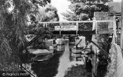
This is East Bridge, at the eastern end of East Street (far right), looking eastwards from the north bank of the River Asker.
In the immediate post-war era, Luton was a medium sized town - albeit a county borough - about to become very much larger.
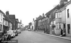
We are looking north from the roundabout, and the Catholic church is just visible in the distance at the end of James Street.
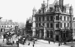
By the end of the 19th century, New Street was both the principal business street in the town and the best for shopping and entertainment.This view is from Paradise Street.
By the end of the 19th century, New Street was both the principal business street in the town and the best for shopping and entertainment.This view is from Paradise Street.
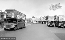
The least attractive part of the town centre is the forecourt to the underground station, which is also used as a bus station.
A ride called the 'Galloping Pigs' once appeared in the Cattle Market, perhaps emphasising the link with a market town. There has been a fair in Loughborough for nearly 800 years.
Some of the most notable developments of the new millennium have taken place at the Eynesbury end of the town.
St Neots and Eaton Socon, and wounded soldiers were often in evidence around the town. The war years provided local women here, as elsewhere, with new opportunities.
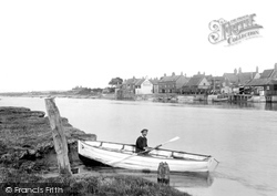
This is a quiet town on the south bank of the River Stour, at the point where it begins to widen into the estuary.
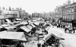
Many retailers with shops elsewhere in the town would also have a stall on market day.
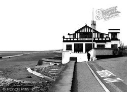
The east end part of the quay faces northwards with views across the flat marshes to the sea beyond.
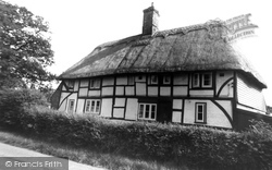
The last two views in Hailsham itself are of a timber-framed cottage on Hempstead Lane, once in the countryside but now firmly within the town's 20th-century expansion - this sweeps past the lane
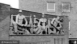
The regeneration of the south side of Dudley town centre began in 1962. First to be completed was a pedestrian way linking Castle Street with the bus station.
This building stands at the northern end of The Parade; it was built in 1926 on the site of a former coaching inn, the Pengwern Arms, which had to be demolished in 1885 following storm damage.
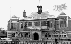
There are 18th- and 19th-century houses, and a fine group of public buildings comprising the Town Hall of 1900, the Public Library of 1929, the Fire Station of 1911 and, at the junction with Church End
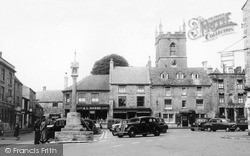
This view shows the west end of the Market Square. Several routes enter town, but none disturb this pretty square. A couple , probably visitors, admire the old market cross.
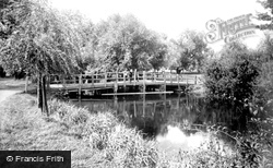
Further east along The Embankment, Newnham Bridge crosses the north branch of the River Ouse at the south end of Tennyson Road. We are looking east from the north bank.
This view shows the west end of the Market Square. Several routes enter town, but none disturb this pretty square. A couple , probably visitors, admire the old market cross.
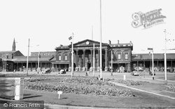
The station was built at a cost of £20,000, and its classic grandeur still dominates St George Square. The foundation stone, laid in 1845, weighed an incredible six tons.
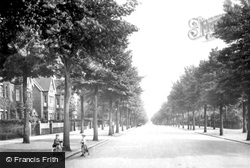
Here we see the well-treed street looking more mature; the photographer is looking south back towards the town centre. It was truly a sylvan approach to Bedford Park.
The eastern end of Bell Street is crossed by Knight Street, a wide road leading from Station Road to Fair Green where a market and fair have been held since the charter was granted in 1306.
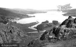
This classic view of England's largest lake was taken from the south end of Loughrigg. Ambleside town is round the corner to the left.
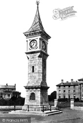
Today it is the centrepiece of the town's Flagpole Memorial, opened in 1995 to commemorate the 50th anniversary of the end of the Second World War.
Places (26)
Photos (26)
Memories (3720)
Books (160)
Maps (195)

