Places
26 places found.
Those places high-lighted have photos. All locations may have maps, books and memories.
- Cemmaes Road, Powys
- Six Road Ends, County Down
- Road Weedon, Northamptonshire
- Severn Road Bridge, Gloucestershire
- Roade, Northamptonshire
- Berkeley Road, Gloucestershire
- Harling Road, Norfolk
- Road Green, Devon
- Builth Road, Powys
- Cross Roads, Yorkshire
- Steele Road, Borders
- Cross Roads, Devon
- Four Roads, Dyfed
- Road Green, Norfolk
- Biggar Road, Strathclyde
- Clarbeston Road, Dyfed
- Five Roads, Dyfed
- Eccles Road, Norfolk
- Grampound Road, Cornwall
- Morchard Road, Devon
- Wood Road, Greater Manchester
- Four Roads, Isle of Man
- St Columb Road, Cornwall
- Clipiau, Gwynedd (near Cemmaes Road)
- New Road Side, Yorkshire (near Silsden)
- New Road Side, Yorkshire (near Cleckheaton)
Photos
14,329 photos found. Showing results 261 to 280.
Maps
476 maps found.
Books
5 books found. Showing results 313 to 5.
Memories
11,058 memories found. Showing results 131 to 140.
Going Down The End Of The Road !
I have quite vivid memories from the late 1950's of Woodhall Parade or "The End of the Road" as those in Woodhall Crescent called it. Harry Skeeles the cockney greengrocer, always with his hat on and mostly with a ...Read more
A memory of Hornchurch by
Purley Parade
We moved into the spacious four-bedroomed maisonette over Purley Radio in Purley Parade in 1955 and I attended Christ Church primary school, just over the other side of High Street (sadly demolished in 1967). A policeman used to see us ...Read more
A memory of Purley
Growing Up In Burghfield Common
We moved to burghfield in 1967, to Abbotts road, me and my sister went to Bland’s school then onto garlands and finally to the Willink. I remember the coal man he always had a black face and I was scared of ...Read more
A memory of Burghfield Common by
Walking To The Shops
I was born on Church Hill in 1962 and my Mum still lives in the house. I remember walking to the shops in the village each day to buy provisions with my gran. There used to be a bucher, baker, greengrocer, haberdasher, post ...Read more
A memory of West End by
I Lived At 7 Church Road Brownhills
The picture (first Ive seen) of my former home brings back memories. I lived at Number 7 which is to the left of the first entry and my bedroom was above that entry. It was called the box room as it was the ...Read more
A memory of Brownhills by
Edward Lloyd
My great grandfather, Edward Lloyd, emigrated to the United States from Ffestiniog. He was a famous tenor in his day and had high ranking with the Eisteddfod both in Wales, and later, in upstate, NY. I am told by a cousin, ...Read more
A memory of Blaenau Ffestiniog in 1900 by
Creekmouth Village
I was born in Creekmouth Village in 1952. The village was at the end of River Road at the confluence of the River Roding and The Thames. The village consisted (in latter years) of 50 Victorian style cottages, 2 up 2 down with ...Read more
A memory of Barking by
Esh Winning Colliery Sawmill
I recall as a young boy the Saw Mill that existed neat Esh Winning Colliery. It was sited just prior to where the Railway siding crossed the road at the bottom of West Terrace. It used to cut pit props which were ...Read more
A memory of Esh Winning by
The Chimes Filling Station
Hello Ken, You may remember us, the Beaven boys at number 71 or 72 (Parents Name Collins). I was born in 1945, Stephen in 1940 and Michael 1936. I went to the lovely Eardley Road Primary school before we moved to Clapham ...Read more
A memory of Streatham
Walsh Manor Boys School Crowbourgh
I lived here from 1970 to 1973 The boys I remember were Malcolm Wilkins, Philip Eldridge, Henry fuller, Sean Cope. Teachers were Mr Laycock, Mr Hanner, Mr Trelforth, Mr Clegg, Mr Beardsall and Miss McGuiness. ...Read more
A memory of Crowborough by
Your search returned a large number of results. Please try to refine your search further.
Captions
5,036 captions found. Showing results 313 to 336.
Cadnam, or Cadenham, stands at an important road junction at the north-western corner of the New Forest; sooner or later every traveller in the locality is bound to pass through the village.
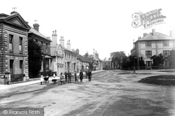
The absence of traffic makes this stretch of London Road in Horsham seem unusually spacious. In those days children could stand safely in the road and pose for photographs.
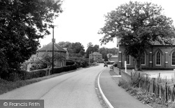
Extra road traffic has also made the road outside the busy village stores and post office (just to the left of the car) a frequent bottleneck.
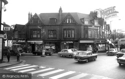
Prince's Corner was named after Prince Albert - as if to emphasise the point, the road on the left here is Albert Road.
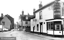
Harbour Road is close to the sea. Both the Angel and the next building are clad in weatherboard. Further down the road on the right is the Globe Hotel.
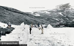
The road south from Braemar climbs through Glen Clunie and then over the rugged Cairnwell Pass, the highest point on a main road in Britain, and now the main A93 between Aberdeenshire and Perthshire.
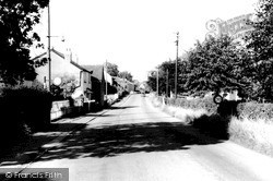
The good road surface seen here contrasts with the situation in the 18th century.
We are looking northwards from Ericksen Road towards Kinson. East Howe Lane (right) leads to Wimborne Road at Headless Cross.
On the left a wide-arched bridge takes Eastcliffe Road over the main line railway and past The Royal Hotel (now The Royal Inn), the first of three large buildings along the road.
We are looking north towards Friary Gardens and Queens Road across the roundabout at the junction with Victoria Road. King Street became one-way for outbound traffic in 1994.
This view looks towards the Jubilee Clock Tower, with Lumley Road to its left.
The Horse and Groom together with the next two buildings made way for a road; the Queens Head inn now occupies a corner of the new road - Queen Street.
This view of the village's main road was taken looking east. It had long since replaced the Old Road which branched off left behind the photographer and forded the river at one point.
In 1904, Winchester Street became Winchester Road, where houses ceased and countryside began. Here the picture was taken with Old Winton Road behind on the right.
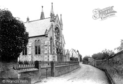
Using granite with Bath stone dressings, the Wesleyan chapel in Restormel Road cost £1,600 when it was built in 1880. The top of its 70-feet spire is seen above the roof ridge.
This view looks towards the Jubilee Clock Tower, with Lumley Road to its left.
Joining North Street with Mawney Road, Como Street had to cross the River Rom at the North Street end.
The village straddles the main A41 Chester Road with the main shopping area spread out in a linear fashion on either side of the road, as we can see here.
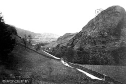
A horse and cart wends its way up a gated minor road through the Coniston Fells.At the time before the coming of the motor car in significant numbers, there were many roads like this in the Lake
What was Broadwaters Lane led from the town centre as a continuation of the Horse Fair to meet the main road, where it became Chester Road.
We are now back at the junction with Hursley Road where Bournemouth Road becomes Winchester Road. We
This is taken further down the same road as 48369. The Swan Inn advertises 'Good Accommodation for Cyclists', and another sign offers 'Horse and Trap or Wagonette for Hire'.
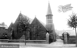
The road is now St Barnabas Road. The church, on the west side of the road, is built in brick with a polygonal bell tower.
This was built in 1901 at the junction of Newton Road, King Street and Cornard Road. The police establishment comprised an inspector, a sergeant, and four constables.
Places (26)
Photos (14329)
Memories (11058)
Books (5)
Maps (476)


