Places
26 places found.
Those places high-lighted have photos. All locations may have maps, books and memories.
- Cemmaes Road, Powys
- Six Road Ends, County Down
- Road Weedon, Northamptonshire
- Severn Road Bridge, Gloucestershire
- Roade, Northamptonshire
- Berkeley Road, Gloucestershire
- Harling Road, Norfolk
- Road Green, Devon
- Builth Road, Powys
- Cross Roads, Yorkshire
- Steele Road, Borders
- Cross Roads, Devon
- Four Roads, Dyfed
- Road Green, Norfolk
- Biggar Road, Strathclyde
- Clarbeston Road, Dyfed
- Five Roads, Dyfed
- Eccles Road, Norfolk
- Grampound Road, Cornwall
- Morchard Road, Devon
- Wood Road, Greater Manchester
- Four Roads, Isle of Man
- St Columb Road, Cornwall
- Clipiau, Gwynedd (near Cemmaes Road)
- New Road Side, Yorkshire (near Silsden)
- New Road Side, Yorkshire (near Cleckheaton)
Photos
14,329 photos found. Showing results 2,921 to 2,940.
Maps
476 maps found.
Books
5 books found. Showing results 3,505 to 5.
Memories
11,058 memories found. Showing results 1,461 to 1,470.
Our Honeymoon
These pictures bring back delightful memories! We spent a week of our honeymoon in the 16th century mill at Lydia Bridge. Across the lawn was a view of the brook and early spring flowers. We stepped outside to the sound of the ...Read more
A memory of South Brent in 1999 by
Growing Up
I moved to Farleigh Road, New Haw in 1952. I attended West Byfleet Junior School and then Fullbrook School until I graduated in 1960 (after taking a special "commercial course"). Left New Haw in 1966 and moved to Vancouver, British ...Read more
A memory of New Haw in 1952 by
Unchanged Lerryn
Lerryn is a place that one almost wants to keep secret so that it does not become a popular destination. It has barely changed in a hundred years. A beautiful and unspoilt village in a steep sided valley, Lerryn lies at the tidal ...Read more
A memory of Lerryn in 2004 by
One Lost Cinema
I love this photo of Loughton High Road as it shows just on the edge the cinema we used to have. Kids could go to Saturday morning pictures. We could see locally all the latest films. To depart this asset from our town was not really progress I think.
A memory of Loughton in 1955 by
Angela's Memory Of High Street
I worked at Market Square Cafe in 1949, fond memories of working for the Arpinos Family. Left in 1950 went to Margate to work and met my husband and I went by Rydam Boat to the USA (Mississippi) in 1955 and was ...Read more
A memory of Bromley in 1949 by
The Second World War
There was an air raid shelter under the green opposite the Three Jolly Wheelers pub. It comprised a number of concrete passageways. My mother my sister and I would use it on occasions when there was a particularly bad ...Read more
A memory of Woodford Bridge in 1945 by
The Bag Wash In Wednesfield Wton
There was an old bag wash where people could bring their dirty washing to be cleaned around New Street/North Street not far from the police station that was on the main Wolverhampton road. The police station ...Read more
A memory of Wednesfield in 1959 by
Frognal Hampstead London Nw3 6yd
Frognal was mentioned in the early 15th century as a customary tenement and in 1740 Frognal field was the eastern abutment of Northfield, part of the demesne. By the 17th century there were several cottages and ...Read more
A memory of Hampstead by
Looking Back
I was born in St Peters St, Islington, 1935, bombed out late 1943, with nowhere to go, had a makeshift home in Aloysius College for a time until we were given a place in 4 Montague Road, Honsey, N8, that's where I knew what it was like ...Read more
A memory of Hornsey in 1944 by
Hugh Bell Teachers
Reading John Culberts memories, I was reminded of my own time at Hugh Bell from 1947 to 52. I believe Hugh Bell to have had the most significant influence on my future career together with the Southfield Road Baptist ...Read more
A memory of Middlesbrough in 1940 by
Your search returned a large number of results. Please try to refine your search further.
Captions
5,036 captions found. Showing results 3,505 to 3,528.
Spring Lane, originally called Back Lane, branches off from Riverside and can be seen at the top centre turning back into the main road. This is the centre of the old village.
In wet weather the road became a quagmire and horses pulling heavy wagons slipped and slid up to St Paul's.
There are lovely roads and drives in the immediate neighbourhood, notably through the woods, and around Worlebury Hill.
The Leicester to Northampton road passes through Welford's High Street, parallel with the much more tranquil West Street.
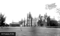
South-west of the town centre, along the Ampthill Road, on a large site between it and the railway line, the County Schools were built in the 1880s on a grand plan with a massive tower and,
year in office for the Labour Government, the Beatles were awarded MBEs in the Birthday honours' list, and an 'experimental' 70mph maximum speed limit was introduced on the new motorways and other main roads
Judging by the state of the road, rose growing did not appear to be high on the natives' list of priorities.
Duck Street forks to the right of the tree, Monxton Road to the left. King Charles I campled near the village with a force of 5,000.
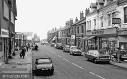
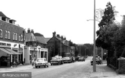
The Mini first took to the road in 1959, so it was a novelty when this picture was taken (centre left).
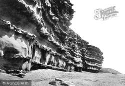
Erosion causes precipitous breaks, producing two miles of sheer cliffs from West Bay to Beach Road at Southover (right), where the boats and a cafe can be glimpsed.
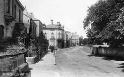
Handsome and dignified Georgian houses and villas line the leafy street.Visitors to the town seem to have been made up from two groups: travellers using the Great North Road, who stopped over just
Across the road beyond is a good Art Nouveau/Gothic church of 1912.
This photograph looks from the railway bridge towards the King's Head in Bulmer Road. On the left, the second house with the lower roof has been demolished.
The policeman standing on the road (left) was then part of the former Merthyr Tydfil County Borough Police Force.
The shop closed in 1968 when it was demolished as part of the road widening scheme.
The old tracks from the neighbouring village of Uplyme are the original routes into the town before the construction of the present road along the coast.
Little has changed at this junction on the roads to Newnham and Hinxworth, known as West End and Back Street.
The road has now been truncated to allow for the building of the Barbican; the church survived severe Second World War bombing to stand in the way of the development, which was completed in the early 1980s
The Bird in Hand stands beside the road linking Knutsford with Wilmslow. Although the sign portrays a hunting bird, there is sometimes an alternative meaning for pubs with this name.
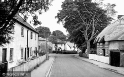
The thatched Old Parsonage at the end of the road is late 15th-century. The exposed timbers have been plastered over. A group of children stand by a 19th-century cottage now called White Gates.
The Hall is situated close to the village green along Hadlow Road.
A 1930s Rover saloon is parked on the road. A trout stream flows through the water meadow here.
All the houses on the left went to make way for the inner ring road and its roundabout; the gable on the far right belongs to The Armoury pub, which does survive.
This view looks along Church Street from its junction with Market Street and Tylers Way; the latter is a modern road and where the boys stand is now a roundabout.
Places (26)
Photos (14329)
Memories (11058)
Books (5)
Maps (476)


