Merry Christmas & Happy New Year!
Christmas Deliveries: If you placed an order on or before midday on Friday 19th December for Christmas delivery it was despatched before the Royal Mail or Parcel Force deadline and therefore should be received in time for Christmas. Orders placed after midday on Friday 19th December will be delivered in the New Year.
Please Note: Our offices and factory are now closed until Monday 5th January when we will be pleased to deal with any queries that have arisen during the holiday period.
During the holiday our Gift Cards may still be ordered for any last minute orders and will be sent automatically by email direct to your recipient - see here: Gift Cards
Places
36 places found.
Those places high-lighted have photos. All locations may have maps, books and memories.
- Shanklin, Isle of Wight
- Ventnor, Isle of Wight
- Ryde, Isle of Wight
- Cowes, Isle of Wight
- Sandown, Isle of Wight
- Port of Ness, Western Isles
- London, Greater London
- Cambridge, Cambridgeshire
- Dublin, Republic of Ireland
- Killarney, Republic of Ireland
- Douglas, Isle of Man
- Plymouth, Devon
- Newport, Isle of Wight
- Southwold, Suffolk
- Bristol, Avon
- Lowestoft, Suffolk
- Cromer, Norfolk
- Edinburgh, Lothian
- Maldon, Essex
- Clacton-On-Sea, Essex
- Felixstowe, Suffolk
- Norwich, Norfolk
- Hitchin, Hertfordshire
- Stevenage, Hertfordshire
- Colchester, Essex
- Nottingham, Nottinghamshire
- Bedford, Bedfordshire
- Bury St Edmunds, Suffolk
- Aldeburgh, Suffolk
- St Albans, Hertfordshire
- Hunstanton, Norfolk
- Chelmsford, Essex
- Bishop's Stortford, Hertfordshire
- Peterborough, Cambridgeshire
- Brentwood, Essex
- Glengarriff, Republic of Ireland
Photos
11,145 photos found. Showing results 6,781 to 6,800.


Maps
181,031 maps found.


Books
442 books found. Showing results 8,137 to 8,160.
Memories
29,072 memories found. Showing results 3,391 to 3,400.
Maidstone Rd And Other Memories
I remember visiting the mill many years ago as my mother had an uncle who worked there, and often went into the house on the right which then was the mill´s offices. Everyone used to buy Viv Wood's fish and ...Read more
A memory of Paddock Wood in 1960 by
Rathbone School
I went to Rathbone (Albany Road) in the early fifties and my best friend there was Frank Doyle, who lived in Phythian Street. After the eleven plus we went to separate schools but kept in touch until I left Liverpool in 1964. I ...Read more
A memory of Liverpool in 1957 by
Birthday
I have no memory of this Hospital of course, but I was born there in May 1934, have now lived in Australia for the past 50 years.
A memory of Sheffield in 1930 by
Eastcote House Garden Party Ca 1961
There was an annual garden party held at Eastcote House. These were fund raisers for various charities. The one year I remember, the party was held in aid of a home for retired actors and the ...Read more
A memory of Eastcote by
Ackworth
My grandparents (Mr and Mrs Scorah) used to live in Town End Avenue, Low Ackworth. I remember visiting them with my mother, while my dad was at war. We used to catch the bus from Scunthorpe to Waterdale, Doncaster. Then we would ...Read more
A memory of Ackworth in 1940 by
A Wonderful Time In Copper Street
My name is Carole McCarthy (nee MALONE) I was born in December 1951 in a maternity unit on Rochdale Road near to the Embassy Club. I lived in Copper Street in Collyhurst which had Barney's at the bottom of the ...Read more
A memory of Collyhurst by
Shelfield Junior And Infants School And St Mark's Church
I went to Shelfield Junior School and have strong memories of the combined smell of bread being baked, fish and chips being cooked and the smell of horses kept in the stables - all ...Read more
A memory of Shelfield in 1941 by
Wwii Billet
My mother, Maude Doyle was billeted at a farm in Outwell while stationed at searchlight battery at Sutton Bridge that served as RAF base. Fighter aircraft used the gun butts there to adjust their cone of fire I understand. The farmer's ...Read more
A memory of Outwell in 1940 by
Not Strictly Ashby : )
Willesley Close was the centre of the universe for the first twelve years of my life from 1959. The garden enclosed twenty yards of the old railway embankment and featured a natural spring, the source of much ...Read more
A memory of Ashby-de-la-Zouch in 1971 by
The Name Of The Hoy And Helmet Pub
On the left of this photograph is The Hoy & Helmet pub at South Benfleet, which was originally built in the 15th century, with later extensions. The ‘hoy’ of the pub’s intriguing name was a broad, ...Read more
A memory of South Benfleet by
Your search returned a large number of results. Please try to refine your search further.
Captions
29,395 captions found. Showing results 8,137 to 8,160.

Work on the dam started in 1930 using stone quarried locally, but its construction was delayed for a while and restarted in 1934. The dam is of the 'hollow massive-buttress' type.

The Lion Enclosure was one of those specifically accommodated into a natural feature of Castle Hill. Here two of its occupants sun themselves.

The grave of Field Marshal Montgomery, who died in 1976, is in the churchyard, and his banner hangs in the nave of the church.

The cathedral, behind the fence (left), looks out onto the main retail area of the city, with Marks & Spencer's store (centre) still thriving.

This view is south-westwards from the quarry gallery to Anvil Point (centre left) where Purbeck's coast becomes a vertical wall of stone.

The parish church of St John the Baptist is shown from the north-east.

The machicolated heights of William Herbert's gatehouse and closet towers look down on the moat which surrounds the famous Yellow Tower, the work of his father William ap Thomas.

Leading to Runcorn Hill, Highlands Road and the surrounding area is a lovely part of the town. Of the cottages shown here only the one in the foreground still survives.

The grandeur and size of Perpendicular architecture owes its inception to the wealth created by the wool trade.

Corbets Tey, inspite of being in Greater London, still retains much of its rural charm.

Atherstone is one of only two places where the game of Shrovetide football is played; the other is Ashbourne in Derbyshire. In 1846 the game was finally banned from the streets of Derby.

Before the railway came in 1838 and today's town began to grow, this was the centre of Woking. Here it appears as though it is completely deserted with not a soul to be seen.

The clock tower shown here, partly enclosed by an hexagonal shelter and situated at the centre of a traffic system, stands on the site of what once was a wayside chapel.

In the churchyard is the grave of the great Victorian Liberal Shaw Lefevre, Lord Eversley, who worked closely with the long-serving Prime Minister Mr Gladstone.

In this picture we can already see the growth of the congestion that was soon to become a problem in the centre of the town.

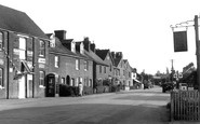
This view takes in the east end of the Market Place and Front Street. On the right is G W Roy's fancy repository and the post office, and just beyond that is the Black Horse pub.

The church was dedicated to St Mary the Virgin during the Norman period; it had belonged to a former Benedictine priory founded by Roger, Bishop of Salisbury.

The village lies inland from Hastings; its medieval church of St Leonard is isolated away from the houses among the trees.

The Victoria Statue 1902 Thomas Brock's superb 13ft high bronze statue of Queen Victoria, which stands at the seaward end of Grand Avenue, was unveiled in 1901.

The red and white lighthouse at the foot of the cliffs is pictured here. It was started in July 1899 and was completed in 1902.

The 12th-century foundations were uncovered during the extensive restoration of 1874- 75. There are several Norman features inside including the south doorway and chancel arch.

We are now standing in a position to the east of the Cross and are looking towards West Street, with Church Hill on the immediate right of the pantiled lean-to building and the Star Inn

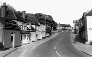
The old market cross stands on a grassy verge to the left of the pub sign. Behind the cross is the entrance to the pub car park.
The main route into the city from the east is a fine illustration of the refurbishment and diversification of redundant 1960s office space.
Places (6814)
Photos (11145)
Memories (29072)
Books (442)
Maps (181031)

