Places
17 places found.
Those places high-lighted have photos. All locations may have maps, books and memories.
- Bridge End, Oxfordshire
- Bridge End, Lincolnshire
- Bridge End, Essex
- Bridge End, Bedfordshire
- Bridge End, Clwyd
- Bridge End, Warwickshire
- Bridge End, Surrey
- Bridge End, Durham (near Frosterley)
- Bridge End, Northumberland (near Hexham)
- Bridge End, Hereford & Worcester (near Tirley)
- Bridge End, Hereford & Worcester (near Bosbury)
- Bridge End, Shetland Islands
- Bridge End, Cumbria (near Carlisle)
- Bridge End, Northumberland (near Hexham)
- Bridge End, Devon (near Kingsbridge)
- Bridge End, Devon (near Sidmouth)
- West End, Yorkshire (near Pateley Bridge)
Photos
40 photos found. Showing results 1,061 to 40.
Maps
520 maps found.
Books
2 books found. Showing results 1,273 to 2.
Memories
1,925 memories found. Showing results 531 to 540.
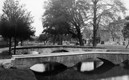
A Game Of Soccer In The River
Every year there would be a game played in the river in the village using the bridges as goal posts and is, as far as I am aware still played today. It would be around 1955 that my late father, Frederick ...Read more
A memory of Bourton-on-the-Water in 1955 by
Childhood Dreams
I came across this website by accident, what a treat. I was raised in Croydon, actually Addington. My nana and granddad lived at 195 Purley Way in Wadden. I spent many happy hours there as a child. I would spend several weeks ...Read more
A memory of Croydon in 1955 by
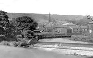
River Irwell
This is the weir on the River Irwell where it swings round and is bridged by the road up to Peel Brow. The mills on the right are on Kenyon Street. There were cotton weaving mills, towel mills and soap works. The Church spire is St. ...Read more
A memory of Ramsbottom in 1955 by
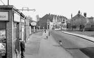
Worcester Park From The Bridge
I lived in Worcester Park from when I was born (1939) until early 1956 when I joined the RAF as an apprentice. The lad in the picture (W455012) could so easily have been me (it isn't) because I was often there ...Read more
A memory of Worcester Park in 1955 by
Life In Full Circle
The little house next to Mary Newman`s Cottage is where I live now...but I first walked past it with my mother at about the time this photo was taken. We got off the steam train at the station just up the hill, to walk to the ...Read more
A memory of Saltash in 1955 by

The Providence Congregational Church 1956
"The Providence", as it was commonly known, stood at the corner of Laundry Yard and The Lynch. Built in 1795 with a later facade it was a gem of late georgian "chapel" architecture. You entered through a ...Read more
A memory of Uxbridge in 1955 by
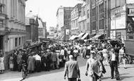
Kennards, Grants And Allders
I was born in 1950, and only left when I married in 1973. I remember the donkey rides in Kennard Arcade in the 50's - they had little bells on their harnesses and for sixpence you could have a ride which seemed like for ...Read more
A memory of Croydon in 1955 by
Fulham Girl
I lived in Burlington Road, at No.1 - it was called Jubilee Terrace, and was built to commemorate one of Queen Victoria's Jubilees. There was a pottery at the New Kings Rd end of Burlington Road which was built way back in the reign of ...Read more
A memory of Fulham in 1955 by
Bridge Street, Coggeshall
I remember Bridge Street as I grew up in Coggeshall and was 8 when this photo was taken. The pub sign on the right is for the Portobella pub, which was on the left. In the distance is the bridge over the River ...Read more
A memory of Coggeshall in 1955 by
Birchington, Epple Bay And Minnis Bay
Birchington with two bays and a village atmosphere 'in town'. A rail station with the most wonderful ice cream parlour opposite - wicker chairs on those old fashioned curved steel bases and circular wicker ...Read more
A memory of Birchington in 1955 by
Captions
1,770 captions found. Showing results 1,273 to 1,296.

This view of the basin from its entrance lock adjacent to the Trent, shows a nearby warehouse and the Crown Inn, now the Waterfront Inn, across the water.

It was also important in draining the nearby Isle of Axholme and the two steam pumping stations once controlled the river level.

In the early 19th century, the colliery at Brereton nearby was connected by rail to a wharf, which enabled coal to be transported along the Trent and Mersey canal.

Initially the village developed along a road constructed on a causeway across the marshes between the castle and a possible wharf near Bramber Bridge.

A comfortable Tudor farmhouse beside a 15th-century pele, Turton Tower is associated with Humphrey Chetham, remembered for the free library, school and hospital that he founded in Manchester.

Built around 1840 to carry the London and North Western railway line north through Lancashire, this splendid six-arch bridge strides across the River Wyre just below Scorton Lakes.

Winter skaters used to risk their lives on the thin ice, and fishing from the bridge has long been a popular activity here.

It is separated from the enclosed village green by the Winn Brook, which is spanned by five little bridges before it reaches the Exe.

Go back into town and cross the Pulteney Bridge with its small shops into Argyle Street.

During the 13th century tolls were paid by those passing under the bridge as well as by those passing over it.

Indeed, the only Thames-side development has been between Caversham and Reading bridges. This has conserved the openness of the river banks which play a central role in the town's leisure.

Frith's photographer has moved beyond Boatslide Weir Bridge to the bank to look at the weir itself. The chains on posts are still here to protect rowers from the hazards of the weir.

The curious Mathematical Bridge across the Cam, built on geometric principles, and originally held together - so the story goes - without any fixing devices.

Two paddle steamers are berthed on the opposite quay, and in the centre of the picture a lady is being rowed down to the river. We can just see the swing bridge in the background.
Two paddle steamers are berthed on the opposite quay, and in the centre of the picture a lady is being rowed down to the river. We can just see the swing bridge in the background.

The bridge, built in 1848, carried the Great Northern Railway main line from Grimsby to London King's Cross (via Peterborough), but since the Beeching cuts it now only carries the Skegness to Nottingham

Beyond are workshops and outhouses, now all gone and replaced by 1970s blocks of three-storey flats.

The king took a keen interest in the College, and often crossed the bridge to talk to scholars.

On the east bank, beyond the bridge, this medieval inn is noted for its 'cruck' construction, the large curved timbers in the gable wall, and for the fact that Jerome K Jerome commends it in 'Three Men

John Rennie's gorgeous bridge, built in 1817 as both river crossing and monument to the battle, was demolished in 1923.

The river flowing beneath the 15th-century bridge is the Darent, which rises near the county boundary with Surrey near Westerham and runs through a myriad of Kent villages to the Thames near Long-reach

Standing beside a bridge across the River Brun, from which the town takes its name, is Burnley Town Hall.

An audience watches from the old bridge as two coracle fishermen cast their nets for salmon or sea-trout. Sturgeon have also been caught here.

Stamford Bridge over the River Derwent is still a popular stopping place for visitors, although the Old Corn Mill inn has recently closed, a victim of drink/drive laws.
Places (17)
Photos (40)
Memories (1925)
Books (2)
Maps (520)

